Superstition Ridgeline Trail: Superstition Mountains

Superstition Ridgeline Trail

The Superstition Ridgeline Trail is not officially marked by Tonto National Forest and doesn’t have a designated number. But, the well known trail is marked on AllTrails and has been hiked by many before so that route finding is not extensively required. The Superstition Ridgeline Trail can be hiked a few different ways depending how far and how long you want to hike. In a one-way route, the hike is 11.25 miles long. Some hikers choose to break up the hike by camping on the Ridgeline whether they’re doing an out and back or one-way hike. 

The Superstition Ridgeline Trail travels between the top of Siphon Draw and Carney Springs Trail. Along the trail are off shoot trails to Peak 5024, Peak 5057, Hieroglyphics Trail, and the Three Sisters peaks. When we hiked the trail in January of 2023, we elected to hike the trail in one direction and arranged with Owen’s dad to pick us up and drive us back to our car. 

Need to Know

This trail is challenging with an extensive scramble required on Siphon Draw. Once on the ridge some sections are on a sloped ridge with steep drop offs. The entire hike is quite exposed with very little to no shade. We brought hiking poles for the decent down Carney Springs Trail which we find hard on our knees. Clean and potable water is not guaranteed and at best available after a lot of rain. It’s best to plan for no water refill.

This is the Sonoran Desert, home to many sharp and spiny plants, venomous reptiles and spiders, and larger wildlife like mountain lions, coyotes, and bighorn sheep. Pay careful attention to your surroundings and always hike snake aware. The Superstitions are remnants of volcanic activity. The rocks are sharp, jagged, and large. We highly recommend stable footwear with good protection.

Superstition Wilderness Area

Almost all of this hike is in federally designated Wilderness Area within Tonto National Forest, meaning it’s closed to all motorized equipment and bicycles. It’s very IMPORTANT to know, this area is closed to drones

Quick Stats: Superstition Ridgeline

Length:

11.25 miles recorded

Route Type:

Out and back

Elevation Gain:

4,255 ft recorded

Vaulted Toilets:

Yes, at Lost Dutchman SP

Dog Friendly:

Not particularly

Fee:

Yes, at LDSP

Difficulty:

Hard

Water:

Yes at LDSP

Logistics Planning: Superstition Ridgeline

Based on our experience on Siphon Draw Trail and Carney Springs trail, we decided to hike up Siphon Draw and down Carney Springs. We knew our legs would be sore and did not want to go down Siphon Draw’s steep descent. Carney Springs is also steep and hard on the legs, but not as bad.

We parked at Lost Dutchman State Park. We used our annual pass. An entrance fee is required at the State Park. Owen’s dad met us at Carney Springs over by the Wave Cave on Peralta road. From there he drove us back to our car parked at Lost Dutchman State Park

Hiking the Superstition Ridgeline Trail

Beginning Section

As stated previously we started our hike from Siphon Draw at Lost Dutchman State Park. For details on hiking Siphon Draw Trail, check out our post covering the hike to Flatiron. This is a steep trail with a lot of scrambling and minimal trail markings once at the siphon. The trail quickly crosses into Tonto National Forest and then the Superstition Wilderness.

At the top of the siphon the trail forks; to the right leads out to Flatiron and straight starts the Ridgeline trail. After a short distance on the Superstition Ridgeline there is another trail split off to Peak 5024. This is less obvious and definitely a hike we recommend. 

As the trail continues east it’s mostly an easy to follow single track trail worn down by previous hikers. Depending on the time of year, yellow or green desert grass will flank the trail along with the usual spiky and thorny plants that are native to Sonoran desert. There are a couple sections of trail over large rocks and boulders where following the trail can be challenging. We suggest slowing down and double checking. For our tracking we downloaded the trail in AllTrails and made sure we aligned best we could. 

Middle Section

After about three miles the trail starts to round the eastern view of Peak 5024. There is a connecting offshoot trail that leads to a cliff overlook. We mistook it for the trail and although it leads to a great view, it’s not the correct direction. Just after a quarter mile later, the trail really lives up to its name and follows the ridgeline for a while. The trail elevation changes aren’t very drastic here and our goal was to keep a good pace and soak in the beauty. 

Soon the trail intersects with Hieroglyphic Trail before going around Peak 5057, the tallest peak in the Superstition Mountain Range. The trail is a little tricky in this area. There is some route finding and scrambling required. One section of scramble is particularly challenging as we had to shimmy and stretch between and over some boulders. It was easier to unload our packs and pass them to each other. In this section of trail, we again suggest having your GPS route available so you can cross reference your location compared to the trail. 

Once past this section the trail returns to its ridgeline namesake and offers some great views! Shortly before the intersection of the trail to the Three Sisters the ridgeline trail starts its descent. The decline here isn’t too hard on the knees and feels good. After the intersection of the offshooting trail, the Superstition Ridgeline trail starts it’s gradual switchback descent down the mountain and to the saddle of carny springs. Keep any eye out for rock cairns marking the trail as the trail cross through West Boulder Canyon.

Final Section

As you approach the saddle of Carny Springs, about 9 miles from the start of the trail, it can be hard to find the trail. It’ll look like there are many different options and for the most part, they all lead the same direction and connect to the trail. We tried to take what looked easiest to follow and what we remembered from previous hikes on the trail. 

Eventually at the true saddle, the trail descent starts its most serious decline down Carney Springs Trail, an unofficial trail in Tonto National Forest, Superstition Wilderness. This is our least favorite section of trail and we find it really tough on our knees. Our hiking poles were really helpful here. They helped take some of the pressure off our knees and to keep our balance as we took large steps down. 

Finally at the bottom of the trail we met up with Owen’s dad. We had used our Garmin inReach Mini to communicate with him and give an update on our distance and expected time to be done. From there, he drove us around the Superstitions to Lost Dutchman State Park, about 30 – 40 minutes away. Carney Springs Trail does share the same trail as the Wave Cave before splitting off

Other Hikes in the Superstitions

5 Best Hikes in the Superstition Mountains

This guide highlights the five best hiking trails in Arizona’s Superstition Mountains, showcasing stunning views, diverse terrains, and varying difficulties. It emphasizes outdoor ethics and provides specifics on each trail, including distance, elevation, and amenities. The trails cater to different experience levels, ensuring memorable adventures in the desert landscape.

Read More »

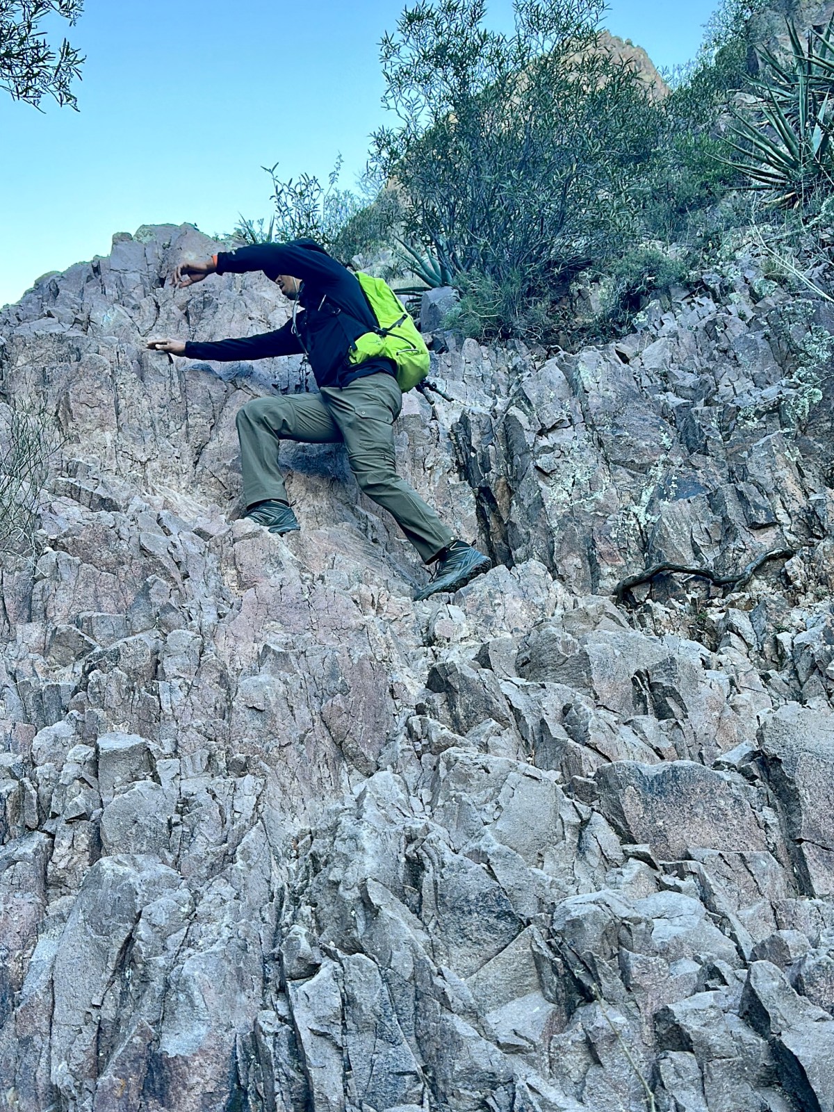
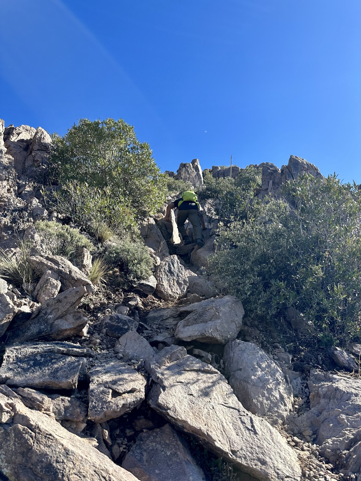
Battleship Mountain Scramble: Superstition Wilderness Hike

Battleship Mountain is a tough but rewarding hike in the Superstition Wilderness near Phoenix. Starting from First Water Trailhead, the 12-mile round trip involves tricky scrambles and stunning views. Just watch out for sharp rocks and wildlife, and remember to pack plenty of water. It’s not for beginners, but definitely worth it!

Read More »
View of Weavers Needle from Dutchman Trail in the Superstition Wilderness - The AZ Hikeaholics

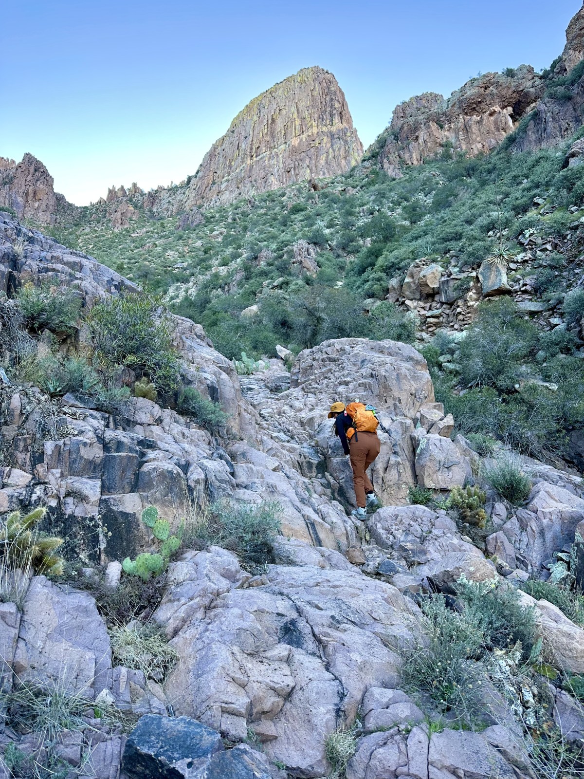
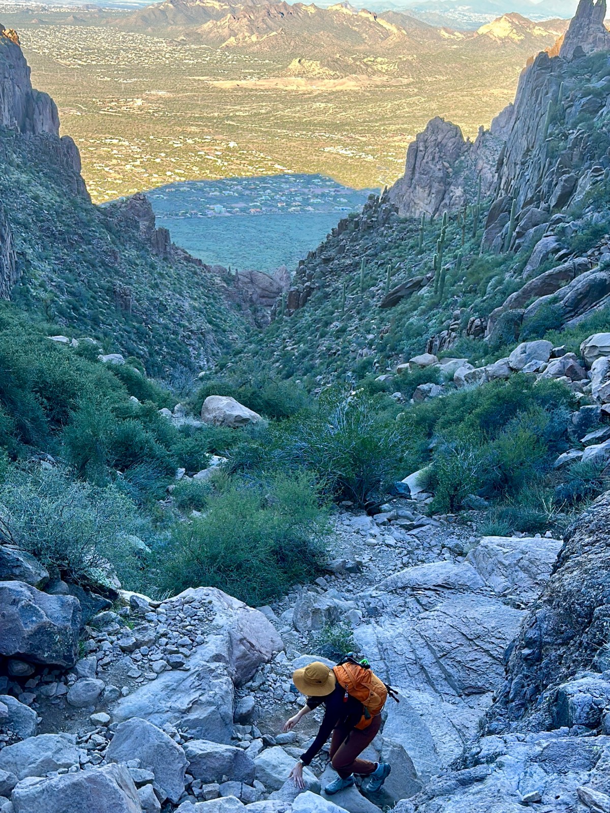
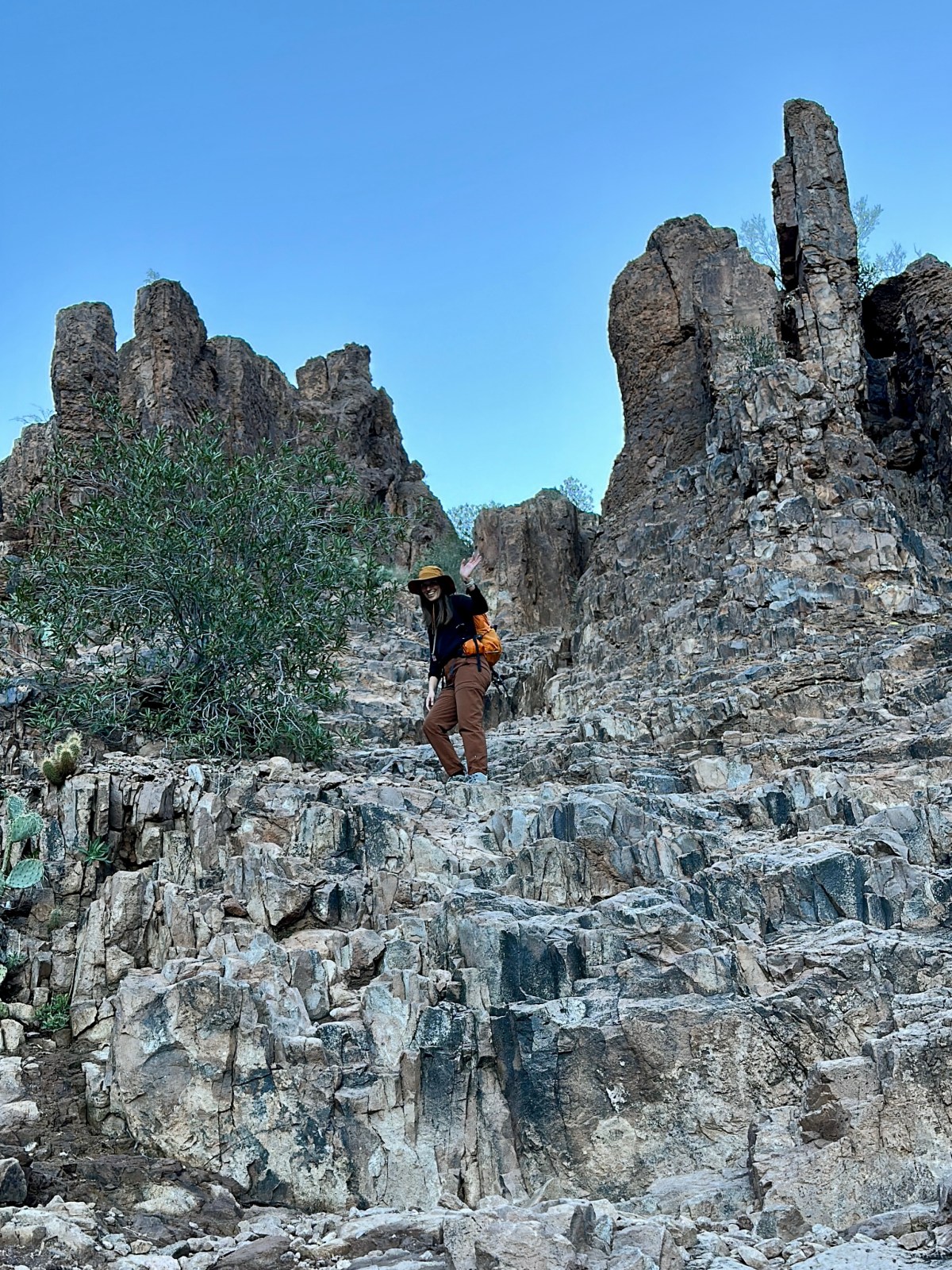
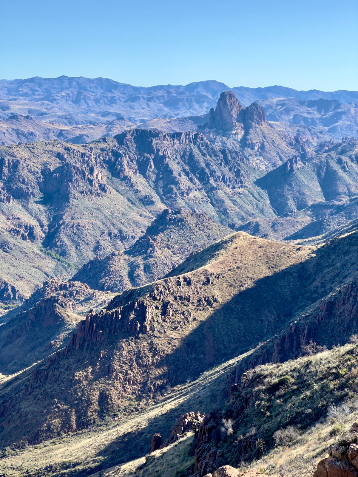
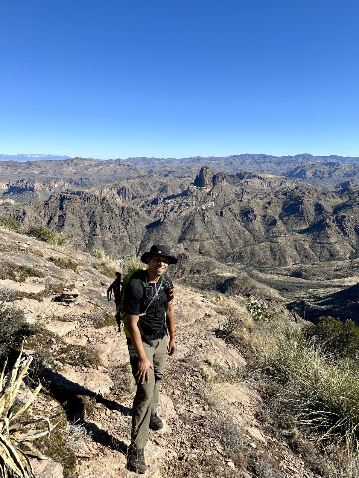
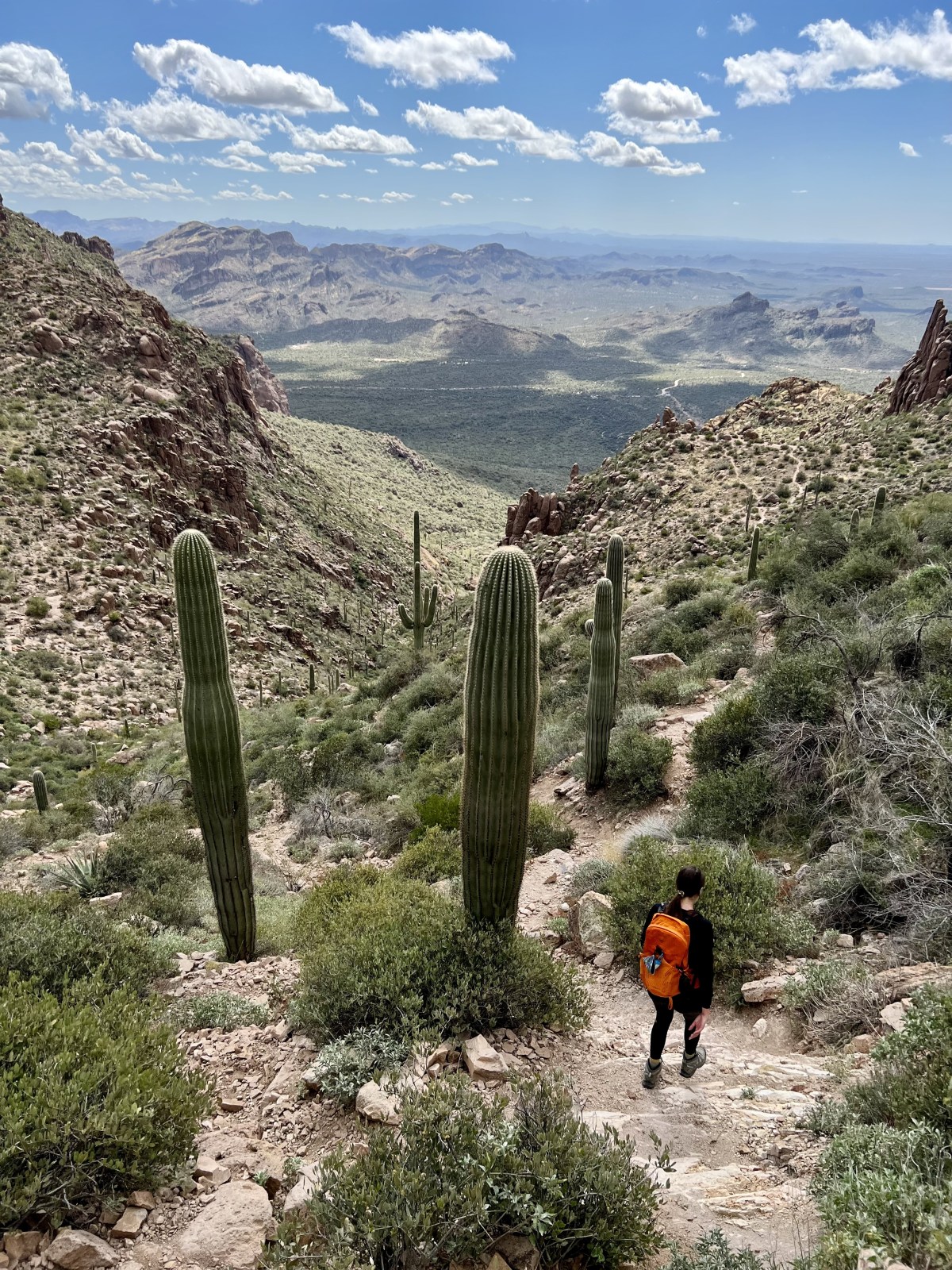
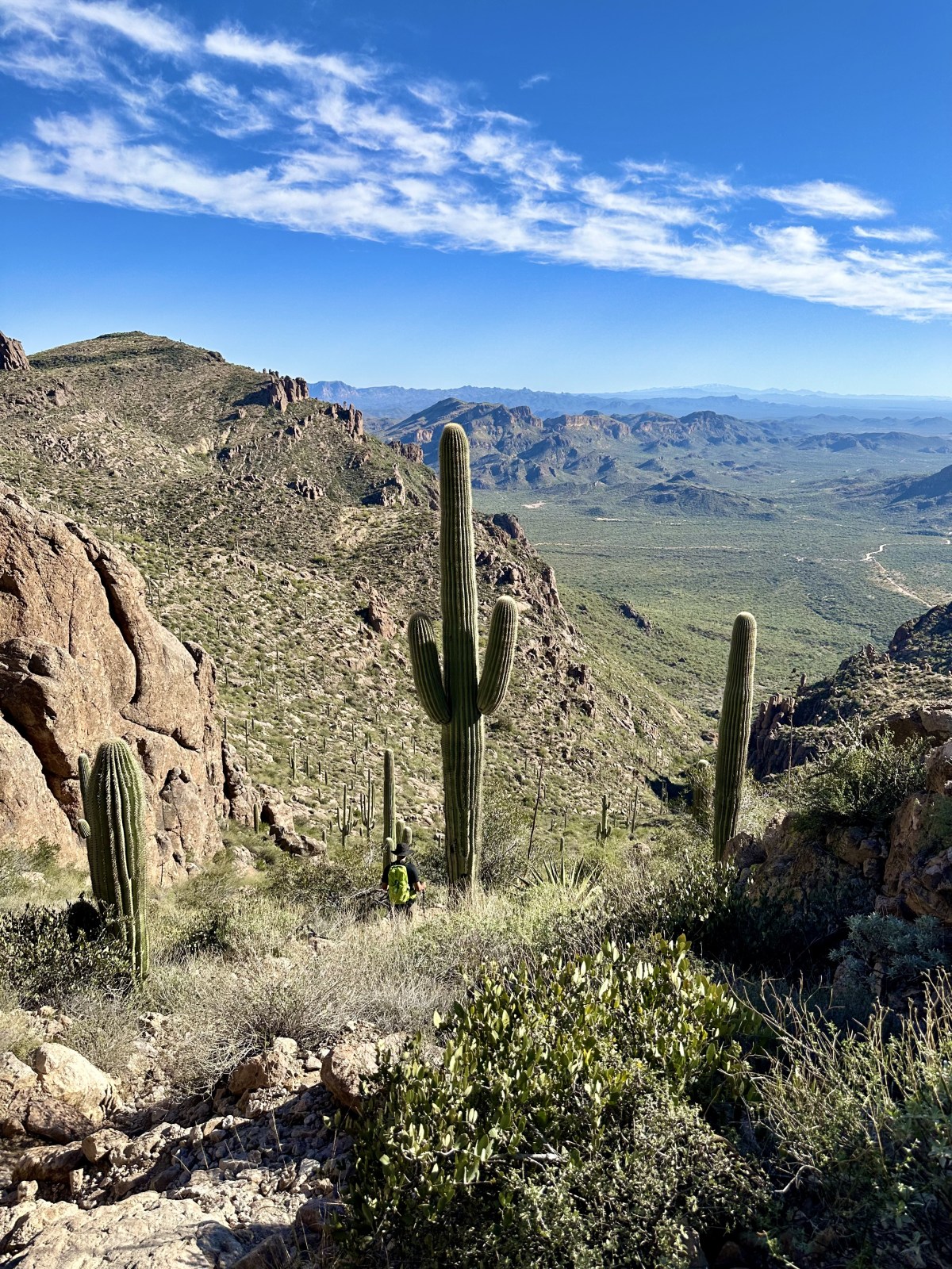
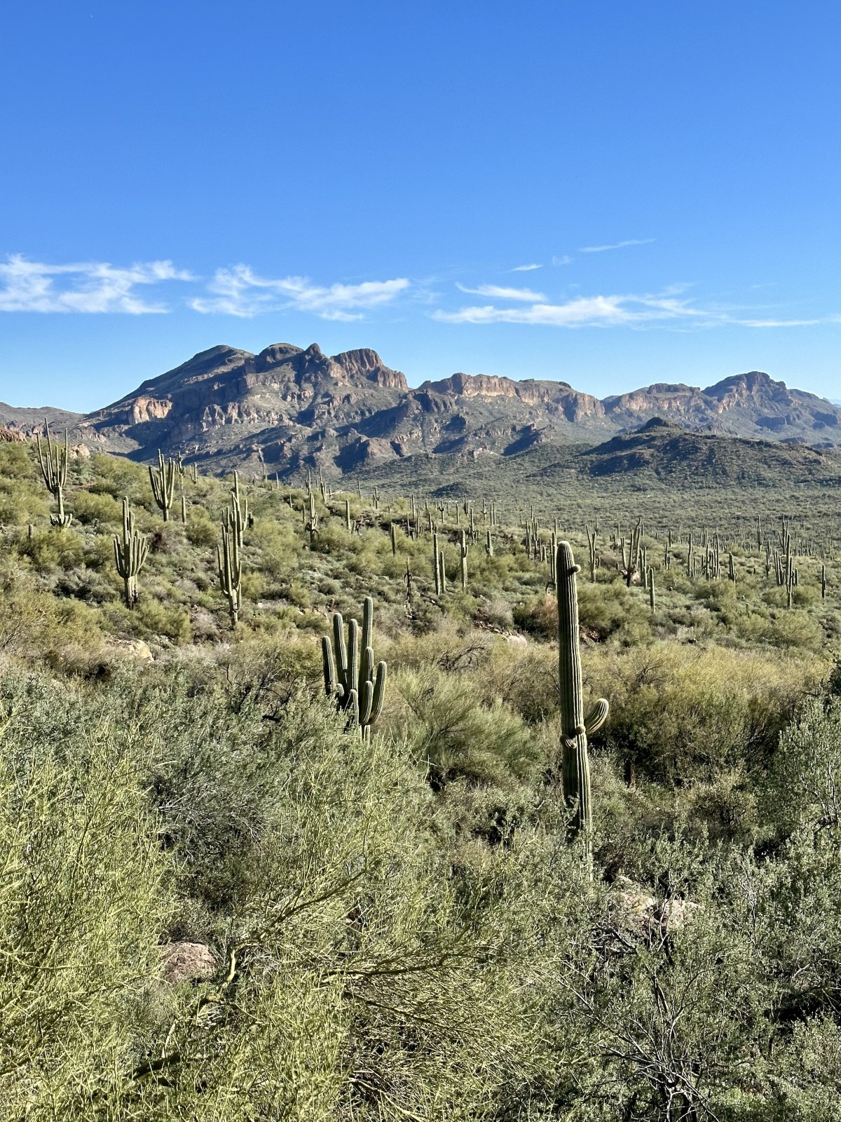
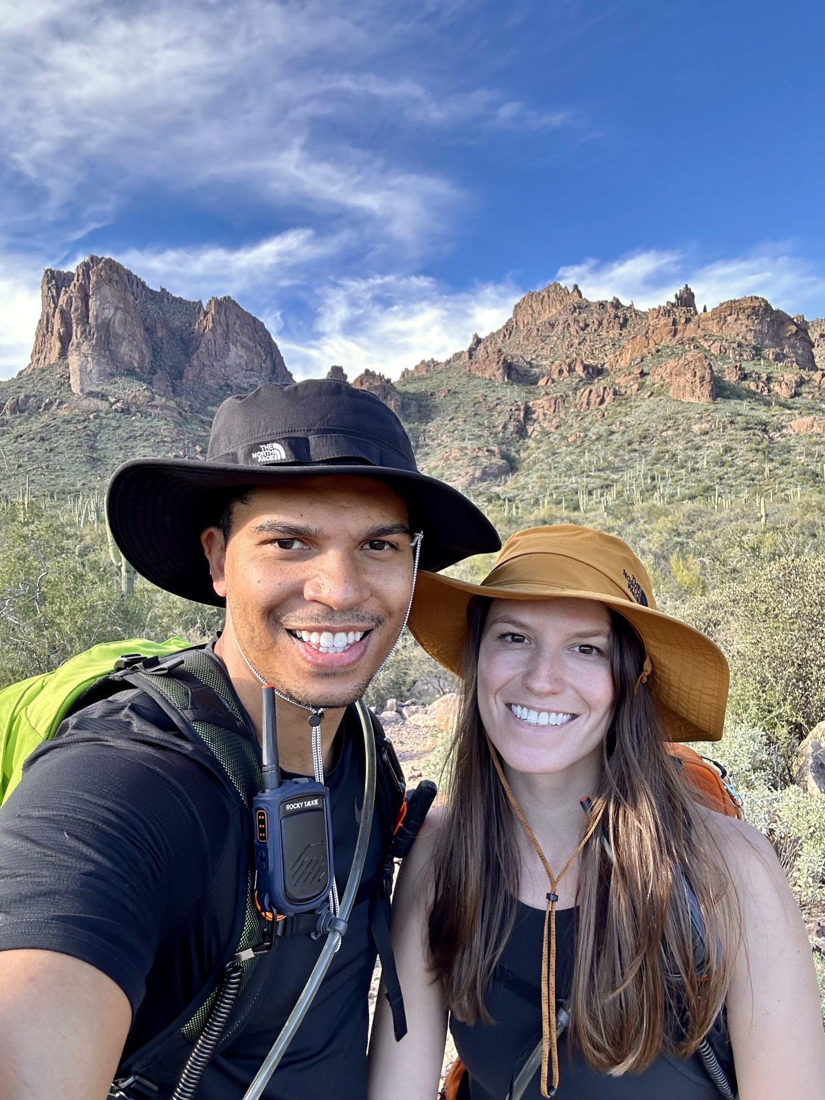
Peralta Trail to Canyon Lake: Superstition Wilderness Hike

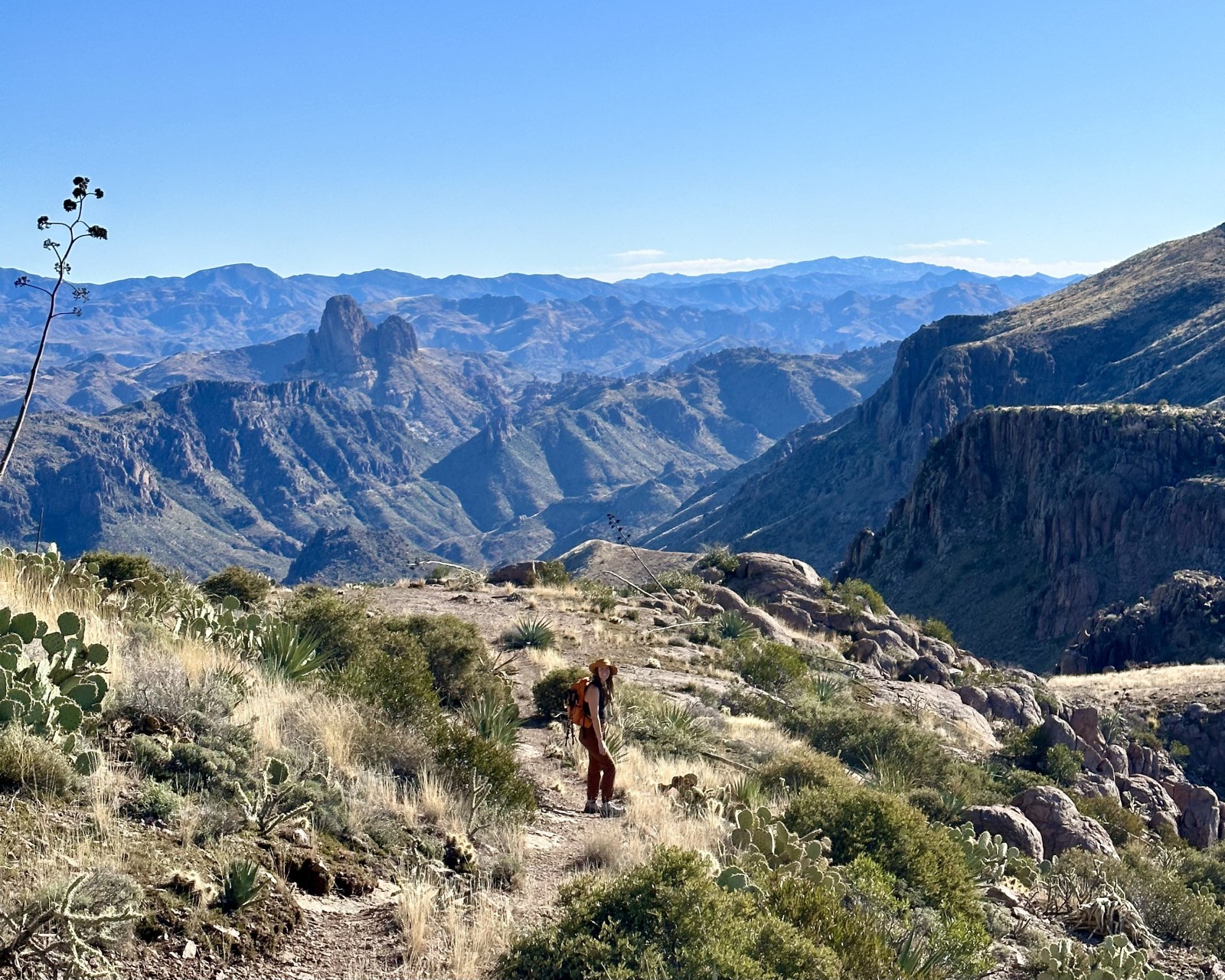
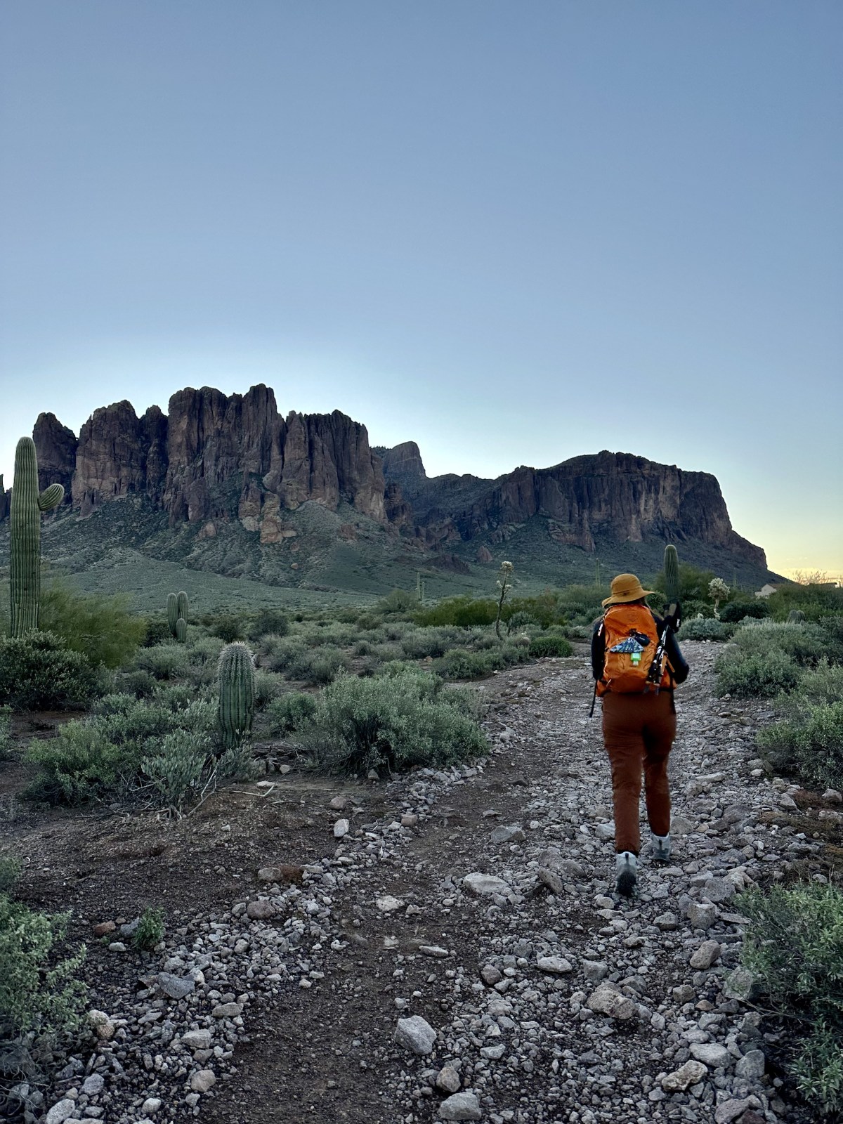
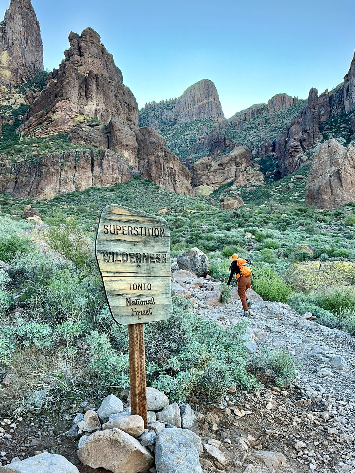
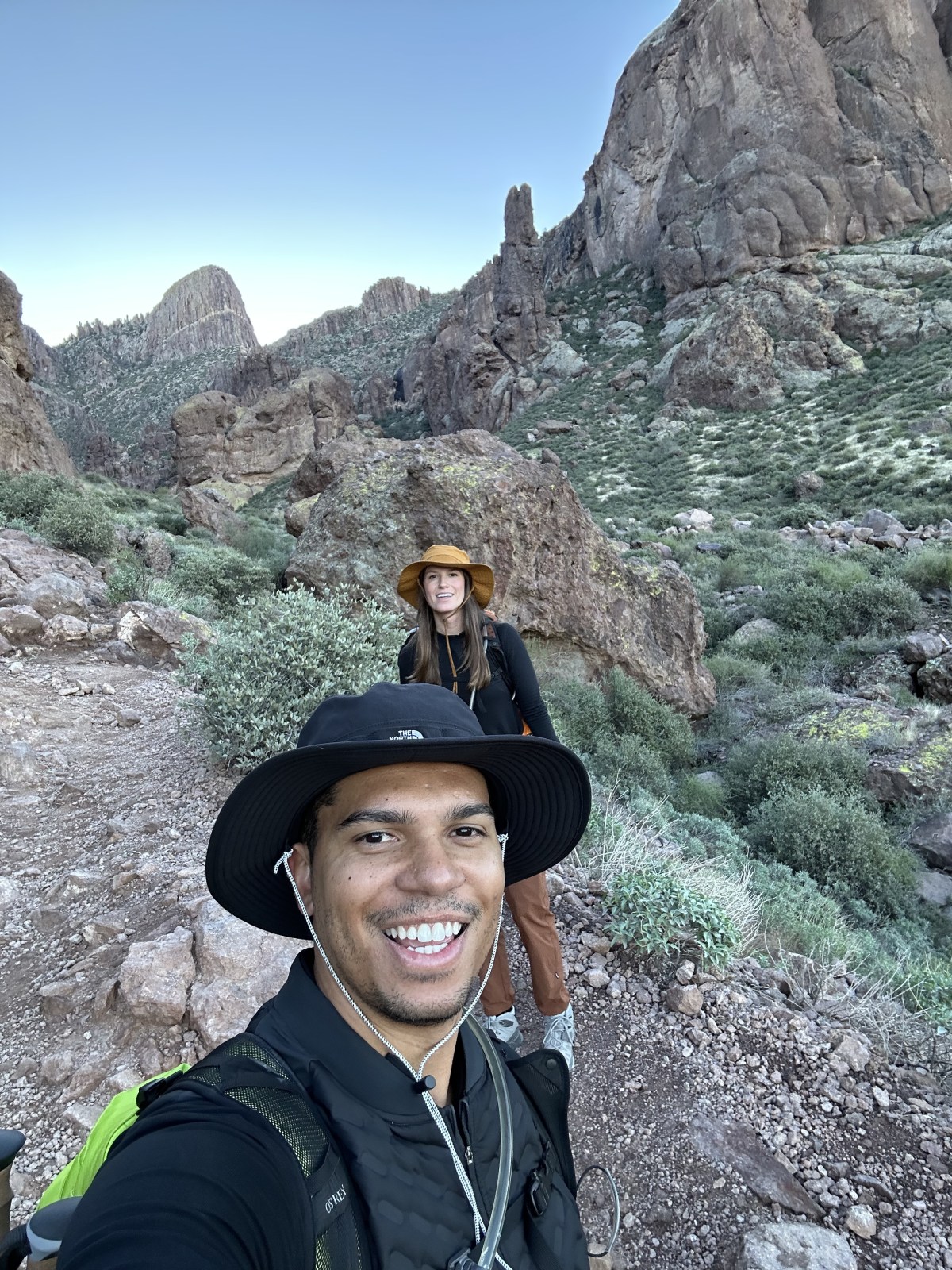
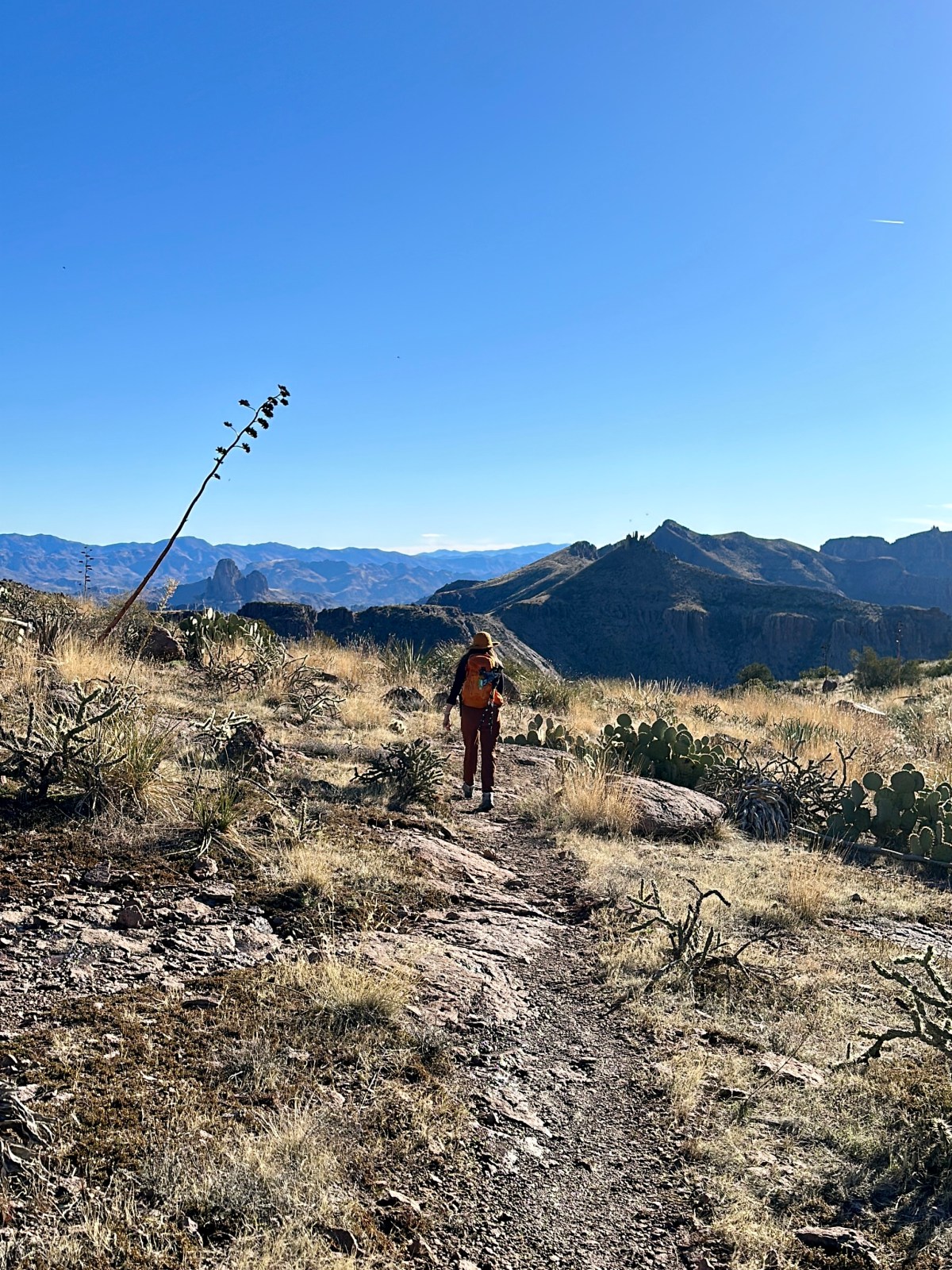
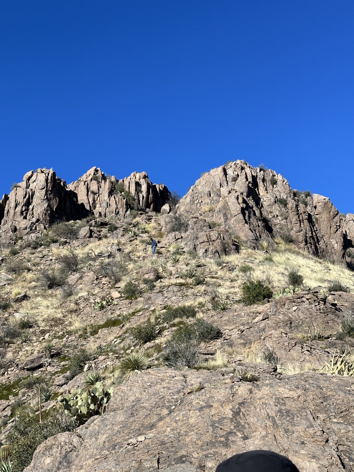
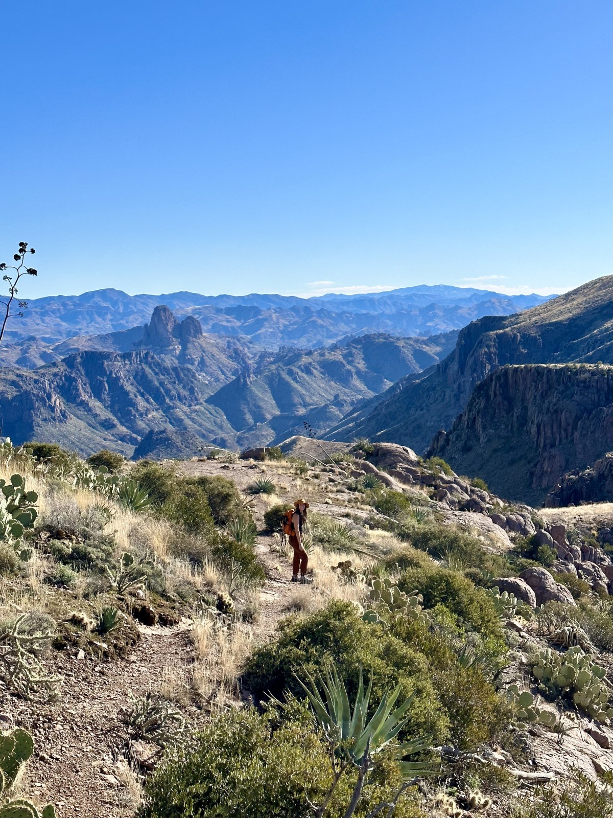
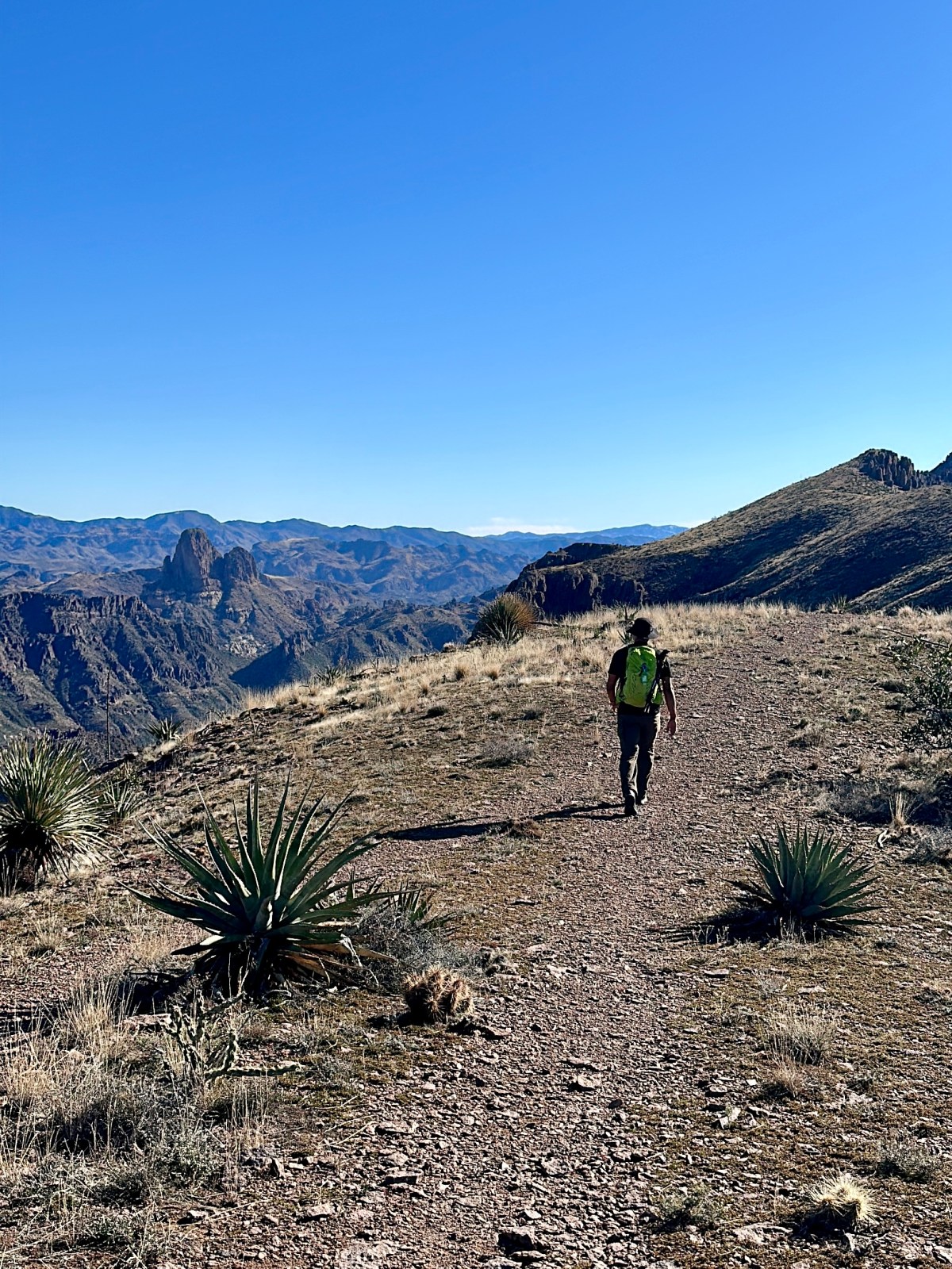
Peralta Trail to Canyon Lake Trail across the Superstition Wilderness of Tonto National Forest is a 15 mile hike in one direction that uses multiple connecting trails. This hike is often completed as a point-to-point hike in a single day, requiring some logistical planning, or an overnight backpack camping hike. We completed the hike in a single day and below get into how we planned to hike and our experience traversing the stunning Superstition Wilderness.

Read More »
Hi There!

We're Lauren and Owen -

We started The AZ Hikeaholics as a way to share our adventures with an audience that was interested. It soon grew into a community and we were all in! The more we learned about the history, geology, culture, biology etc, of the places we were exploring, the more we wanted to know.

You may also like -

Join our mailing list!

Never miss an update

Stay up to date by subscribing to our mailing list to receive our monthly newsletter and other important updates!