
Hike Three Sisters Summit: Superstition Wilderness
How to Get to the Trailhead
The Three Sisters Summit hike starts from the same trailhead as Wave Cave at Carney Springs Trailhead.
-
From Phoenix, take the US-60 East through Mesa, Apache Junction, and Gold Canyon.
-
Turn left onto Peralta Road and follow it north for about 6 miles. The road becomes dirt but is passable for most vehicles.
-
The small parking lot is on the west side of the road. Arrive early — it fills quickly.
If the lot is full, there are small pull-offs nearby or overflow parking farther down the road. This trailhead is on Arizona State Trust Land, so you’ll need a permit ($15 per person, not per vehicle).
Leave No Trace Reminder
Please remember to practice the Leave No Trace principles when hiking Three Sisters. Stay on trail, pack out all trash, and explore prepared. Don’t carve into rocks! For more guidance, see our hiking tips here.
Quick Stats
Length:
7 miles
Route Type:
Out & Back
Elevation Gain:
2,512 ft
Vaulted Toilets:
No
Hiking the Carney Springs Trail
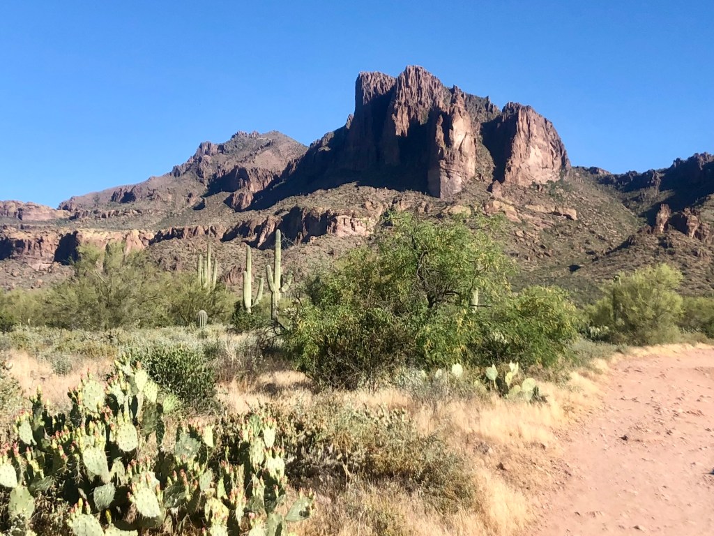
We started early to beat the heat. The trail begins wide, following Carney Springs Road, before narrowing as you enter Tonto National Forest and the Superstition Wilderness.
About a half mile in, the trail splits:
Left → Wave Cave Trail
Right → Carney Springs Trail (your route to Three Sisters)
Carney Springs Trail is narrower, overgrown, and much less trafficked than Wave Cave. Expect plenty of bushwhacking, thorny vegetation, and overgrowth. Long pants and tall socks are recommended.
Look for red and white paint markings and cairns to stay on track — this trail can be confusing, and offshoots can easily pull you off course.
The Climb to Carney Springs Saddle
From the start, the trail climbs steadily and quickly becomes a leg workout. There are some short rock scrambles, but nothing as technical as Flatiron.
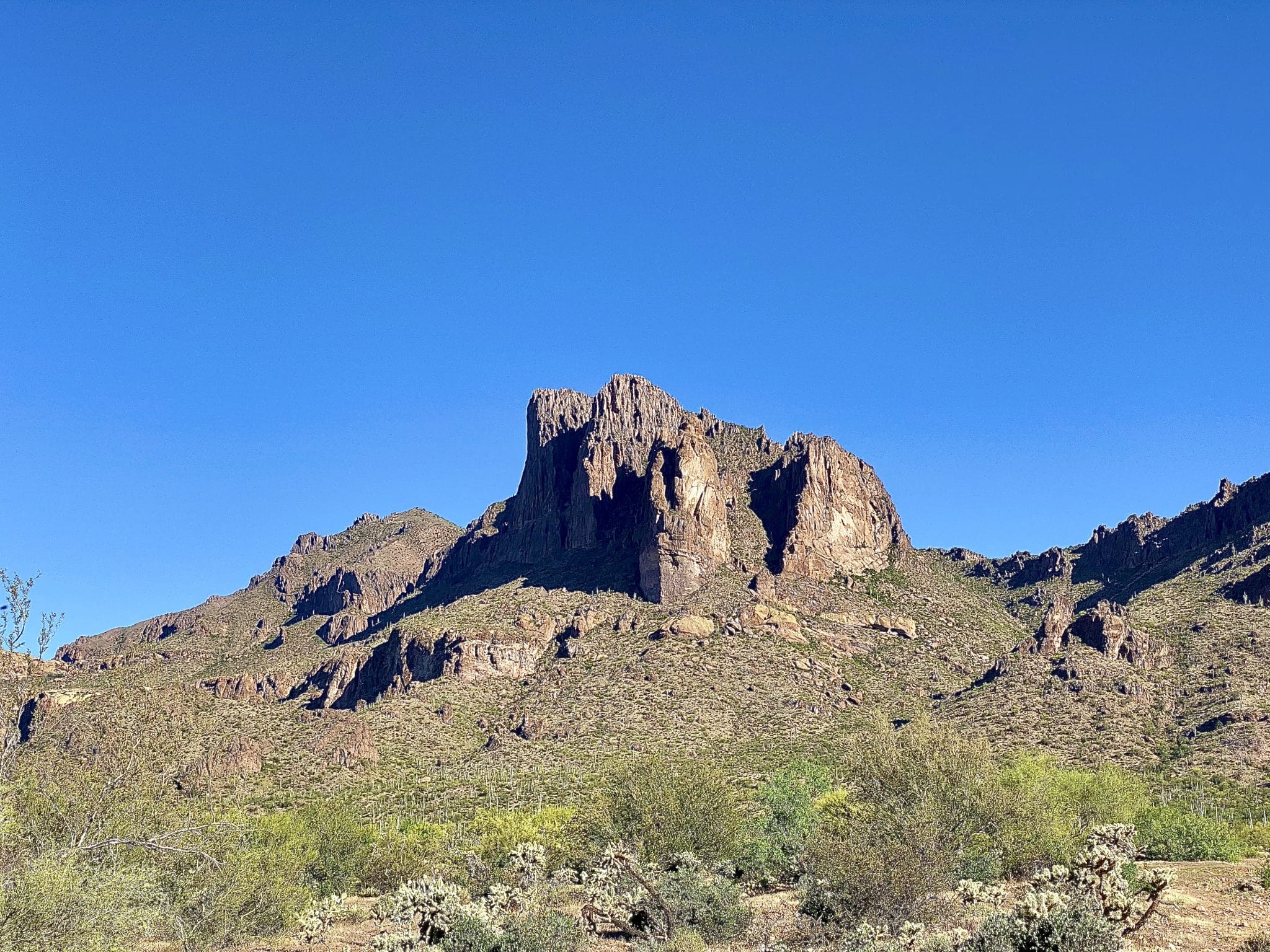
At about 2 miles in, you’ll reach Carney Springs Saddle, where you’ll join the Ridgeline Trail. The views open up here — saguaros with dozens of arms, volcanic rock formations, and sweeping desert vistas.
From the saddle, the trail dips briefly before flattening out, then begins climbing again. This is where Weaver’s Needle comes into view, growing more prominent as you ascend.
Final Push to Three Sisters Summit
This section feels long and exposed, with little shade. The desert heat can be brutal, so it’s best to hike this trail in cooler months. Around mile 3, you’ll reach a sharp left turn leading to the summit.
At the top, you’ll find sweeping views of Weaver’s Needle and Four Peaks (which from this angle looks like two). You can stop at the closest “sister” for a rest or continue farther east to reach the furthest formation.
We reached the summit at 10:40 a.m., ate lunch, and soaked in the views before heading back down.


Our Experience on the Descent
The hike back down was faster but still tough. One hiker in our group slipped into an agave (bring a first aid kit!) and later had both soles of his shoes break off, making the descent extra tricky.
We returned to the trailhead around 2:05 p.m. after 5.5 hours of hiking. My Apple Watch recorded 8.2 miles and 2,696 feet of elevation gain from the parking lot.
Tips for Hiking Three Sisters Summit
- Bring more water than you think you’ll need. I ran out for the first time ever on this hike.
- Start early or hike in cooler months. Shade is almost nonexistent.
- Wear long pants and tall socks to avoid thorns and overgrowth.
- Pack sunscreen and reapply — I still got burned despite reapplying.
- Always carry a first aid kit.
- Wear sturdy hiking shoes — a blowout on this trail would be miserable.

