

We want to remind you to practice the LEAVE NO TRACE principles while hiking Quartz Peak Trail. Please remember this trail is in the Sierra Estrella Wilderness and is subject to Federal Wilderness protection laws. It’s important to stay on trail, pack out all trash, and explore prepared. Don’t carve into any rocks or take any rocks. It is illegal! Check out our hiking tips here.
*Reminder, we completed this hike in February 2021 and trail and dirt road conditions may have changed since we originally created this post*
Quick Stats:
Length:
6 Miles
Route Type:
Out and back
Elevation Gain:
2,526 ft
Vaulted Toilets:
Yes
Getting here
This might be one of the most difficult parts or limiting factors to this hike! We used the ‘Directions’ feature from the AllTrails app and selected Apple Maps. There are a few reasons as to why:
-
- In our research, we read that people got stuck coming from the west entrance due to the high amount of sand.
-
- Apple Maps does not give the west entrance route as an option
-
- The south entrance from Maricopa, AZ was closer to our home
-
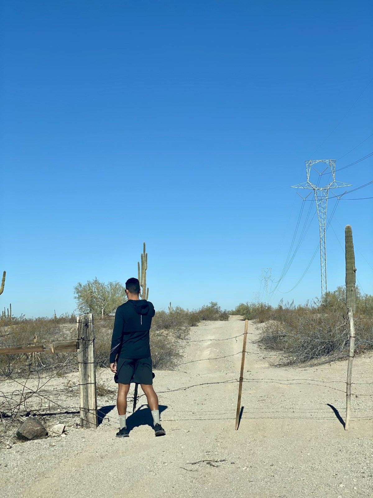
- 33.198980, -112.240070
Google Maps does give both routes, but we can’t provide details or tips to it as we haven’t tried that way. However, there is information out there! Coming from the south was a lot of fun but sometimes a little heart stopping. The route had very little sand and no deep sand. But the route does have multiple wash crossings with steep grades, large rocks, and many pothole like divots. We 100% recommend a vehicle with adequate clearance, usually 8 inches or higher and AWD or 4WD. The additional power to the wheels will help get through the tough angles while the clearance will save your undercarriage. We also recommend taking the route slowly, no matter your tires. Speed of sharp rocks increases chances of a flat. If you’re an avid off-roader, consider airing down your tires if you have the ability! Parking at the trailhead had room for about 15-20 cars.


The Hike
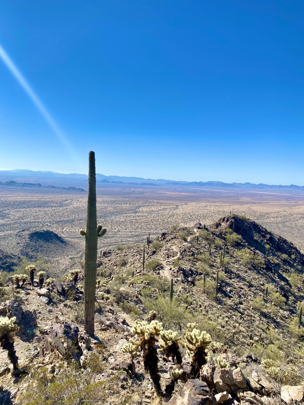
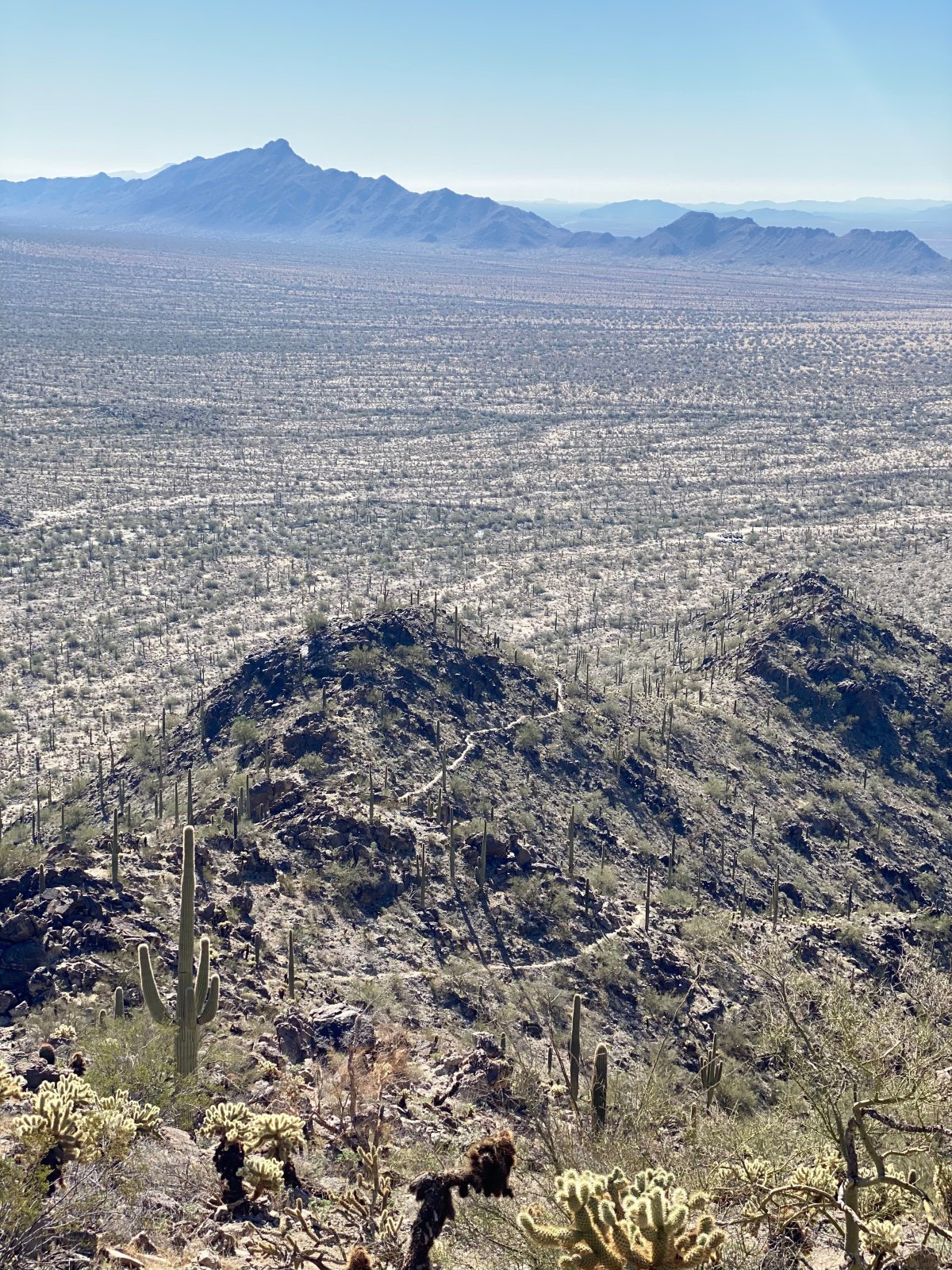
We found the hike to be absolutely stunning as we ascended the Sierra Estrella Mountains. The hike is pretty much a constant incline once you get to the base about 0.5 miles in. Much of the trail is an easily identifiable, well maintained trail built on switchbacks. The captivating Arizona desert floor starts feel smaller and smaller as you continue to ascend. Throughout are massive Saguaros encouraging you on the sidelines while Chollas look like they’re cheering you on in the crowd. Be mindful of Cholla bulbs that have fallen off and are on the trail. We stepped over a few. They’re naturally very sticky spines and won’t be fun if they go through your shoe.
Our heart rates were quite high this entire hike. We were hiking at a pretty good speed, even with the elevation change. It was a good test of our fitness. Our overall recorded time over the 6 miles was around 3 hours. As you get to the final mile or so the hike becomes more of a scramble with a less defined route at times. Take your time to scan the route ahead of you and often you’ll see where you should go. Don’t always be in a rush to follow those in front of you.

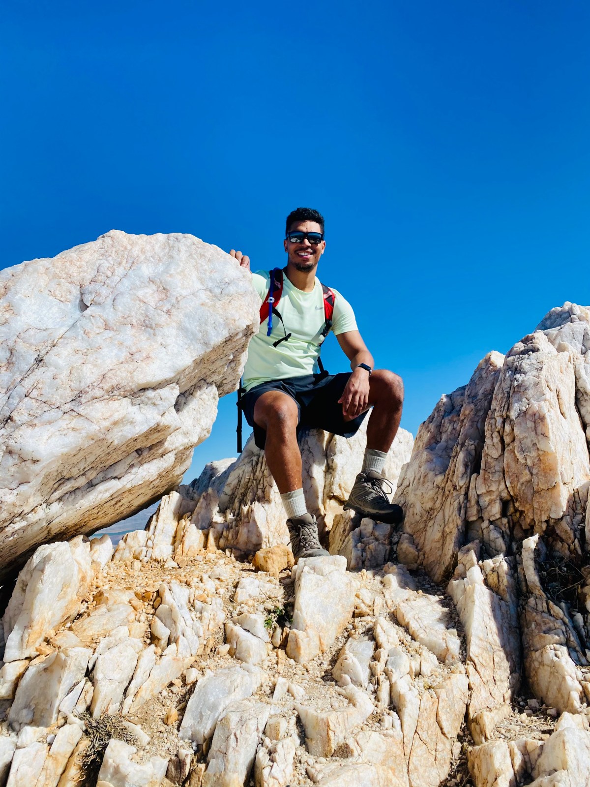
Peaking
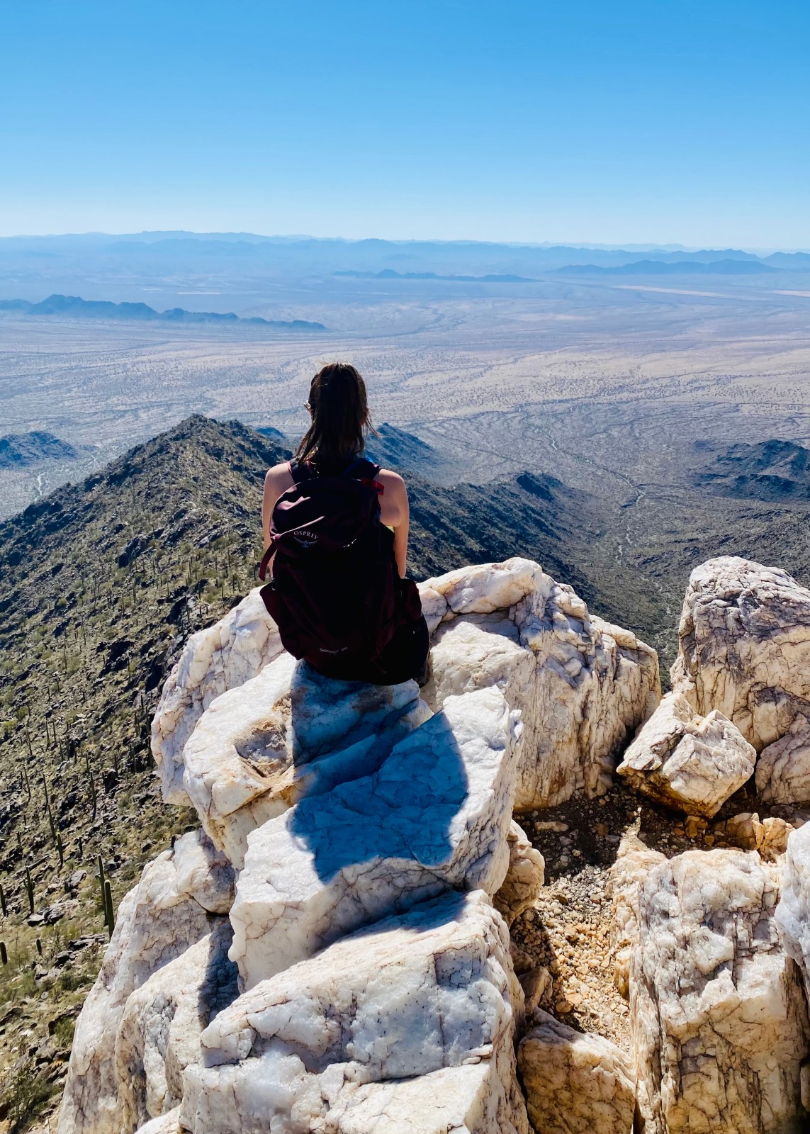
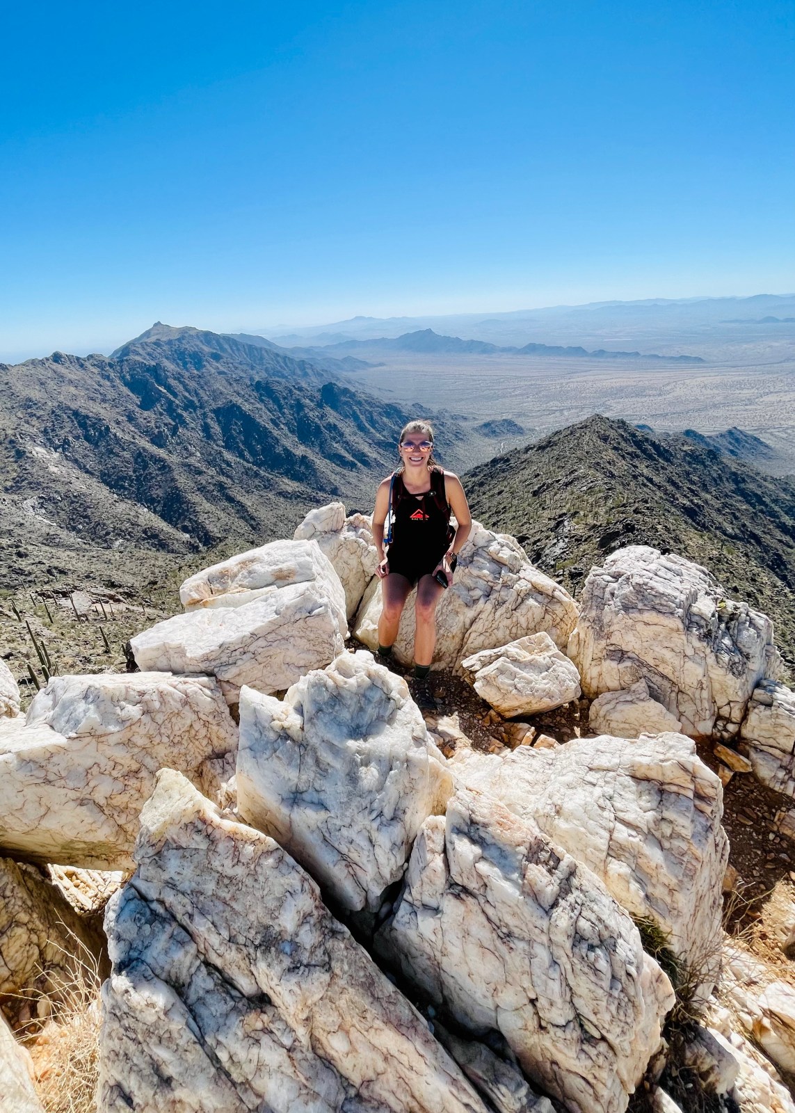
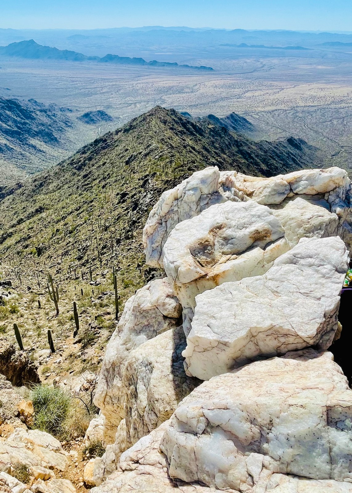
As you get very close to quartz filled peak, you’ll see more and more quartz on the trail. At the base of the peak, there is an option to go around to the east side and boulder your way up. We went this way. It was difficult for Lauren because of her height. A man on the peak was nice enough to help pull her up. For Owen, it was quite easy to scale. However, this side has a sharp drop off and a fall could be deadly. On west side, the route isn’t as scary, but still not a simple climb. We ended up coming down this way.
Once at the peak, soak up the amazing 360 views. To the northeast is South Mountain. It looks so tiny below the Sierra Estrella Mountains. To the west are many ranges we hope to get to one day. Be sure to sign the booklet or journal kept in the tin box within the rocks!

Come Prepared and LNT
It’s important to be prepared for this hike as it’s not easy to get to and you won’t be able to easily get food after you finish the hike. We recommend to bring lunch with you. We ate our sandwiches at the top of the mountain, but had food when we got back to our car as well. Along with extra water in case we drank all of ours. We usually bring a cooler with us to leave in our car when we hike for our extra water and food when we get back. It is also important to Leave No Trace while hiking Quartz Peak trail. Be sure to pack everything out. And PLEASE don’t take any of the quartz. When we were hiking up we saw someone hiking down with a big piece of quartz. Please don’t do this! If everyone took a piece of quartz there would be no quartz left!

