Looking for hikes in Sedona that are a bit more challenging but not quite a full-on climb? These moderate hikes offer the perfect balance. Elevated views, red rock beauty, and a good workout without being too intense. Whether you’re hiking to a vortex site or exploring scenic canyons, these trails are a great way to experience the magic of Sedona without overdoing it. Looking for other places to stay, ear, or other Sedona hikes? Check out our full itinerary page here.
Table of Contents
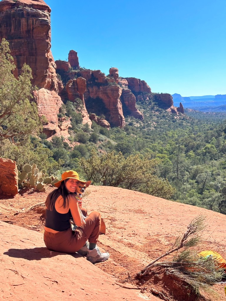
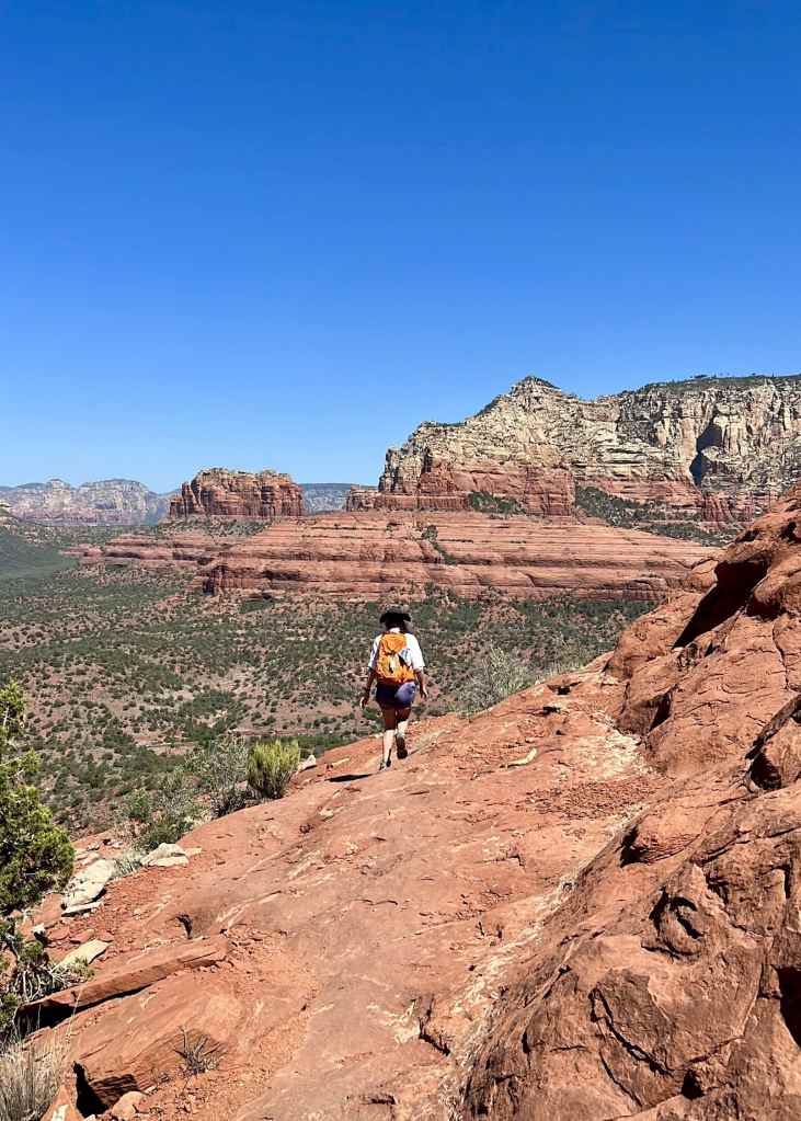
Pyramid to Scorpion Trail Loop
We loved this trail! On a Saturday evening in late July we were the only ones on trail (can’t guarantee it will always work out like that)
Overall the trail isn’t too challenging except for a short section on the south side of the loop on Pyramid Trail. Here it is quite steep
Alltrails lists the loop clockwise, we HIGHLY RECOMMEND going counter clockwise and finishing on Pyramid trail. This will offer spectacular views of Cathedral Rock
We recorded 2.2 miles with 301 ft of elevation gain
The parking lot is not large and may be used by overflow parking from Crescent Moon Ranch
To make the hike longer, start at Scorpion trail at the top of the hill across the street from the high school for a 4.3 mile hike
Red Rock Pass or other interagency pass not required
Tip! Hike on this trail during golden hour for a great glow on Cathedral Rock. If you plan to be on trail after dark make sure you have a light and trail map
Chuck Wagon Loop
Great trail on the west side of Sedona with multiple entry points.
We started at the Long Canyon Trailhead parking just north of the Mescal trailhead parking.
Tip! Great morning hike based on sun angles and surrounding red rocks
Long Canyon Trail to Deadman's Pass Trail to Mescal Trail Loop
We recorded about 5 miles because we ventured further down Long Canyon before turn back to connect to Deadman’s Pass Trail. Our elevation gain was 398 feet.
We started on Long Canyon Trail just up the street from the main Mescal Trail parking lot
Our route was counter clockwise, but each direction offers great views
There are no vaulted toilets at this trailhead but there are at Mescal Trail
We did not see a requirement for a Red Rock Pass or other interagency pass at the trailhead
Tip! Great morning hike based on sun angles and surrounding red rocks
Cow Pies Trail to Hangover Trail
We recorded an 5.25 miles with over 700 ft in elevation gain
We started from Cowpies Trailhead off Schnebly Hill Rd. You need high clearance and 4wd. If you don’t want to drive the road up you can hike from Munds Wagon Trailhead
There are vaulted toilets at the Munds Wagon Trailhead, but none at Cowpies Trailhead
A Red Rock Pass or other interagency pass is needed (America the Beautiful)
This link shows the full loop from Munds Wagon, but you can pick what route you want to take
Cathedral Rock Loop: Slim Shady - Templeton - Hiline Trails
We recorded an 8 mile loop with over 1,082 ft in elevation gain
The trailhead is at Yavapi Vista. Parking is limited! We recommend getting there early
There are vaulted toilets at the trailhead
This trail is popular for bikers, be alert! There are a lot of narrow and hidden turns that make it hard to see
A Red Rock Pass or other interagency pass is needed (America the Beautiful)
We recorded 6.4 miles with over 850 ft in elevation gain
There is limited parking for The Ridge Trail with only 3 spots designated for the trail. You can do this loop starting at different trails as well or park at the city park down the street
There are a ton of different trails in this area known as Carroll Canyon
There are no restrooms or trash cans at the trailhead
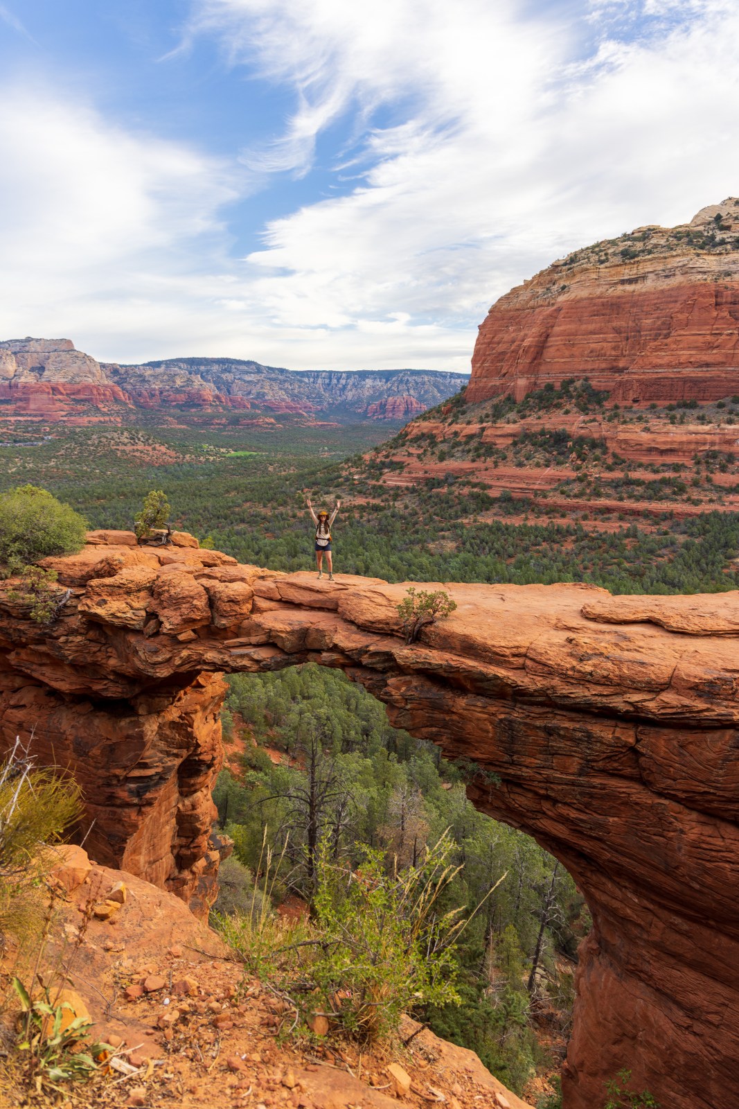
This is a VERY popular 3.9 mile out and back hike with 521 ft in elevation gain. Most times there is a line to wait to take a picture on the bridge. Plan ahead!
There are vault toilets at the trail head
The parking lot does not close, but it it small and fills up quick. Do not illegally park! There is a shuttle system we recommend taking. You can find shuttle times here
2 mile loop with a combination of trails. Bunkhouse Trail to East Gate to Javelina Trail to the House of Apache Fires Trail back to Bunkhouse
There is a $7 entrance fee to enter the park. You can learn more on the State Park’s website here
Red Rock State Park is a nature preserve and environmental education center so there are no trash cans to keep animals safe! Dogs also aren’t allowed in the park
This is a 6.5 mile out and back trail with 564 ft in elevation gain. It is $12 per vehicle. For more information check our Coconino National Forests website
This is a very popular hike! The parking lot is small and fills up quickly. There are vault toilets and picnic tables
There are a lot of water crossings and depending on how full Oak Creek is the water could be high. We both wore water shoes
There are a few different ways you can hike this. One option is a 2.7 mile loop with 285 ft in elevation gain. Another option is a 4.4 mile loop with 528 ft in elevation gain.
There are two different spots to park at. One spot is Cathedral Rock parking. In order to park at Cathedral Rock you have to use a shuttle. You can also park at Turkey Creek parking. In order to get here you have to drive down a dirt road from VoC.
Here is the link for the Turkey Crossing route on AllTrails and here is the link for the Cathedral Rock Route on AllTrails.
Little Horse to Chicken Point
This is a 4.3 mile out and back hike with over 616 ft in elevation gain
The parking lot does not close, but it is small and can fill up quick. There is a free shuttle you can take to get here
Vault toilets and a kiosk to buy a Red Rock Pass is at the trailhead
Vultee Arch
3.4 mile hike out & back with over 534 feet in elevation gain
The moderate hike to get to Vultee Arch is from Dry Creek Road. Dry Creek Road is a tough road and you need high clearance and 4WD. There are no vault toilets at the trailhead!
This is the road people take to get to Devil’s Bridge so there will be people on the road until you pass the turn off for Devil’s Bridge
If you don’t have a high clearance vehicle you can hike this from Huckaby / Cowpie / Munds Wagon Trailhead. It is a 5.8 mile out and back hike with 941 ft in elevation gain
If you do have a high clearance vehicle you can drive up Schnebly Hill Road and park on the side to cut off some miles
If you don’t have high clearance to get to the very end of the road then this is a 3 mile out & back hike with 462 ft in elevation gain. If you do have high clearance the trail is only about 1 mile out & back
This hike has a pretty narrow section to it! If you don’t like heights this hike might not be for you
There are a few ways to hike to Seven Scared Pools & Cave. The shortest way is from Solider Pass Trailhead. The parking lot is closed for Solider Trailhead. You have to take a shuttle to get to the trailhead. Here is the link to AllTrails for Solider Pass to Seven Scared Pool. There are not vault toilets at this trailhead!
Another option is to park at Jordan Trailhead and hike Cibola Pass to Seven Scared Pools. You don’t need to take a shuttle for this trailhead. Here is the link to AllTrails. There are vault toilets at this trailhead!
If you want an even longer hike you can do Brins Mesa Loop. You can still hike to Solider Pass and the cave on this hike!