
Governors Peak Hike Overview
Governors Peak in the Hell’s Canyon Wilderness is a quiet, challenging hike north of Phoenix. The trail climbs over 1,700 feet in about six miles round trip and is lightly trafficked, which makes it perfect if you’re looking for solitude. Along the way you’ll follow cairn-marked paths, pass through rugged desert canyons, and may even spot wild burros before reaching sweeping summit views of Lake Pleasant and the Bradshaw Mountains.
Quick Stats
Length:
6.3 miles recorded
Route Type:
Out and back
Elevation Gain:
1,800 ft recorded
Vaulted Toilets:
No
Directions to Governors Peak Trailhead
The trail begins off N Castle Hot Springs Road, north of Lake Pleasant. After passing the lake, the paved road turns to dirt, but it is generally manageable for sedans with careful driving. We used Apple Maps to navigate and had no issues finding the trail. Parking is limited to small roadside pullouts, so arriving early is best. At the start you’ll find a trail register book where hikers can sign in for safety before entering the wilderness.
What to Expect Trail
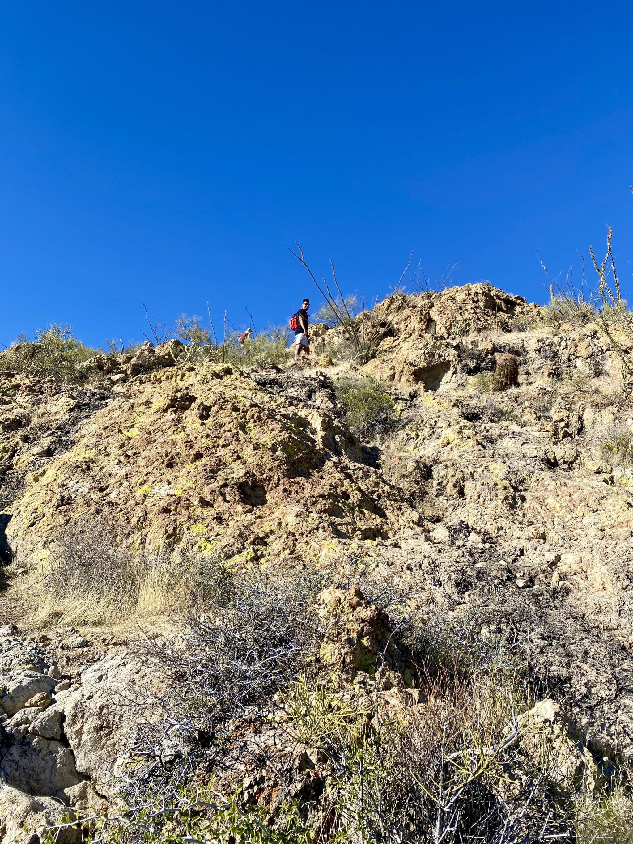
The hike starts with a short wash crossing and soon enters designated wilderness area, where the terrain becomes steeper and signage is limited. Cairns are essential here, as the trail can be difficult to follow without them. As we worked our way up the canyon, we spotted several wild burros grazing nearby—an unexpected highlight. The climb is steady and includes a few false summits that can make the route feel longer than it is. Near the top, the trail grows steeper and rougher, requiring careful footing on loose rock and eventually a short boulder scramble to reach the summit.
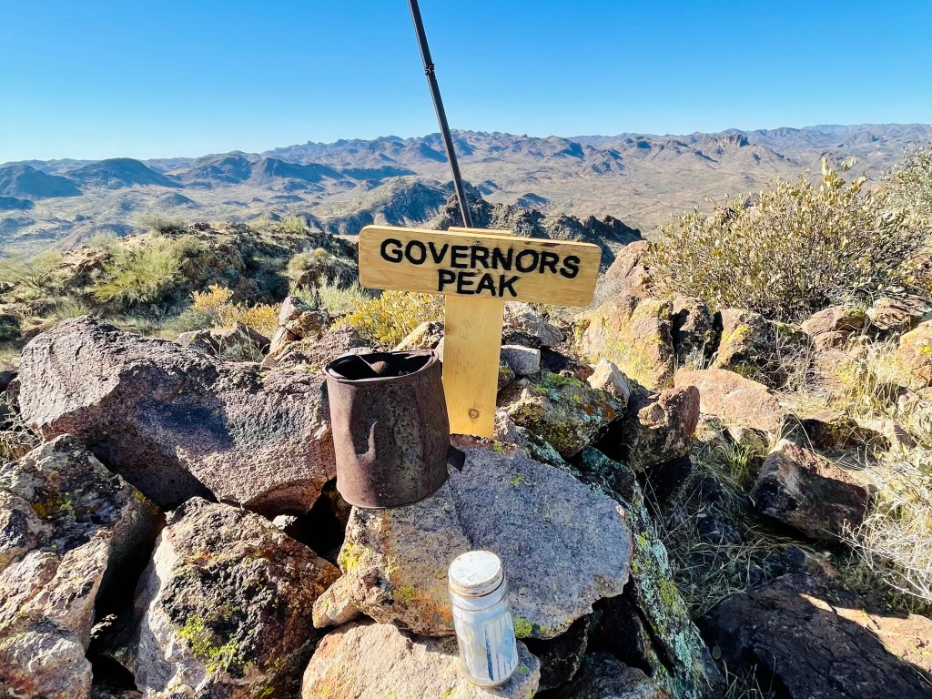
Views from the Summit of Governors Peak
The views from the top make the effort worthwhile. To the south, Lake Pleasant sparkles in the desert light, while to the east you can spot the historic Castle Hot Springs Resort tucked below the ridge. Looking northwest brings the Wickenburg Mountains into view, while the Bradshaw Mountains dominate the horizon to the northeast. At the very top, you’ll find a summit register tucked into the rocks and a sign marking Governor’s Peak.
This hike measures a little over six miles out and back, although it feels longer than the AllTrails listing of 5.2 miles. The route gains more than 1,700 feet in elevation and is best rated as moderate to difficult, especially considering the steep and rocky final push. There are no facilities, and parking is limited, so be prepared. Dogs are allowed but the rough footing and steep terrain may be challenging for some. The best time to hike is late fall through spring, as summer heat makes this route unsafe.


Other Hikes in Phoenix
Governors Peak is a lesser-known trail in the Hell’s Canyon Wilderness, offering challenging terrain, wildlife sightings, and panoramic views without the crowds of Sedona or the Superstitions. For hikers looking to explore new parts of Arizona, this trail makes a rewarding adventure. If you’re planning more hikes in the region, check out our full guide to the best hikes near Phoenix for more ideas.

