
Hiking Balanced Rock from Brown’s Ranch Trailhead
Brown’s Ranch to Balanced Rock is a scenic trail in the Scottsdale McDowell Mountains and part of the McDowell Sonoran Preserve. With miles of interconnected trails, this area is popular with hikers and mountain bikers alike. We set out from Brown’s Ranch Trailhead for a longer hike that would take us past Balanced Rock, one of the preserve’s standout formations. The trail is easy to follow, mostly flat, and a great choice if you want desert views, iconic rock features, and a moderate hike close to Scottsdale.
Quick Stats
Length:
6.3
Route Type:
Out and back
Elevation Gain:
350 ft recorded
Vaulted Toilets:
Yes
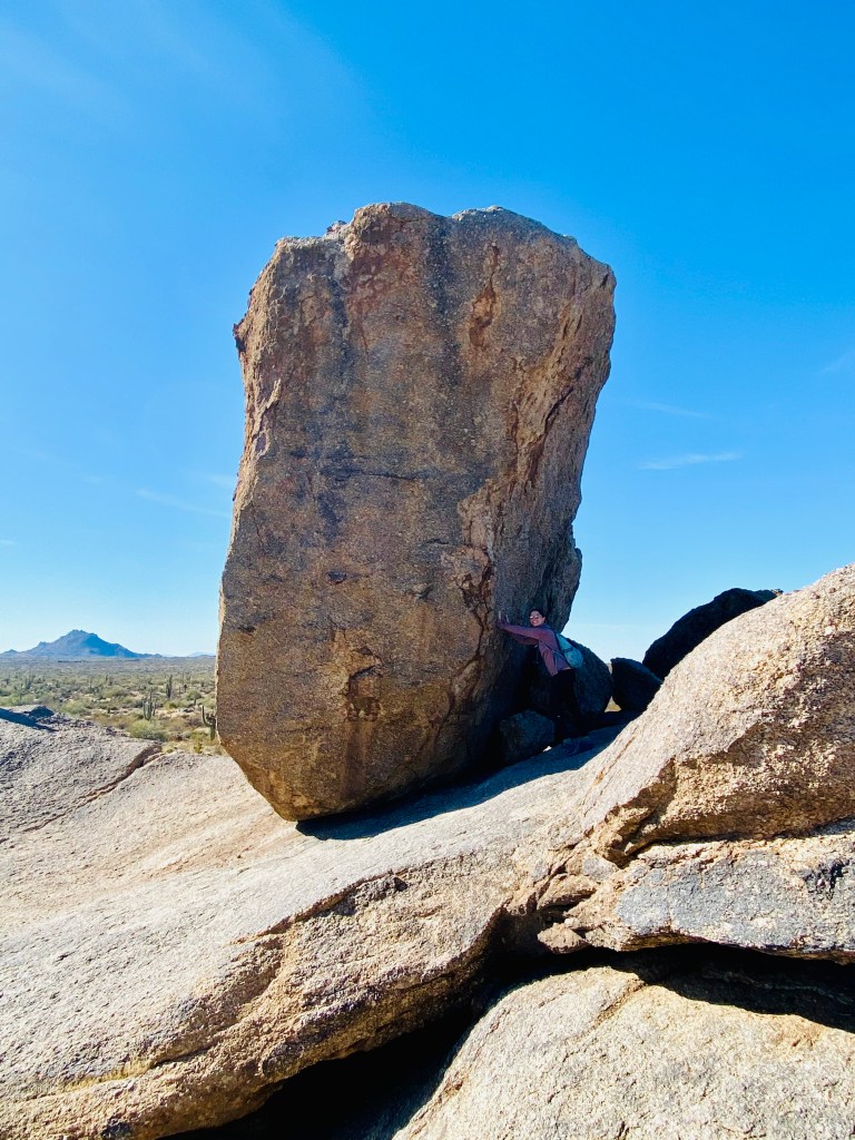
Balanced Rock
Balanced Rock is one of the standout landmarks in the McDowell Sonoran Preserve. This unique formation makes a great photo spot and is a fun turnaround point if you want a shorter hike. The trail is mostly flat and easy to follow, with classic Scottsdale desert views along the way.
Extending the Hike Beyond Balanced Rock
Instead of turning back, we decided to continue on. From Balanced Rock we followed the trail west past the Chuckwagon intersection and onto Cholla Mountain Loop Trail. Heading north for 1.2 miles, we reached Branding Iron Trail, then briefly followed it to South Diablo Trail. This black diamond bike trail gave us views all the way to Cave Creek before we turned around to head back.
Returning to Brown’s Ranch Trailhead
For the return trip we took a slightly different route to mix things up. From Cholla Mountain Loop we rejoined Balanced Rock Trail, then connected west to Watershed Trail. Watershed took us south for about 0.9 miles, reconnecting with Chuckwagon. From there we followed the trail back to Brown’s Ranch Road and returned 1.4 miles to the parking lot. Using a trail map was extremely helpful since the McDowell Sonoran Preserve has so many interconnected options.


Trail Experience and Tips
Overall, this loop through Brown’s Ranch was one of our favorite hikes in the McDowell Mountains. We saw plenty of mountain bikers but surprisingly few hikers, which made it feel peaceful. Along the way we had views of Four Peaks, Tom’s Thumb, and even Cave Creek in the distance. With little elevation gain, this area is perfect for easy to moderate hikes depending on how far you want to go. If you visit, make sure to include Balanced Rock as part of your route.
For more McDowell Sonoran Preserve hikes, check out our guides to Quartz Trail at Lost Dog Wash and Tom’s Thumb.

