

Hike Browns Peak: Four Peaks Wilderness in Arizona
Browns Peak, the tallest of the Four Peaks in Arizona, is one of the most challenging and rewarding hikes near Phoenix. Sitting at 7,657 feet, it offers rugged terrain, a tough scramble through the infamous “chute,” and panoramic views stretching from the Superstition Mountains to the Mazatzals.
Leave No Trace
We want to remind you to practice the LEAVE NO TRACE principles while hiking Browns Peak. Please remember to stay on trail, pack out all trash, and explore prepared. Don’t carve into any rocks. It is illegal! Check out our hiking tips here.
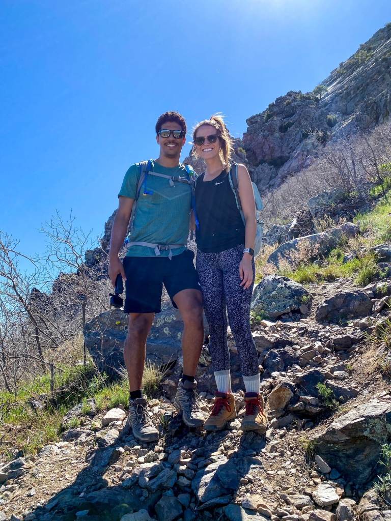
We went at the end of April 2020 and the weather was beautiful. It was in the high 70’s while we were hiking and once we got to the top it was cooler and we had a nice breeze.
Quick Stats: Brown's Peak
Length:
4.7 Miles
Route Type:
Out and back
Elevation Gain:
1,909 ft
Vaulted Toilets:
No
Dog Friendly:
No
Fee:
No
Difficulty:
Difficult (Class 4 scramble)
Water:
No
How to Get to Browns Peak Trailhead
We left from North Scottsdale and took Shea Road east to the Beeline Highway (Arizona State Route 87). This is one of the most beautiful drives in the state, passing through the Fort McDowell Yavapai Nation and then into the Tonto National Forest. As you head north toward Payson, the desert landscape opens up into rolling hills, towering saguaros, and rugged rock formations that showcase Arizona’s incredible scenery.
After about 13 miles, look for the turnoff to Cline Cabin Road (Forest Service Road 143) on the right. On Apple Maps it’s labeled as Cline Cabin Road, but most maps use the Forest Service designation. The turnoff coordinates are 33.6783, -111.5028.
Stay on Forest Service Road 143 for roughly 17 miles. You’ll pass OHV staging areas and other forest road junctions before reaching the turn for Pigeon Spring Road. Follow signs toward Lone Pine Trailhead, making a sharp right onto Pigeon Spring Road and continuing south. The Lone Pine Trailhead coordinates are 33.7054, -111.3379.
We arrived at the trailhead parking lot around 9:00 a.m. and grabbed the last spot. By the time we finished, cars were lined along the road and at nearby pullouts. Arrive early if you want a spot in the main lot.
Road Conditions to Lone Pine Trailhead
Once you leave SR 87, the road immediately turns to dirt. A high-clearance vehicle with 4WD or AWD is strongly recommended, especially depending on recent weather.
This road is not regularly maintained and is very winding, bumpy, and washboarded in sections. When we visited in 2020, it took us about 1.5 hours to cover the 19 miles from the turnoff to the trailhead in a Ford Ranger. airing down tires can make the ride smoother.
Expect a slow, rough drive — but the views and the hike are worth the effort.
Hiking Browns Peak in the Four Peaks Wilderness
Browns Peak is the northernmost of the Four Peaks, part of the Mazatzal Mountains that dominate the desert between Tonto Basin and the Mogollon Rim. The trail begins at the Lone Pine Trailhead at 5,700 feet and climbs to the summit at 7,659 feet. Not only is Browns Peak the highest of the Four Peaks, it’s also the highest point in Maricopa County. Fun fact: the Four Peaks are featured on the Arizona license plate.
The hike begins on a relatively flat, well-marked trail before transitioning into a gradual incline. As you gain elevation, you’ll catch your first views of Roosevelt Lake shimmering in the distance.
Coming from the lower elevation of Phoenix, we immediately felt the difference in altitude, but after a short adjustment we found our pace.
One of the most enjoyable aspects of this trail is the change in vegetation compared to the Sonoran Desert below. Higher elevations bring cooler temps, tall pines, and seasonal color changes that can make it feel like autumn, even in spring. The trail is easy to follow here, with occasional signage to keep you on track.
Approaching the Summit Scramble
As you near the base of Browns Peak, you’ll reach a sign directing hikers up toward the summit. Up to this point, the hike is relatively easy. Beyond the sign, the terrain quickly shifts — the incline steepens and the scrambling begins. This is the section that makes Browns Peak one of the most challenging summit hikes in the Phoenix area.

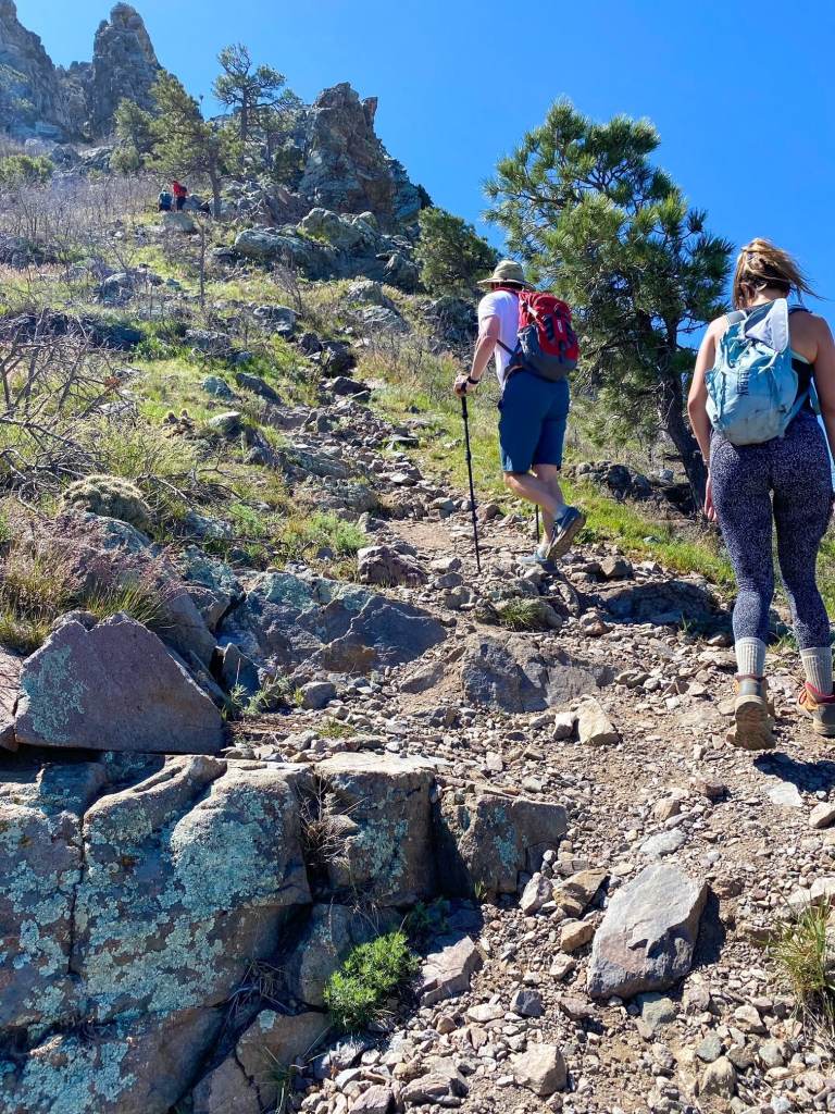

The Climb Through the Chute
The final stretch to the summit is what makes Browns Peak both famous and intimidating. The last half mile is a Class 4 climb through a steep scree chute. This section is nearly vertical in places and requires careful scrambling over loose rock of all sizes.
Take your time here — footing and grip are crucial. Rocks often shift underfoot and can tumble onto hikers below, so move slowly and allow space between groups. Hidden cacti among the rocks make things even trickier. Helmets are recommended if you’re hiking with others to protect against falling debris.
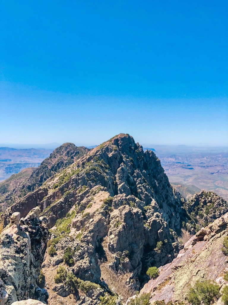
Summit Views
Reaching the summit is incredibly rewarding. On a clear day you can see as far as Humphreys Peak in Flagstaff, the highest point in Arizona. To the south, Phoenix landmarks like Camelback Mountain and Piestewa Peak are visible, while closer views take in the rugged Mazatzal Mountains and Roosevelt Lake.
We took a long break at the summit to enjoy the views, snap photos, and eat lunch — a much-needed reward after the climb. Don’t forget to pack snacks and plenty of water; you’ll be glad to have them once you reach the top.


