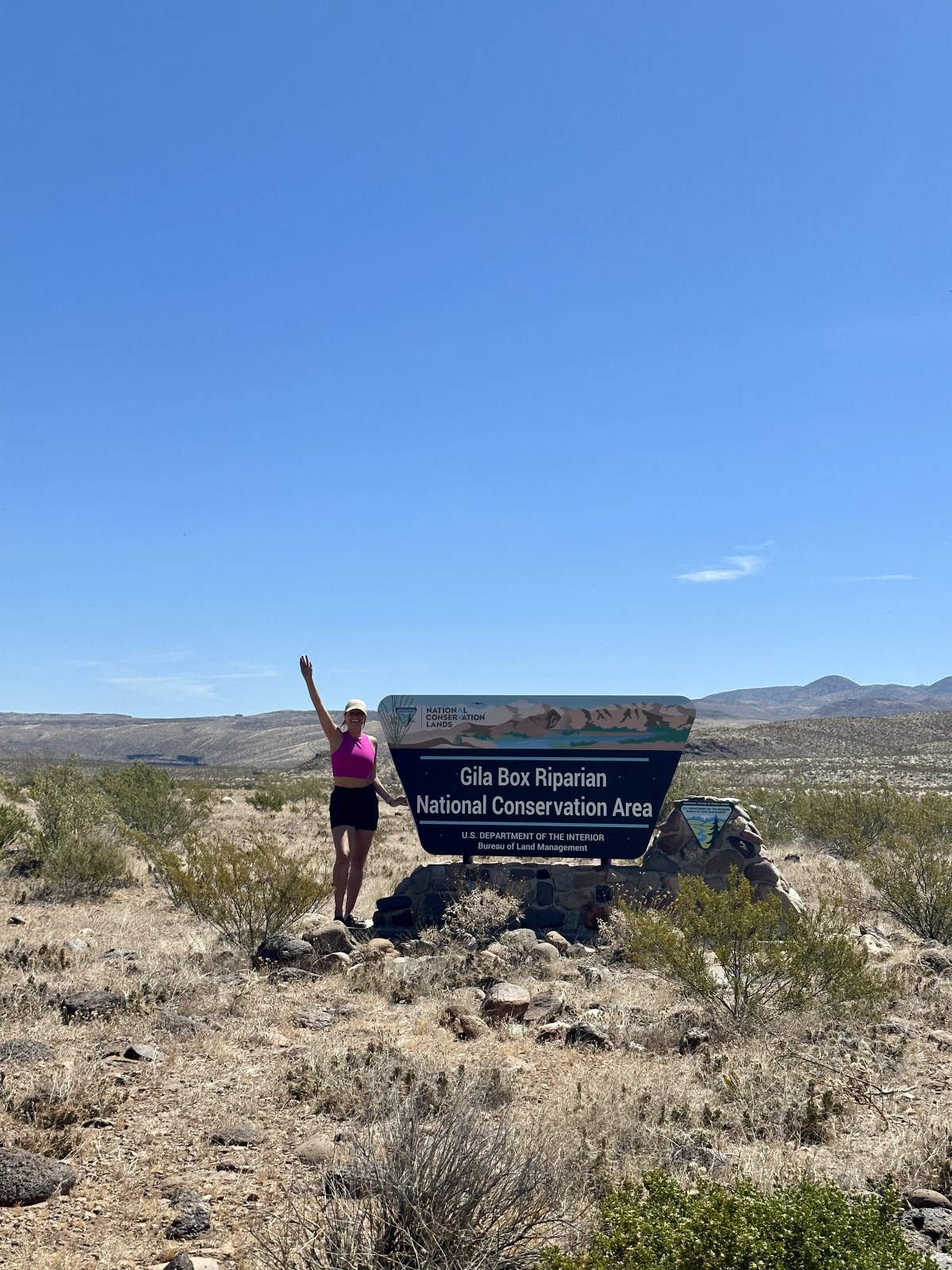
Where is Gila Box Riparian?
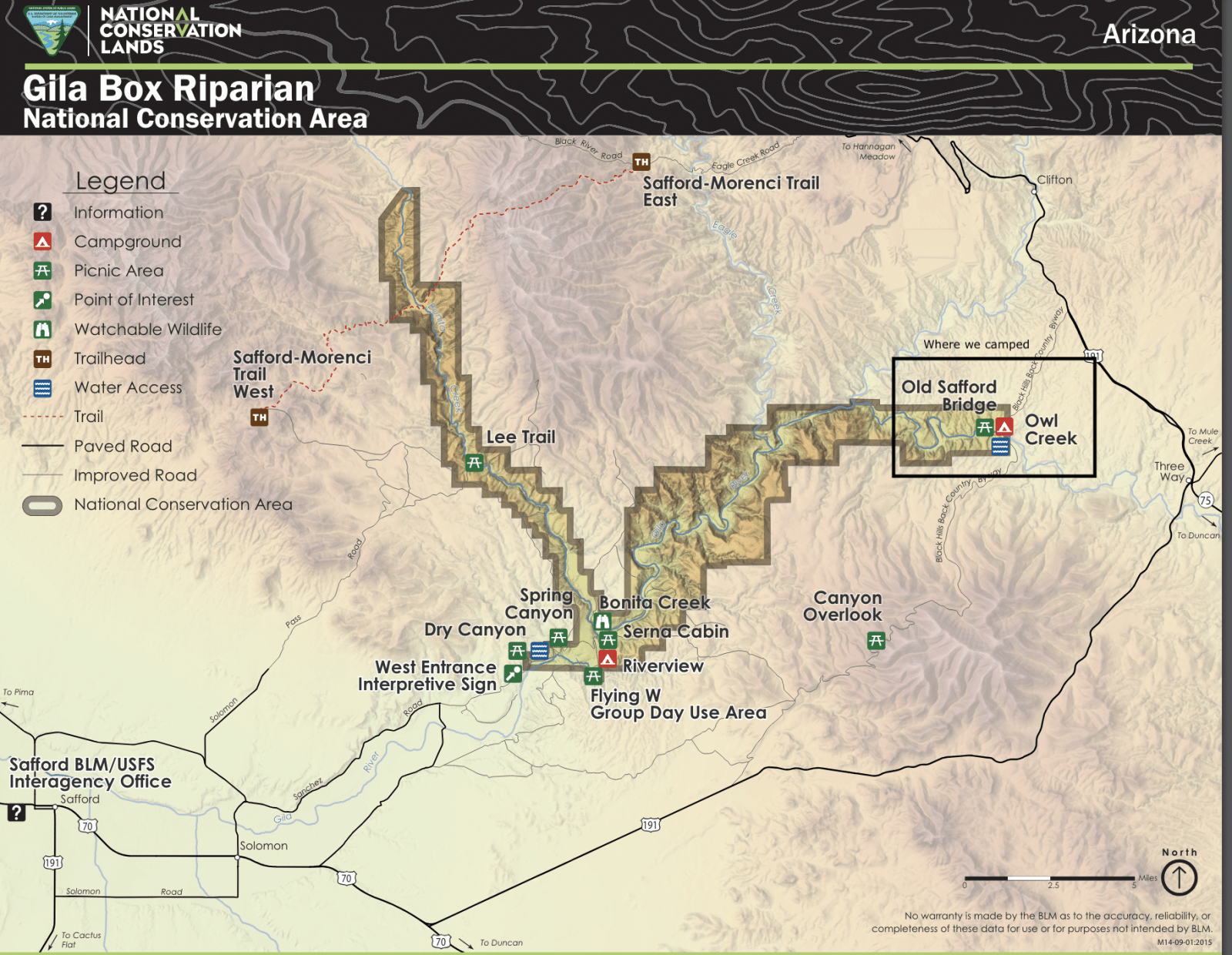
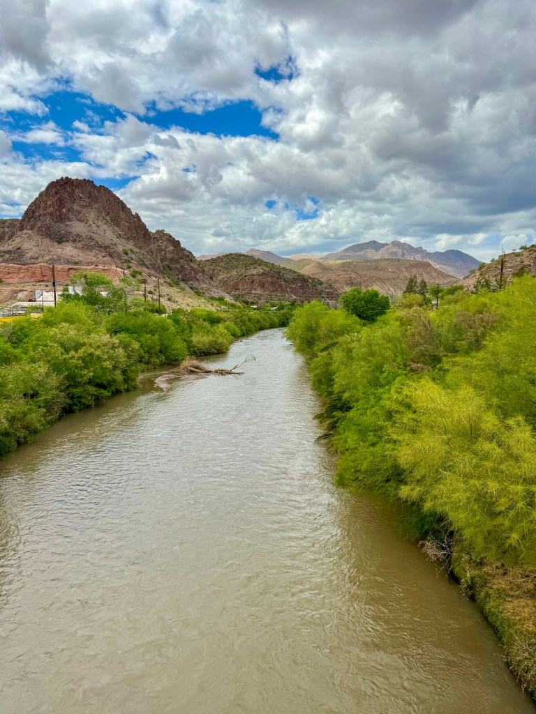
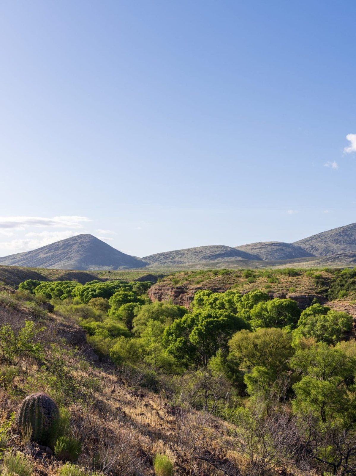
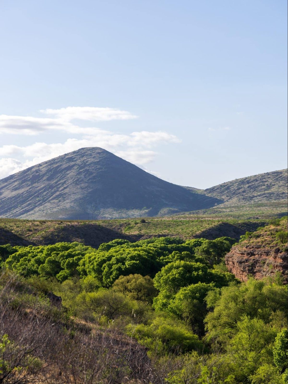
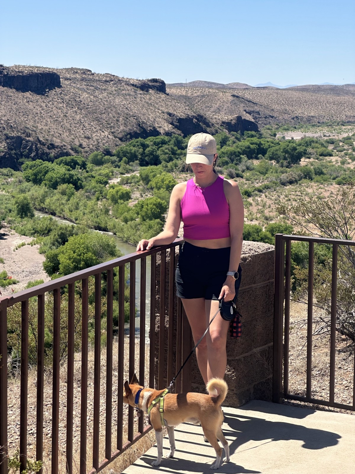
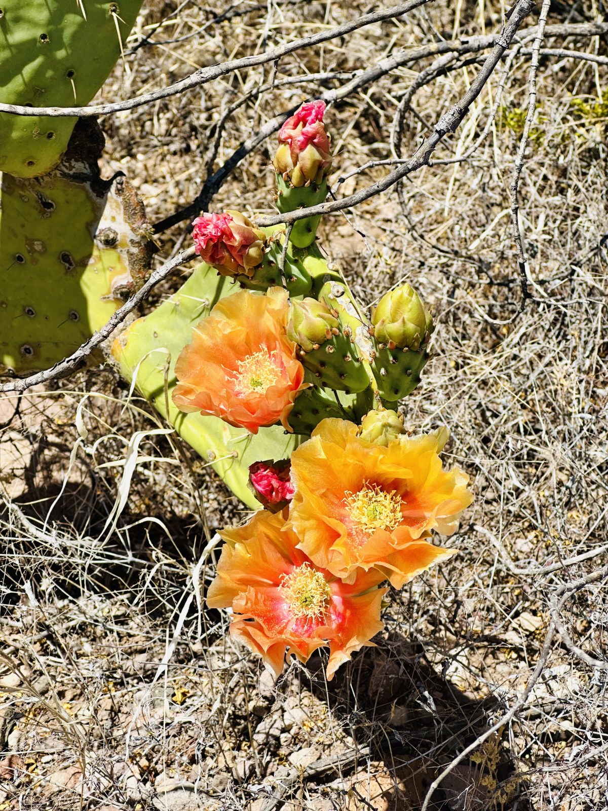
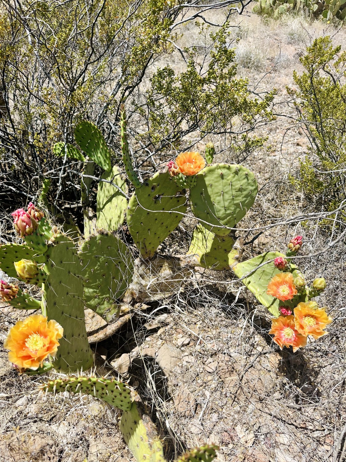
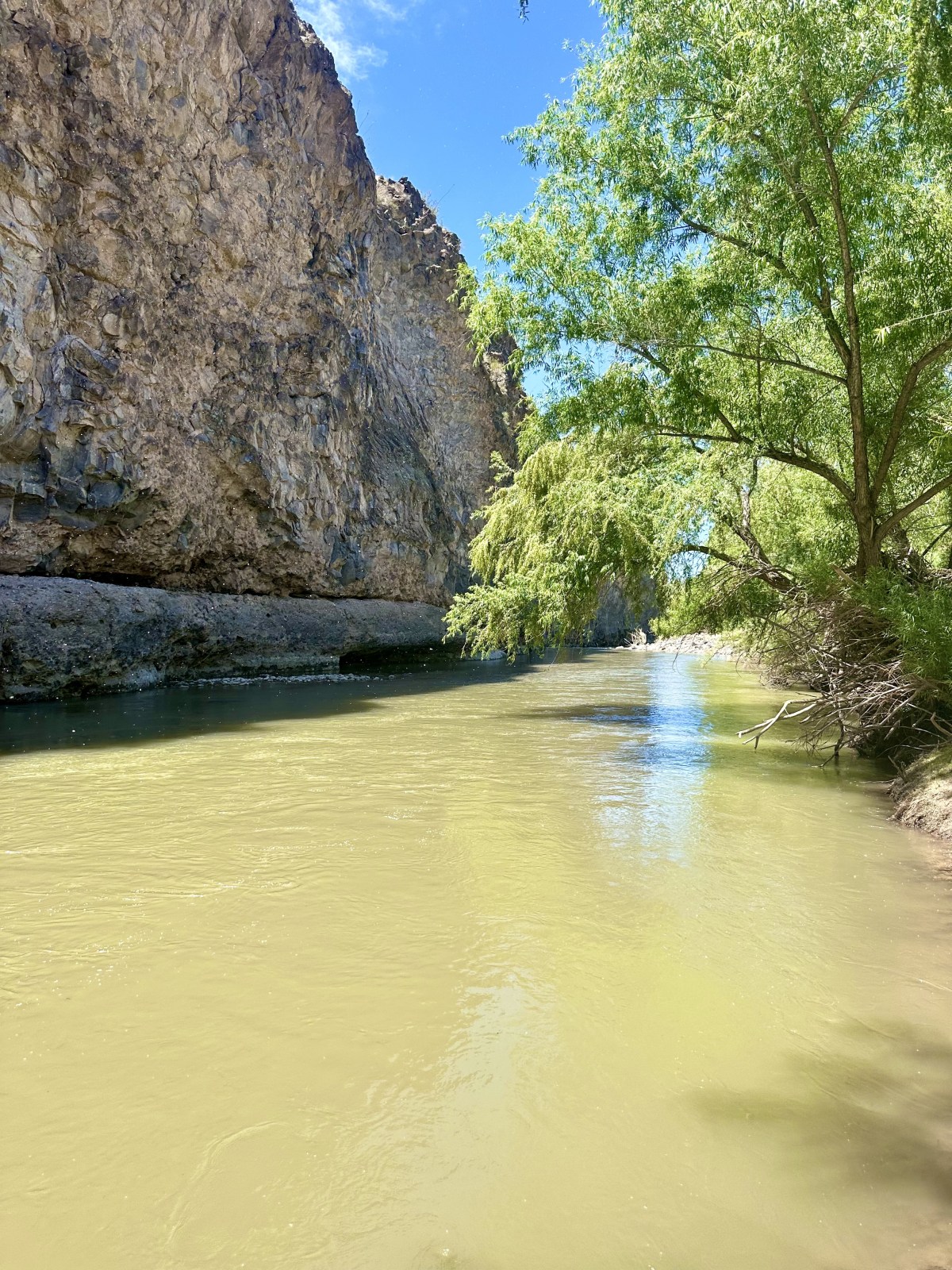
Gila Box Riparian National Conservation Area is a remote hidden gem in eastern Arizona. The land is managed by the Bureau of Land Management under the US Department of Interior. Depending on where you access the National Conservation Area, it’s about 3 to 3.5 hours east of Phoenix. Overall, the 23,000-acre area covers four waterways: The Gila and San Fransisco Rivers, and Bonita and Eagle Creeks. There is a west fork and an east fork of Gila Box Riparian NCA. While the west entrance is closer to Safford, AZ, the east entrance is closer to Clifton, AZ. During our April 2024 trip we visited the east end of the conservation area and camped at Owl Creek Campground which is highlighted in the map. We brought our dog Finnick with us. The campground and trails are dog friendly!
Important reminder: This area is remote and help can be hours away, while cellphone service is limited or non-existent! Preparation can save lives. Please remember to Leave No Trace and recreate responsibly when exploring.
The weather: When checking the weather for Owl Creek Campground and the east end of Gila Box Riparian we used the very small town of ‘Three Way’ as it is the closest weather location on Apple Weather. For the west end of Gila Box, we recommend using the town of Solomon as it is the closest to the west entrance.
What is a Riparian Area?
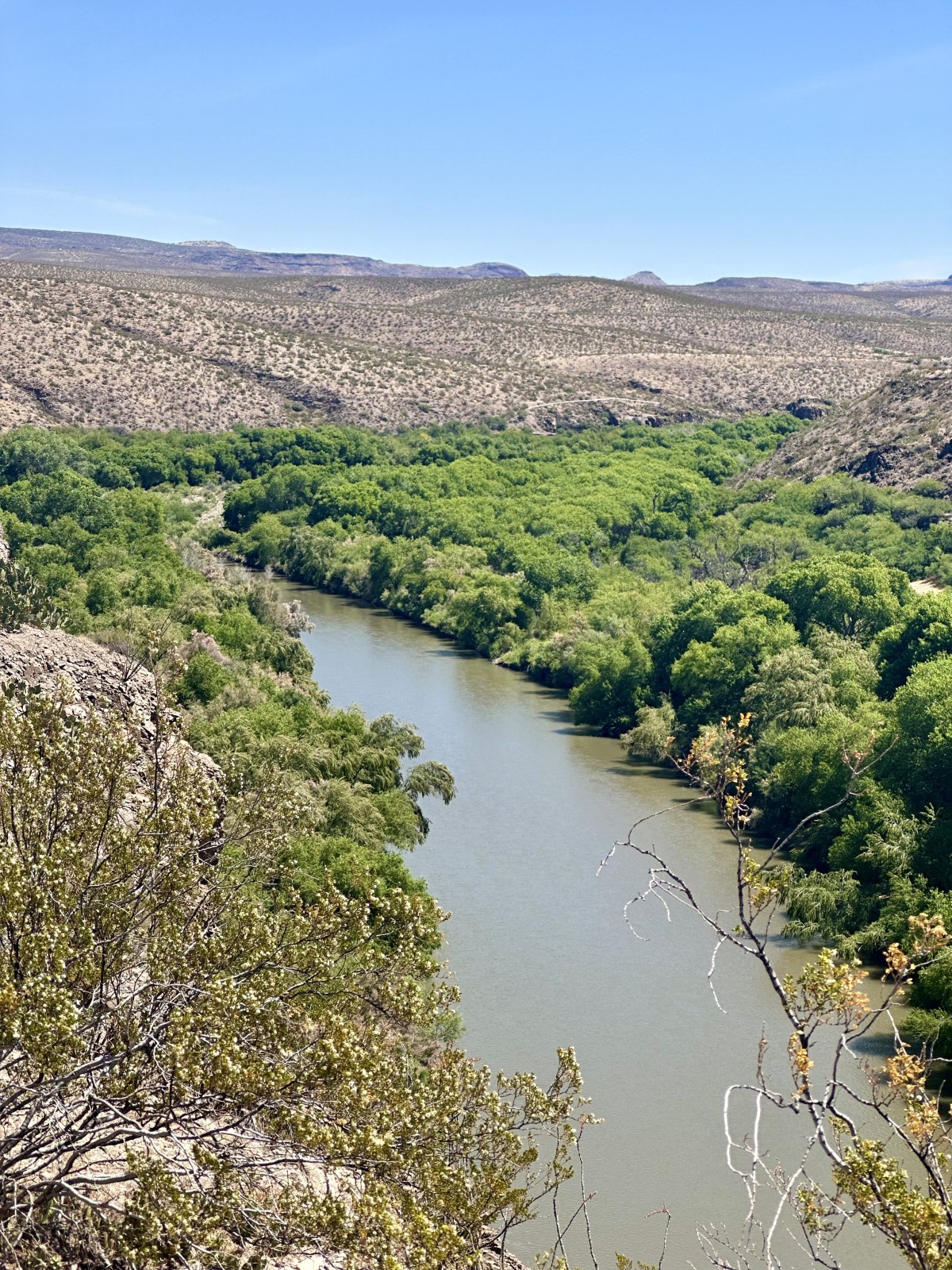
Riparian zones, or areas, are lands that occur along the edges of rivers, streams, lakes, and other water bodies. Examples include streambanks, riverbanks, and flood plains. – NPS
What is a National Conservation Area
National Conservation Areas are managed by the Bureau of Land Management and vary in location and focus. The BLM says, “these areas are managed to conserve, protect, restore, and enhance America’s national and cultural heritage, while providing compatible multiple uses including grazing, oil, gas and mining.” – BLM
East Fork of Gila Box Riparian


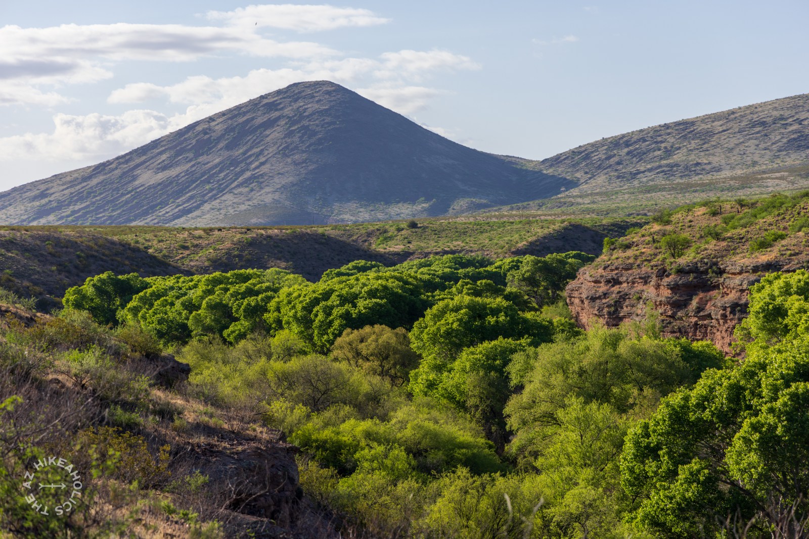
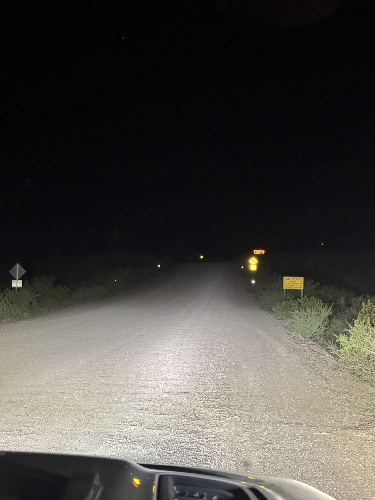
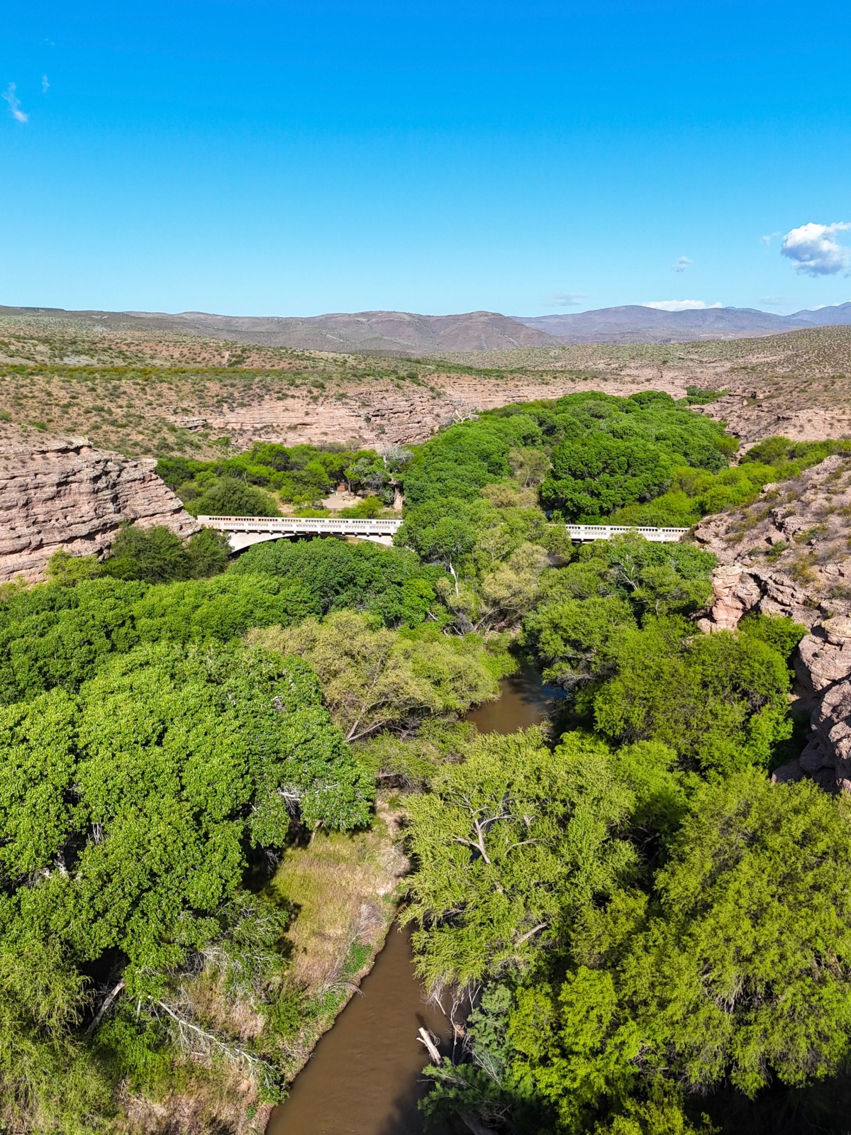
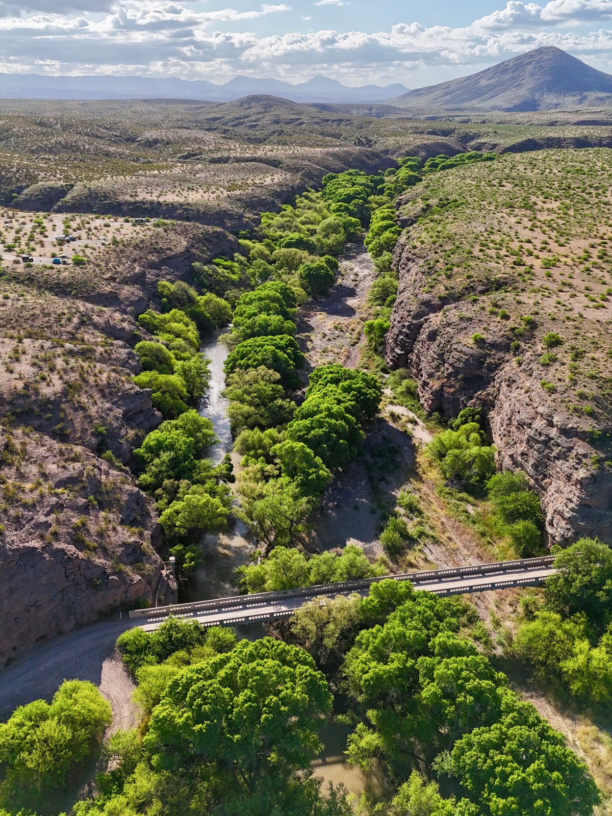
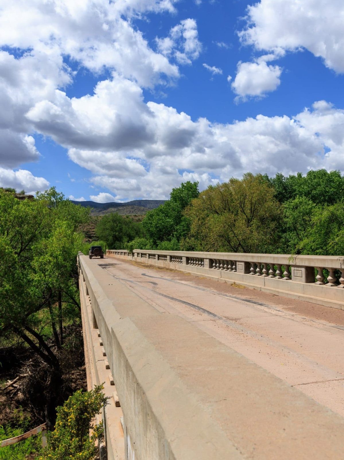
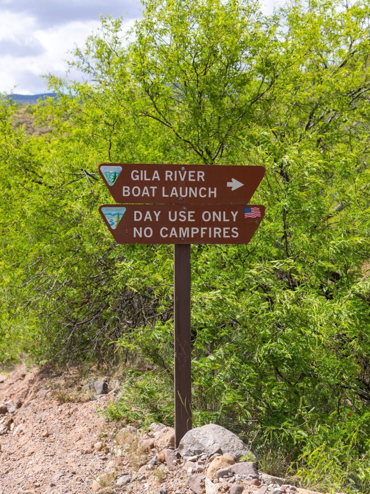
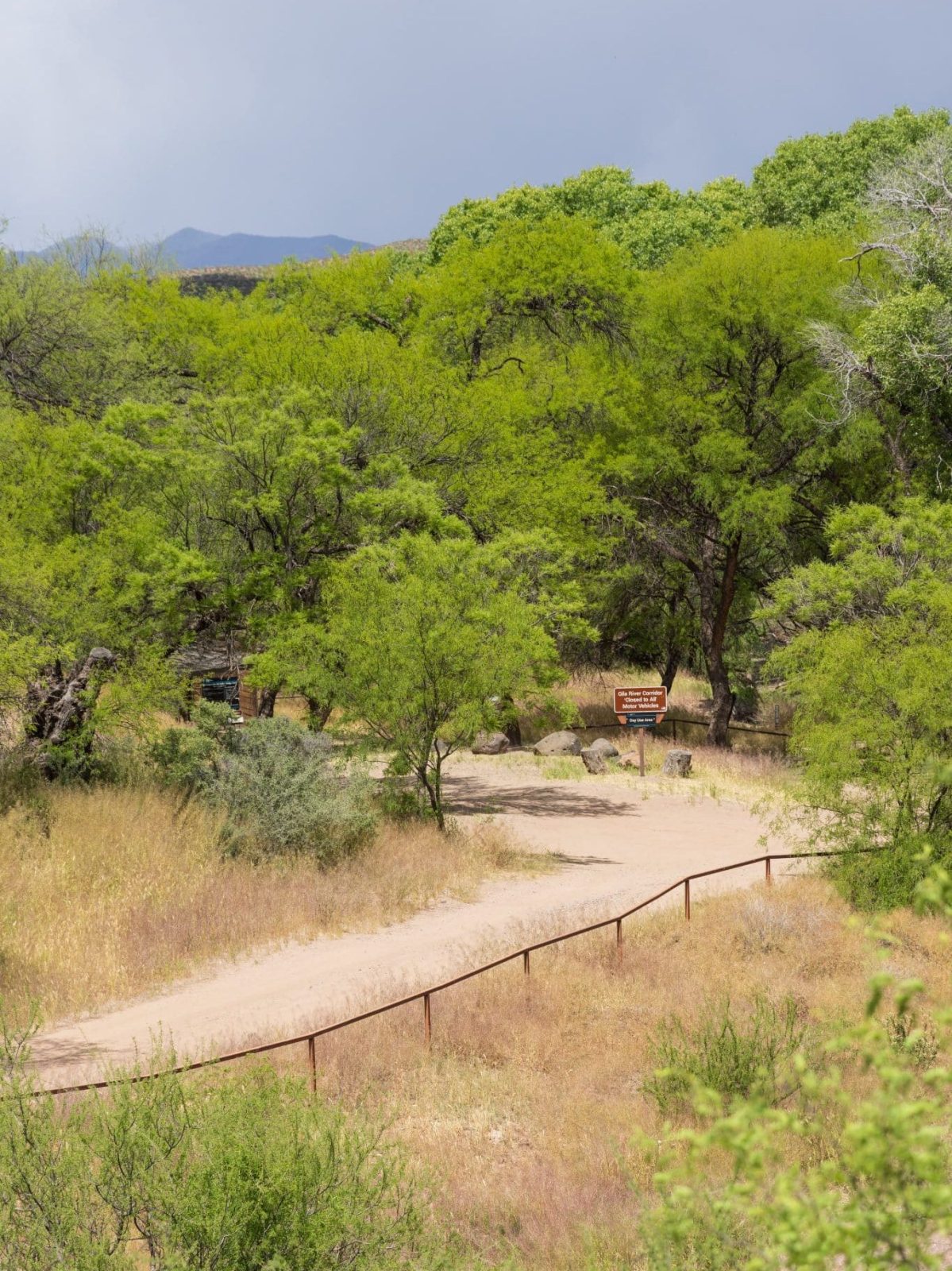
The east fork has much more limited access compared to the west fork. In fact, all the roads are dirt with irregular maintenance. The most popular and accessible locations on the eastern half of the National Conservation Area are Owl Creek Campground, the Old Safford Bridge, Gila River Boat Launch Day Use Area, and the Old Safford Bridge Picnic Area. Additionally, the historic Black Hills Back Country Byway that cuts through Gila Box Riparian National Conservation Area. The scenic drive, easily completable within a few hours or less, depending on how often you stop! We suggest using Google Maps for navigation as Apple Maps was not accurate.
Owl Creek Campground
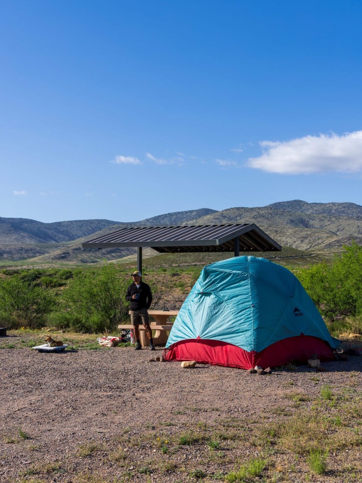

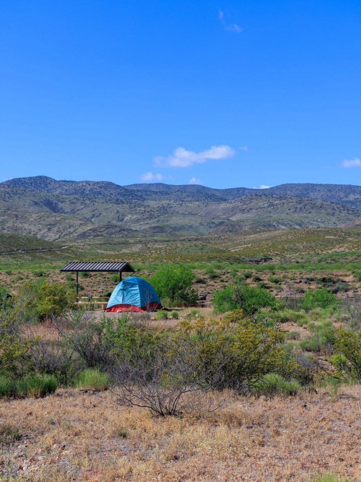
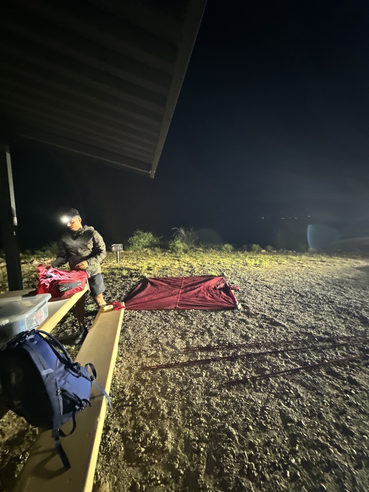

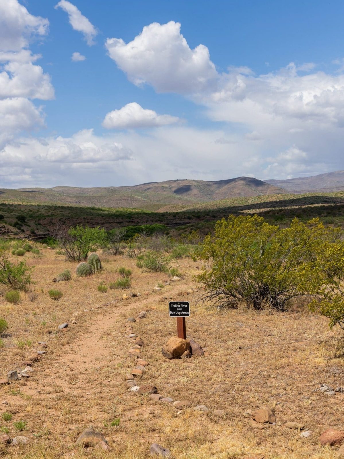

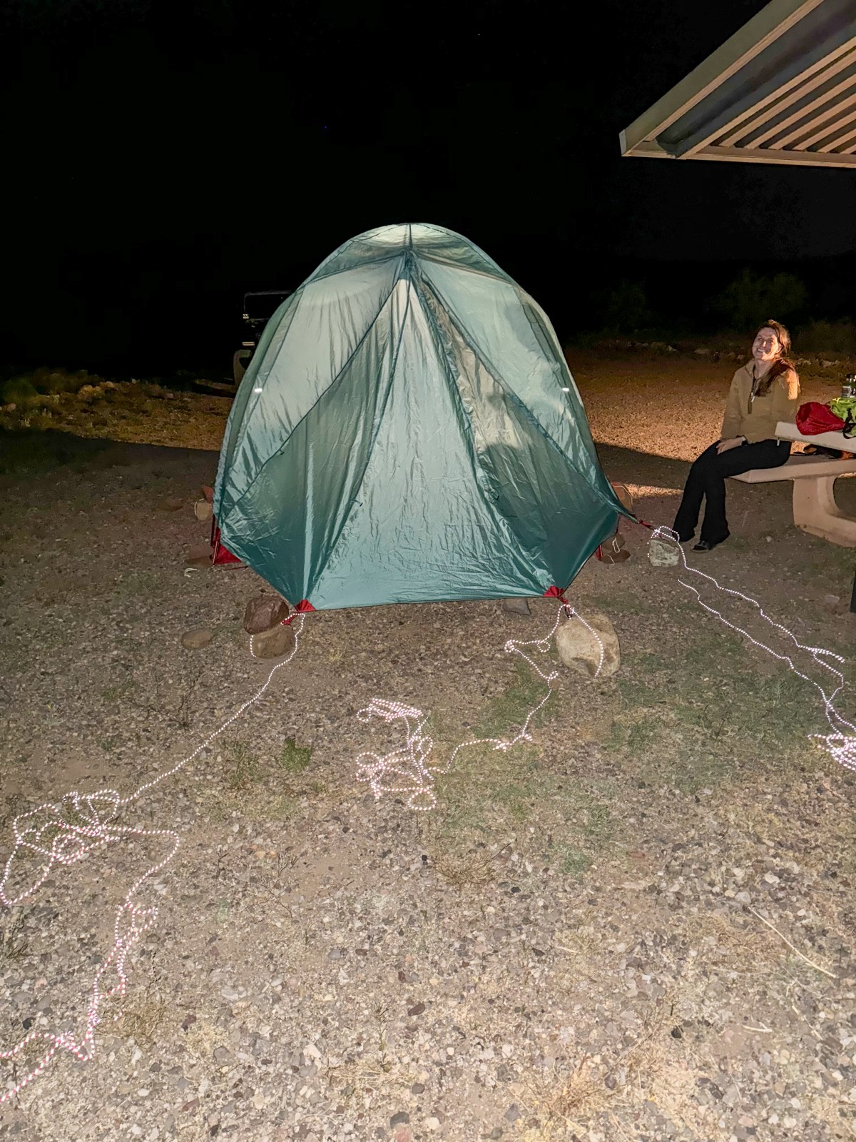
Owl Creek Campground sits on the cliff edge of the Gila River. The BLM campground has 7 first-come, first-served campsites. Also, each campsite has a fire ring, picnic table, grill, and shade structure. There is one vaulted toilet at the entrance of the campground where there is a self service pay station. We had pretty good cell service with Verizon Wireless at the campground but made sure to download the area on Google Maps ahead of time. It is $5 a night and a BLM Ranger does come by to check. Maximum length of stay is 14 days.
Unfortunately, it was very windy during our trip and we decided to only stay one night, but the campground is beautiful! There are 4 sites that are on the “edge” of the cliff. The other 3 sites are across the dirt road running down the middle of the campground, but they still have beautiful views! Lastly, if you’re interested in learning more about our camping gear, check out our blog post here.
Black Hills Back Country Byway


The historic Black Hills Back Country Byway was once a mining and ranching route between Safford, Arizona and the mining towns and operations at Clifton and Morenci, Arizona. The 21-mile dirt road was built by prison labor between 1914 – 1920 and is today accessible for most vehicles during dry conditions. We suggest at least having a crossover SUV with decent clearance. A Subaru Forester, Toyota Rav4, or Honda CRV would do just fine on the road. Four-wheel drive isn’t required, but AWD or 4WD might help with traction during some of the steeper sections. Overall, the road is fairly easy with some washboarded sections and some small rocky sections. We traveled from north to south, but either way, the road intersects with the US 191, it just depends on where you enter and exit from.
There are multiple roads that offshoot from the main byway, and they require 4WD and high clearance. Additionally, there are stops along the way with viewpoints, informational signs, and a couple picnic areas. Unfortunately, most of the signs have faded in the sun by now, but some signs are still legible. Heading south, we had great views of the valleys, distant mountains, and massive Mount Graham in the distance. For most of the drive we were the only ones on the road! With cattle crazing the hillsides, old dilapidated ranches, and modern day cattle fences, it was easy to picture life out on the road 100 years ago because it appears not much has changed.
An Important Reminder
Bureau of Land Management: Do not attempt the byway if you have a travel trailer or any vehicle more than 20 feet long. Motor homes and trailers can be left at parking areas provided near kiosks at each end. Please take extra care to drive defensively on this route. Always expect a vehicle around the next bend and remember: mountain courtesy gives uphill traffic the right of way.
Black Hills Rockhound Area
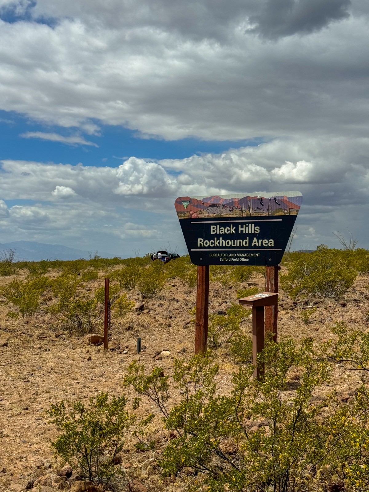


The Black Hills Rockhound Area is popular for its dense collection of Fire Agate, a semi-precious gemstone only currently found in three US states, Arizona, California, and New Mexico. Once you start to look closely, you’ll see a lot of pieces and it’s harder to decide what not to pick up. We were looking for some bigger pieces. This is one of two rockhound places in Arizona and there were multiple groups out there during our visit.
There is no fee to rockhound, but there is a register at the sign that we highly encourage everyone to sign. The rockhound area is very exposed with no large trees for shade. We suggest brining plenty of water and sun protection. Additionally, there are small cactus throughout the desert floor and rockhounders should wear closed-toe shoes and be careful with their hand placement.
West Fork of Gila Box Riparian


The west fork of Gila Box Riparian is accessible from the town of Solomon, AZ which is just east of Safford Arizona. Bonita Creek Road is the main road in through the west entrance and is paved much of the way. Along the road there are multiple day use and picnic areas. Like the east fork, there is a campground on the west fork; this one is named Riverview Campground and has 13 designated sites with a fire pit, grill, picnic table, and shade structure. Additionally there are vaulted toilets and an nightly fee is required. Our first visit to Gila Box Riparian NCA was in May 2023 and it was a beautiful day!
Historic Clifton
Clifton is the county seat of Greenlee County, the smallest in Arizona. The historic town was once the heart of Arizona’s mining operations on the east side of the state. Today, the small town is still connected to mining, especially to the nation’s largest copper mine just north in Morenci. Clifton sits in a canyon and straddles the San Francisco River. It is the southern base of the Coronado Trail, aka US Route 191. This drive is high on our list for scenic drives to complete, and we heard summer and fall are absolutely beautiful. Furthermore, the Coronado Trail leads to Alpine, Arizona in the White Mountains and connects to State Route 260 or continues into New Mexico and north all they way up to our Northern States. We can’t wait to update this with more photos after we make the drive!