Kofa National Wildlife Refuge - Arizona
Signal Peak in Kofa National Wildlife Refuge is located within one of Arizona’s most rugged and remote desert landscapes. In fact, this area that plays a vital role in protecting one of the Southwest’s most iconic species, the desert bighorn sheep. The name Kofa comes from the King of Arizona gold mine and the surrounding mountains that once drew prospectors to the region. However, today the refuge protects a vast stretch of land from northeast of Yuma along US Route 95 and north toward I 10 near Quartzsite.
Protection for this rugged desert landscape began in the 1930s after bighorn sheep populations were nearly wiped out due to human impact. In fact, the preservation of the Kofa Mountains and surrounding desert predates the National Wildlife Refuge system itself. Later, in 1990, Congress designated 547,719 acres of the refuge as wilderness, offering even greater protection to this remote and wild landscape.
Today, Kofa National Wildlife Refuge remains largely undeveloped, with dispersed camping allowed in designated areas and a network of dirt roads that wind through the desert and mountains. This was our third visit to Kofa National Wildlife Refuge, but our first time hiking to Signal Peak one of the most difficult summits in the area. However, the views from the summit are incredible and part of what makes Arizona so amazing.
Signal Peak Hike
Quick Stats: Signal Peak Trail
Length:
recorded 4.1 miles
Route Type:
Out & Back
Elevation Gain:
recorded 2,178 ft
Vaulted Toilets:
No
The hike to Signal Peak in Kofa NWR is very challenging and we recommend this trail only be attempted by experienced hikers, and those without a fear of heights. Although only 2 miles to the peak from the trailhead, the trail is often quite narrow, quite steep, consists of loose rock scree, and is challenging to navigate. To best navigate the trail look for the worn path, rock cairns, and download the trial to your phone for use without cell service. We use the paid version of AllTrails+.
This is the Sonoran Desert, home to many sharp and spiny plants, venomous reptiles and spiders, and larger wildlife like mountain lions, coyotes, and bighorn sheep. As a result it’s imperative to pay careful attention to your surroundings and always hike snake aware. The rocks are sharp, jagged, large and can be loose.
Getting to Signal Peak Trailhead
The Signal Peak Trailhead is relatively deep into Kofa National Wildlife Refuge and does require a vehicle with high clearance and at a minimum All-Wheel Drive (AWD) when conditions are good. From US-95 you take Palm Canyon Road to it’s junction with Kofa Queen Canyon Road just inside the National Wildlife Refuge boundary. From there the road travels north a bit taking you back into BLM land before turning right and heading east back into the wildlife refuge. Once off the highway, the road is dirt the entire time. Palm Canyon Rd is heavily wash boarded. Kofa Queen Canyon Rd is primarily a single vehicle width and consists of uneven rocky ground. Furthermore, at points the ruts are wheel with apart creating a mound in the center.
Kofa Queen Canyon Road eventually enters the canyon where the road becomes softer, still a rocky consistency. At some points the road is narrow with rocks and trees flanking the sides. However, the road remains obvious the entire time. We used OnX Offroad to track our progress to the trailhead that we pinned oursleves on the map. Additionally, you can also use AllTrails where the trailhead is labeled. Here are the coordinates: 33.36862102370923, -114.06182262241664 | Google Maps
There is no trailhead sign, but the road does split off for a short bit where you can park. And two posts indicate the start of Signal Peak Trail.


Gear Needed for Signal Peak Trail
In addition to hiking and trail navigation experience, it’s critical to do this hike with a good pair of hiking boots with strong support and great traction. We both wore Salomon X Ultra 5 Lows (Women’s | Men’s) and we have more on hiking boots here. Although we did not bring hiking poles, they could be very helpful coming back down the mountain. We found ourselves coming down with three or four points of contact on many of the steep sections.
What to Expect on Signal Peak Trail
The trail starts off gradual with no visual sight of Signal Peak. The main peak visible is Ten Ewe Mountain. The trail soon starts to increase in slope angle as it switch backs up the spine of the hill and then goes around the western slope of Ten Ewe Mountain. The Signal Peak trail is a consistent climb and quite narrow, but usually easy to find. Near the saddle, the trail is more challenging with many routes possible and some light scrambling. Take your time finding the correct route because some routes look good at first but can lead to something more challenging than needed.
Once at the saddle you’ll see Signal Peak trail heads down a little, still on the west side of mountain, with a seasonal stream and small canyon on the right. The trail quickly gets back to its steep climb. Eventually the trail crosses stream bed and follows along another seasonal stream flow.
As you get closer to Signal Peak the trail navigates a steep section of stream bed made up of large boulders and for us, this was the most challenging part of the trail to navigate. Our legs were tired and sore so we were trying hard to find a route that was easier. However, that wasn’t always the case. We kept looking for rock cairns and eventually made it to the final saddle. From there the trail to Signal Peak is more clear and we took that all the way to top. Once at the top we made sure to sign the summit register.


Additional Posts to Consider

The AZ Hikeaholics Top Gear Recommendations
Gear for the trail ranges from what’s in our pack to what’s on our back and feet. Here you’ll find what we trust and bring, including the essentials and what keeps us comfortable!

Hiking Essentials: Our 10 Must-Have Gear Picks for Every Hike
The Ten Hiking Essentials Outdoor exploration comes with risks, especially when venturing into remote or rugged areas. That’s why we always carry the ten hiking

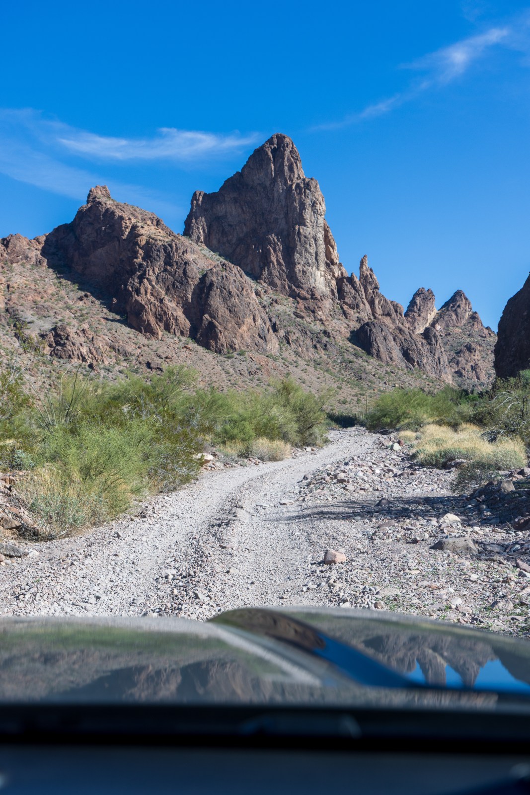
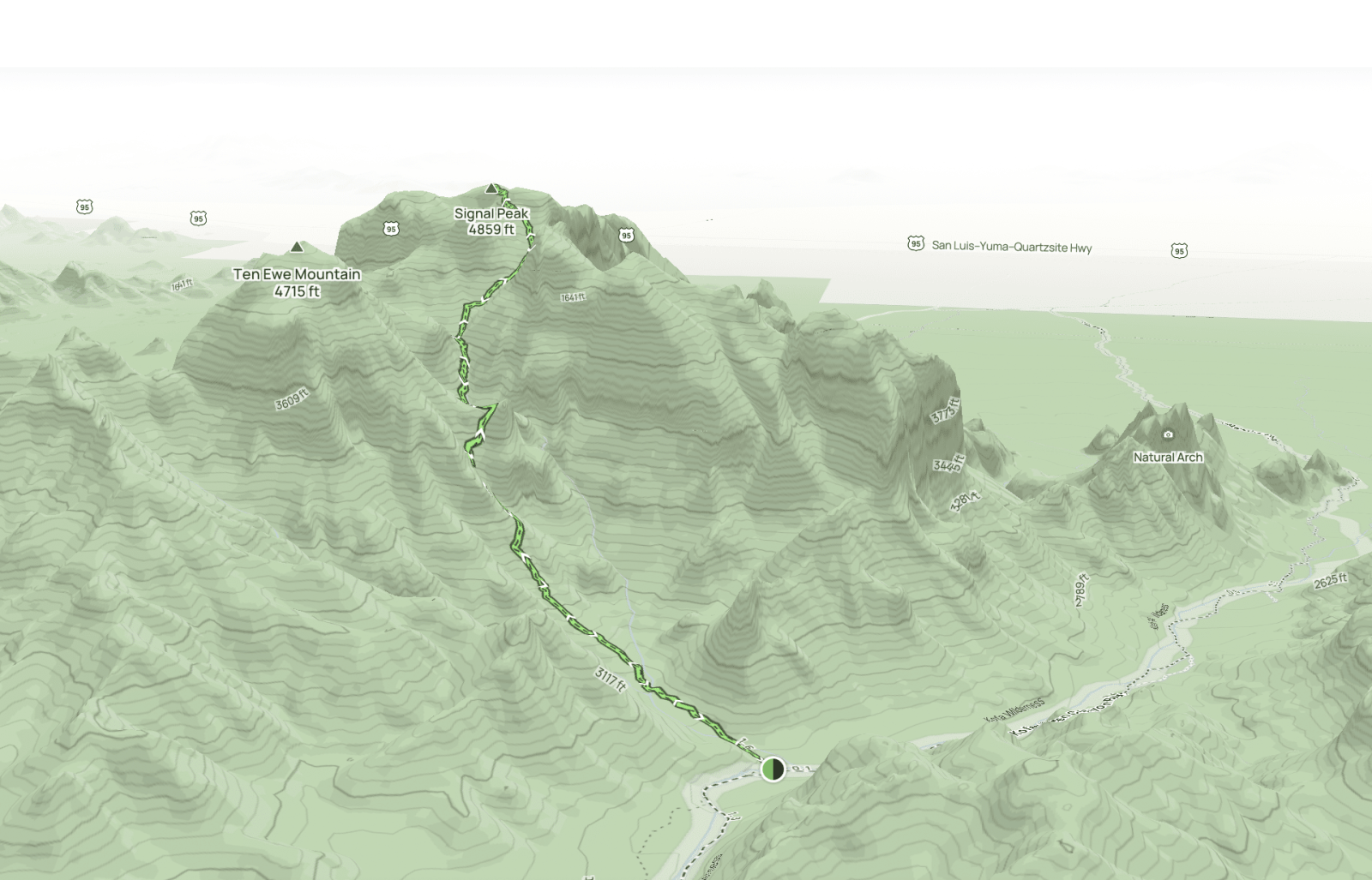
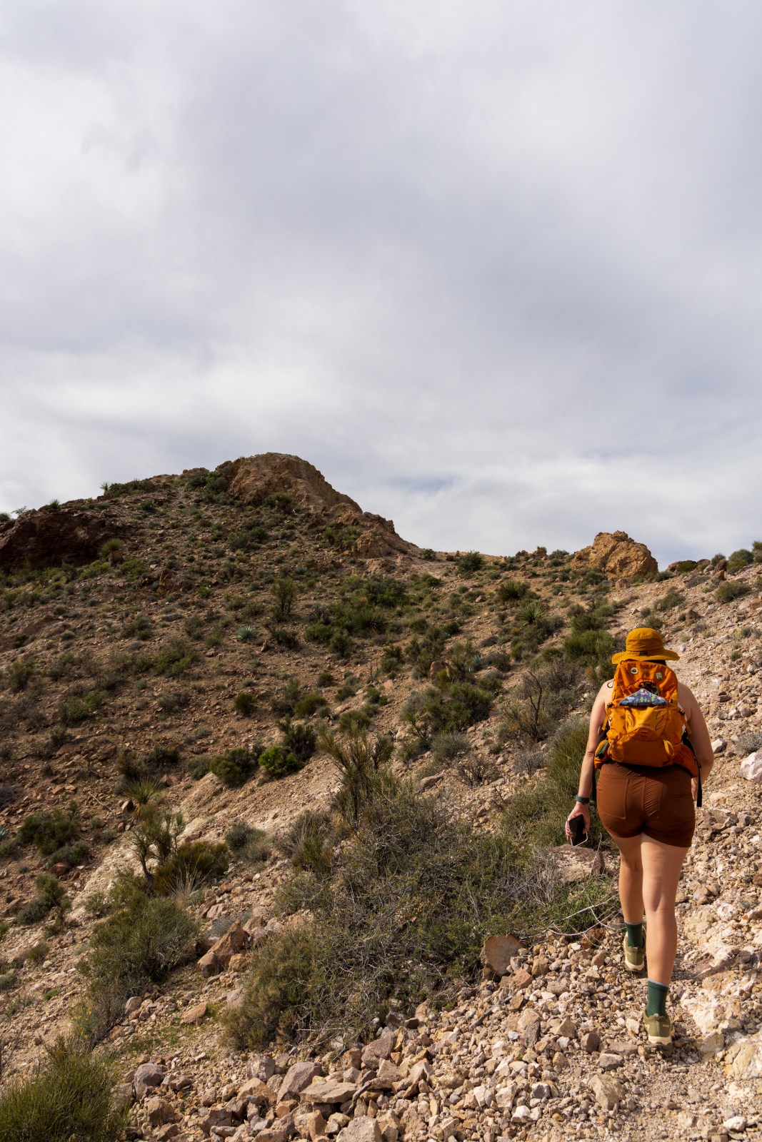
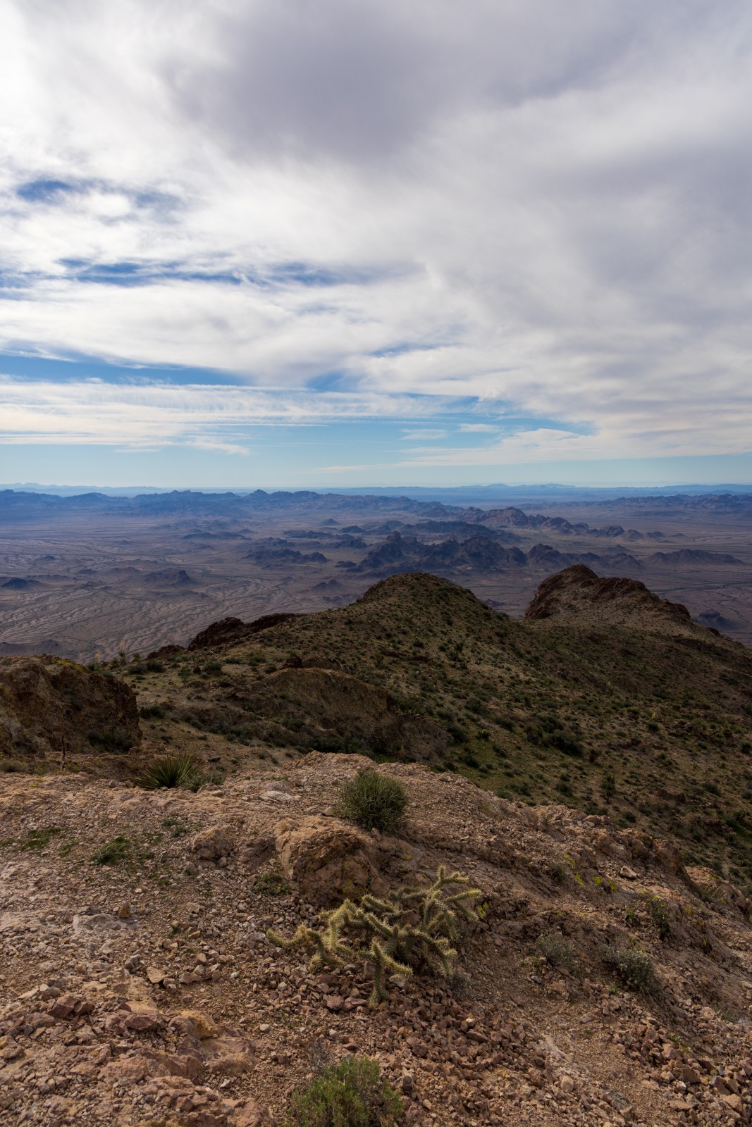
Battleship Mountain Scramble: Superstition Wilderness Hike
Battleship Mountain is a tough but rewarding hike in the Superstition Wilderness near Phoenix. Starting from First Water Trailhead, the 12-mile round trip involves tricky scrambles and stunning views. Just watch out for sharp rocks and wildlife, and remember to pack plenty of water. It’s not for beginners, but definitely worth it!