
Yosemite to Sequoia and Kings Canyon
After spending four nights in Yosemite National Park, we made our way south to Sequoia and Kings Canyon National Parks. We entered Kings Canyon from Fresno, California, and with the parks only a few hours apart, it felt like a natural next stop.
We reserved three nights at Lodgepole Campground in Sequoia and spent our time walking among giant sequoia groves, hiking to waterfalls and scenic viewpoints, and taking in the beauty of the Sierra Nevada from the road.
In this blog, we are sharing our full itinerary, helpful tips for visiting, and what to expect if you are planning to camp in the parks.
Table of Contents
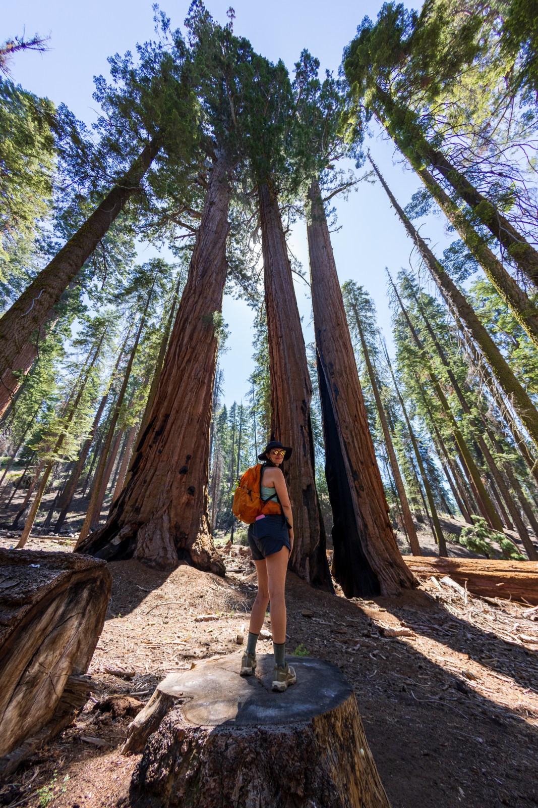
Giant Sequoia Trees Are Special
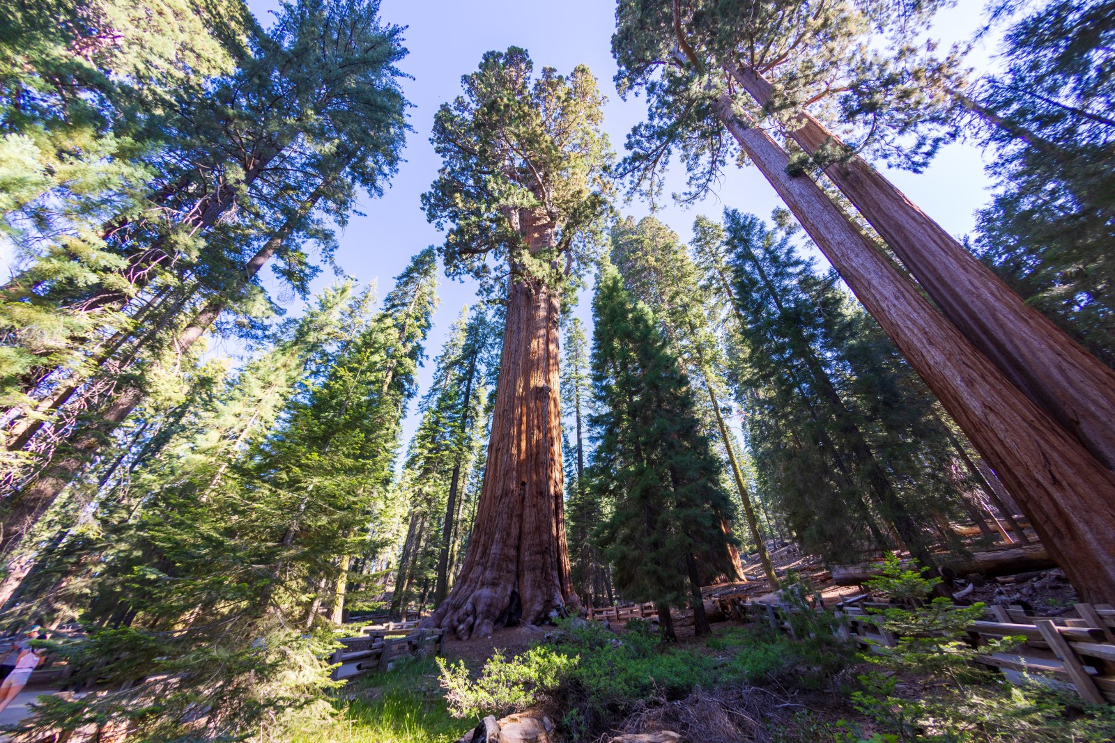
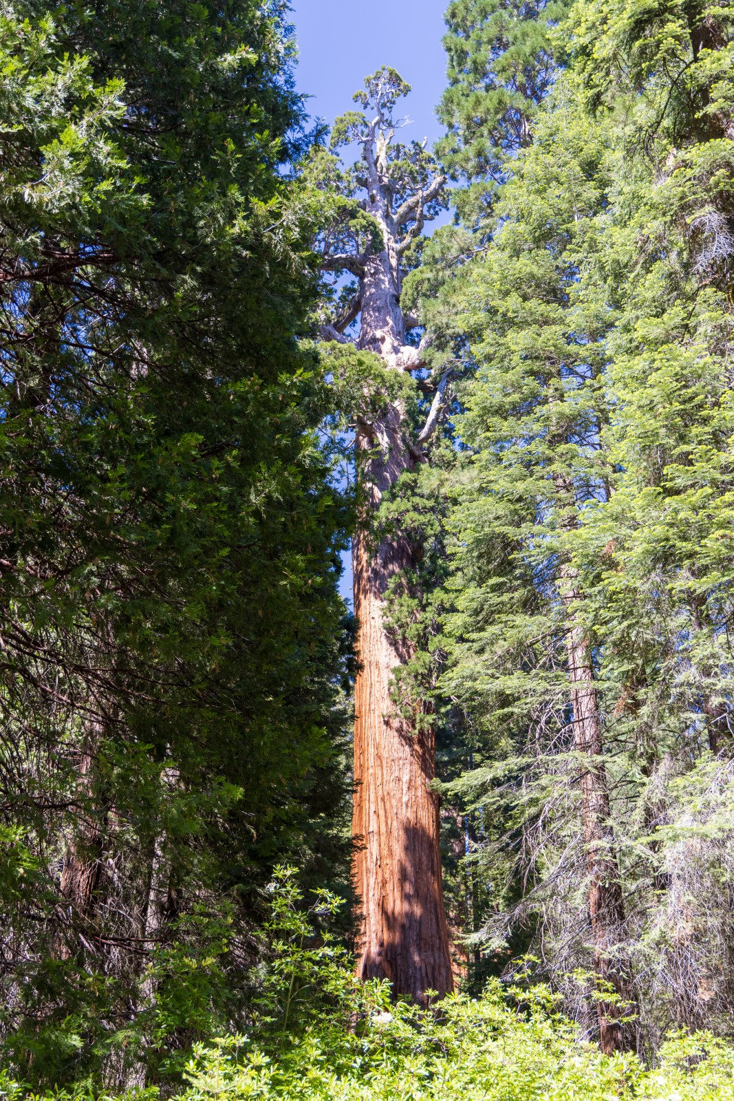
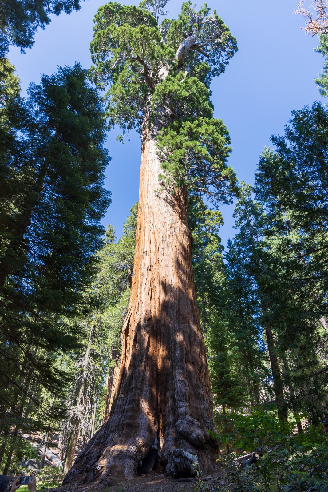
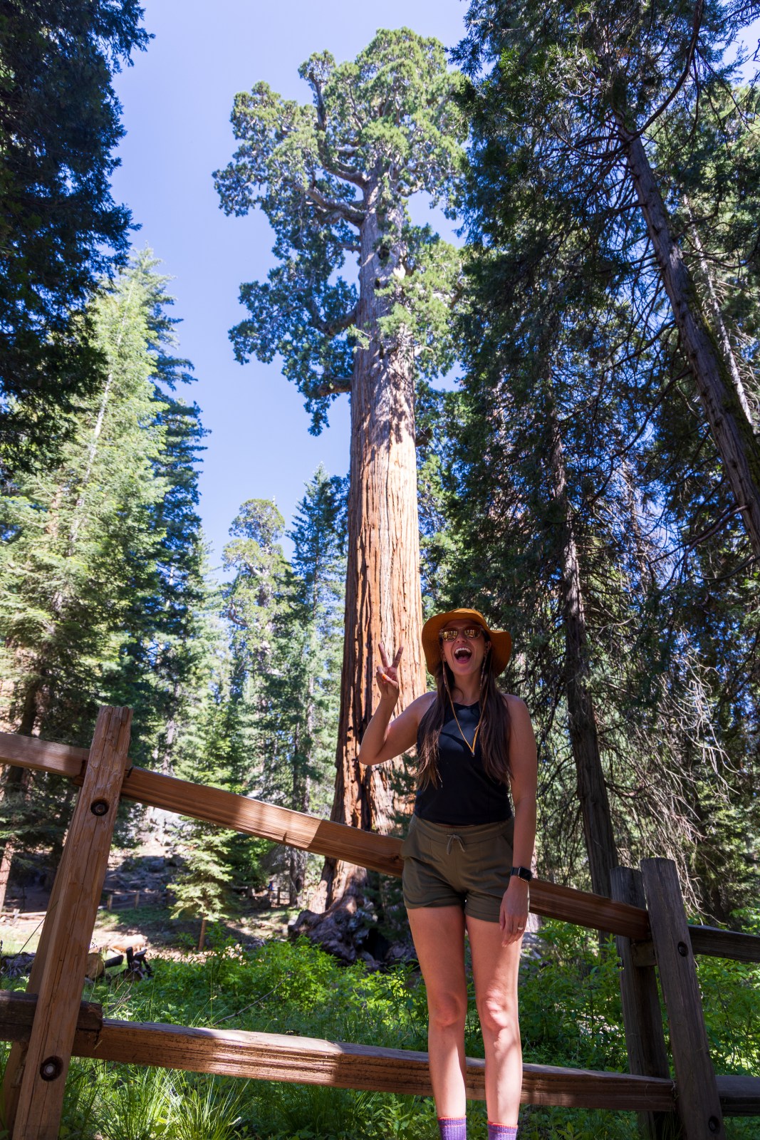
When you arrive at Sequoia National Park, it is easy to see why it became the second federally designated national park in the United States, after Yellowstone. The giant sequoia trees here are nothing short of spectacular.
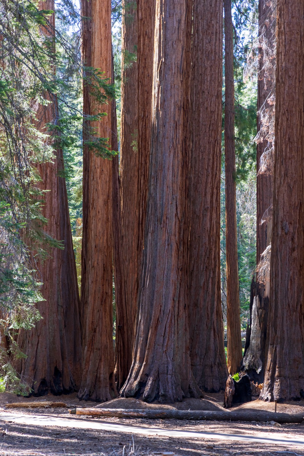
These trees are not only towering, with many growing over two hundred feet tall, but their trunks are also incredibly wide. Some of the sequoias in the park are more than one thousand to two thousand years old. They have witnessed centuries of change and continue to thrive in a very specific environment.
Sequoia National Park protects the largest collection of giant sequoia groves in the world. These trees grow only on the western slopes of the Sierra Nevada mountain range, in a narrow zone sometimes called the sequoia belt. The conditions in this area, including elevation, sunlight, precipitation, and temperature, are just right for the trees to reach their massive size.
Sequoias also have a fascinating survival strategy. Their cones only open and release seeds when exposed to the heat of a forest fire. These trees have evolved to withstand natural threats and grow stronger over time, making them some of the most resilient living organisms on Earth.
The history of Sequoia National Park is quite interesting. In fact, Colonel Charles Young-a commissioned officer in the US Army and a Buffalo Soldier, served as the first superintendent of Sequoia National Park. It has been a place of inspiration and conservation for over 100 years. However, it was once under threat of logging and mismanaged tourism.

General Grant & Kings Canyon
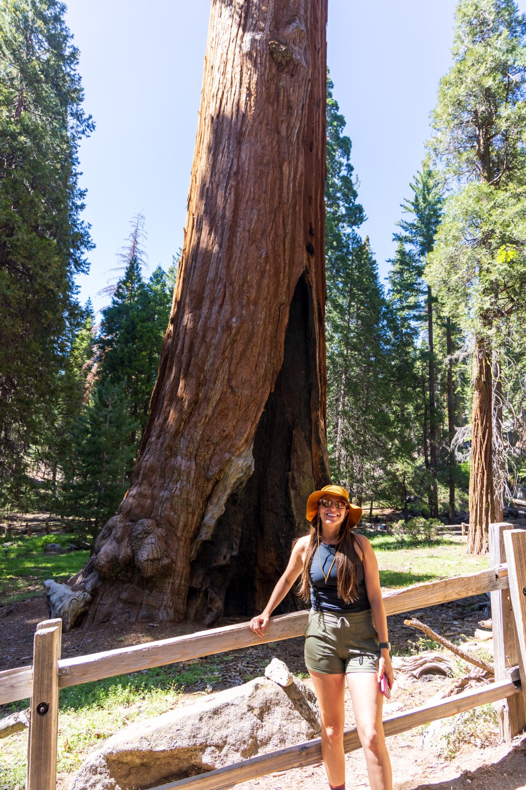
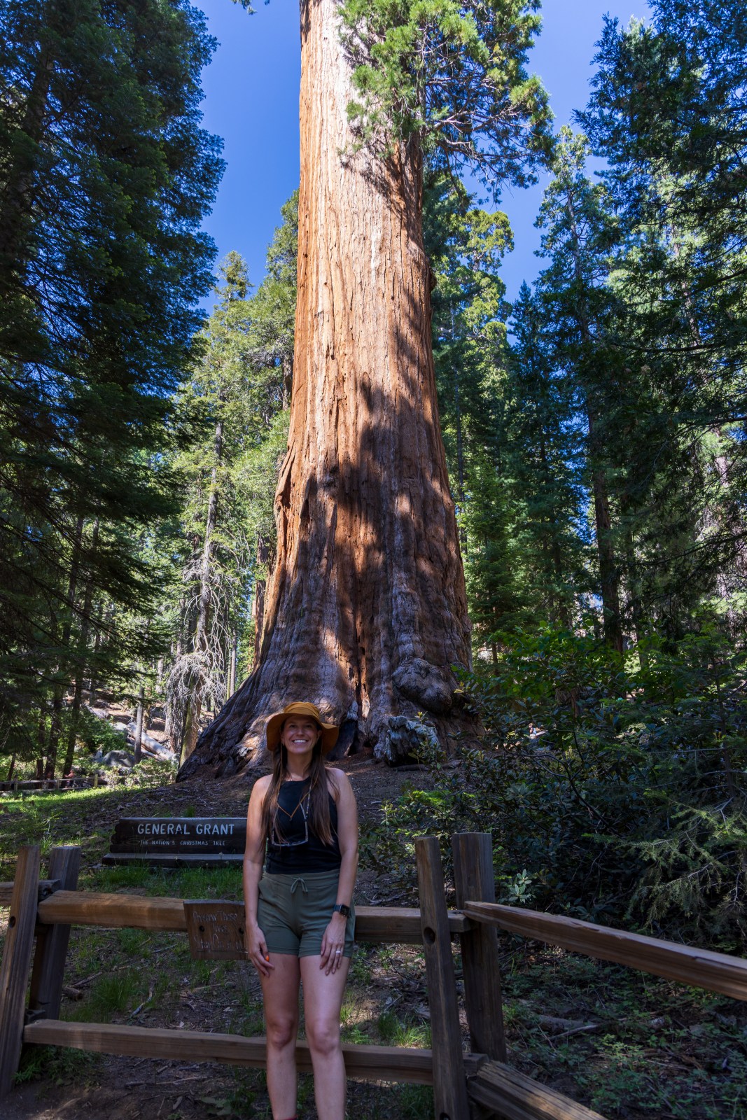
What we now know as Kings Canyon National Park originally began as General Grant National Park, which was designated in 1890 along with Sequoia and Yosemite. The park was first created to protect the area around the General Grant Tree, one of the most famous giant sequoia trees in the world. It was later named a National Shrine and remains the second largest tree on Earth by volume.
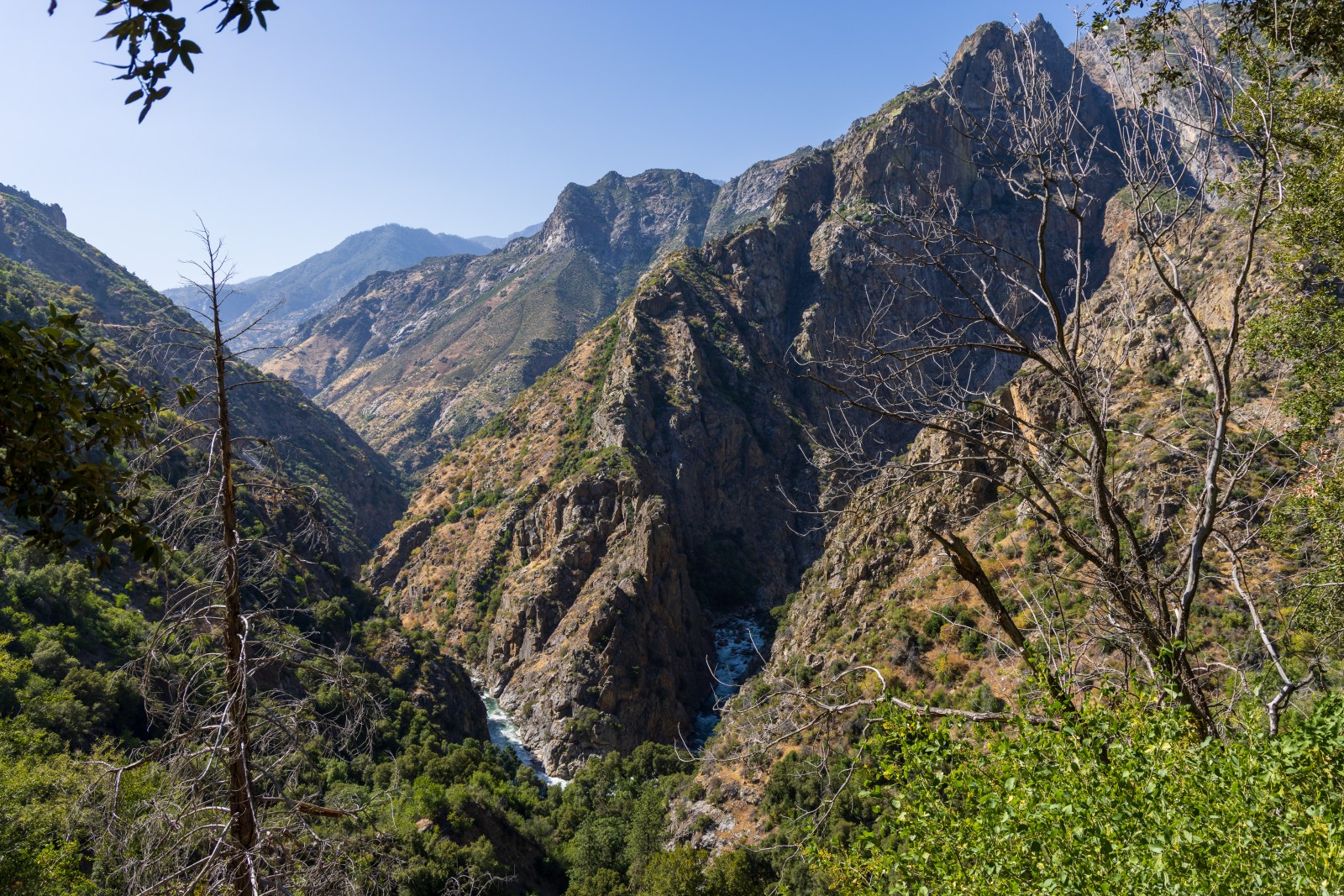
In 1940, the park boundaries were expanded and the name was changed to Kings Canyon National Park. The name comes from the Kings River, which carved much of the canyon, including the glacier-formed valley through which the South Fork of the Kings River now flows.
Today, Sequoia National Park and Kings Canyon National Park are co-managed by the National Park Service. It can be a little confusing to understand where one park ends and the other begins, but it does not affect your experience. One entrance fee grants access to both parks, and in several areas they directly border each other.

Sequoia and Kings Canyon Itinerary
We arrived mid afternoon on Wednesday after stopping in Fresno to resupply on some food and gear, plus eat lunch.
Wednesday – Scenic Stops and Camp Setup
- Entered the parks via the Kings Canyon entrance near Grant Grove
- Visited the General Grant Tree and walked the short loop
- Drove to Panoramic Point for views of Hume Lake and the Sierra Nevada
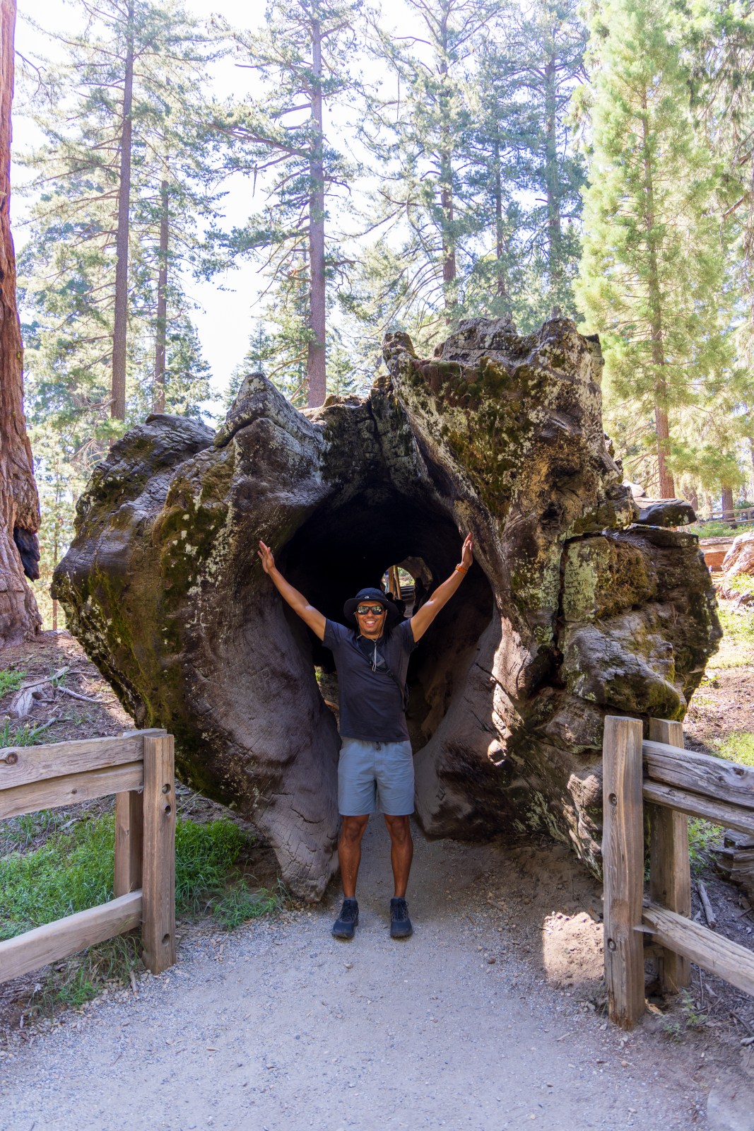
- Continued south into Sequoia and stopped at Tunnel Log
- Checked in and set up camp at Lodgepole Campground
Thursday – Giant Sequoias, Waterfalls, and Sunset Hikes
- Started early at the General Sherman Tree to beat the crowds
- Hiked the Congress Trail to Circle Meadow for more giant sequoia views
- Returned to camp and hiked to Tokopah Falls from Lodgepole
- In the evening, drove to Moro Rock and hiked it at sunset
Friday – Kings Canyon Scenic Drive and Hiking
- Drove east to the Cedar Grove area of Kings Canyon
- Hiked to Roaring River Falls and explored Zumwalt Meadow
- Made multiple stops along the Kings Canyon Scenic Byway for overlooks
- Took the route past Hume Lake to return to camp
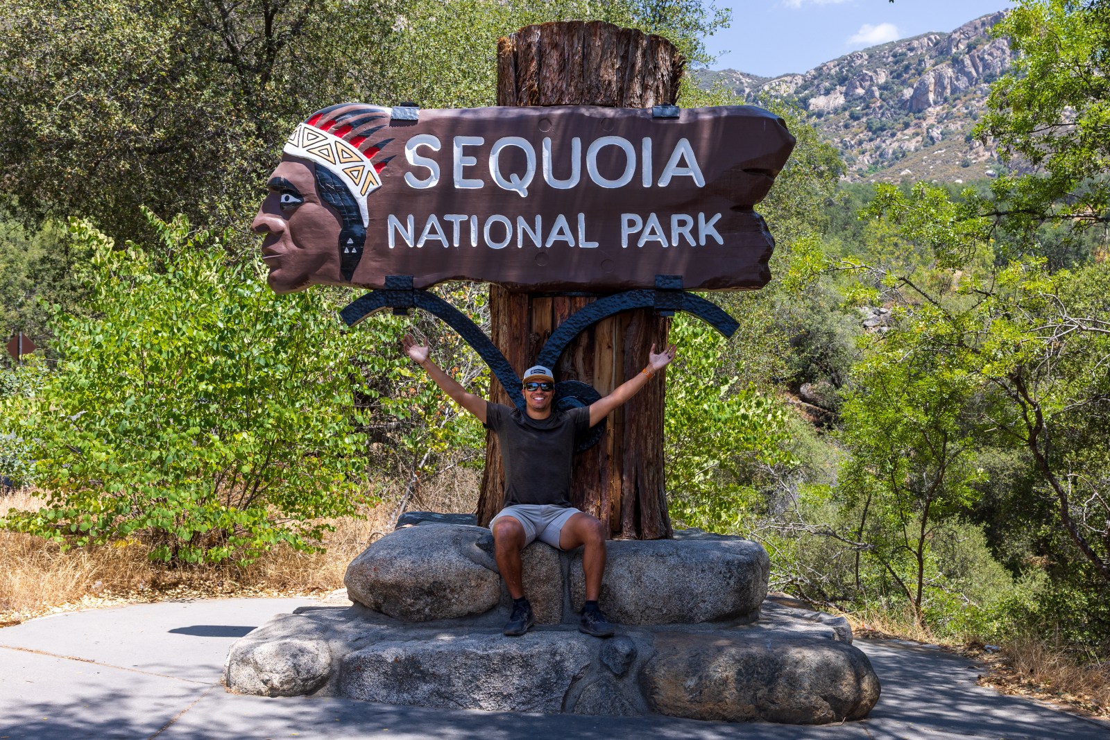
Saturday – Departure via the South Entrance
- Packed up camp and exited through the south entrance of Sequoia
- Stopped at the historic wooden Sequoia National Park sign on the way out


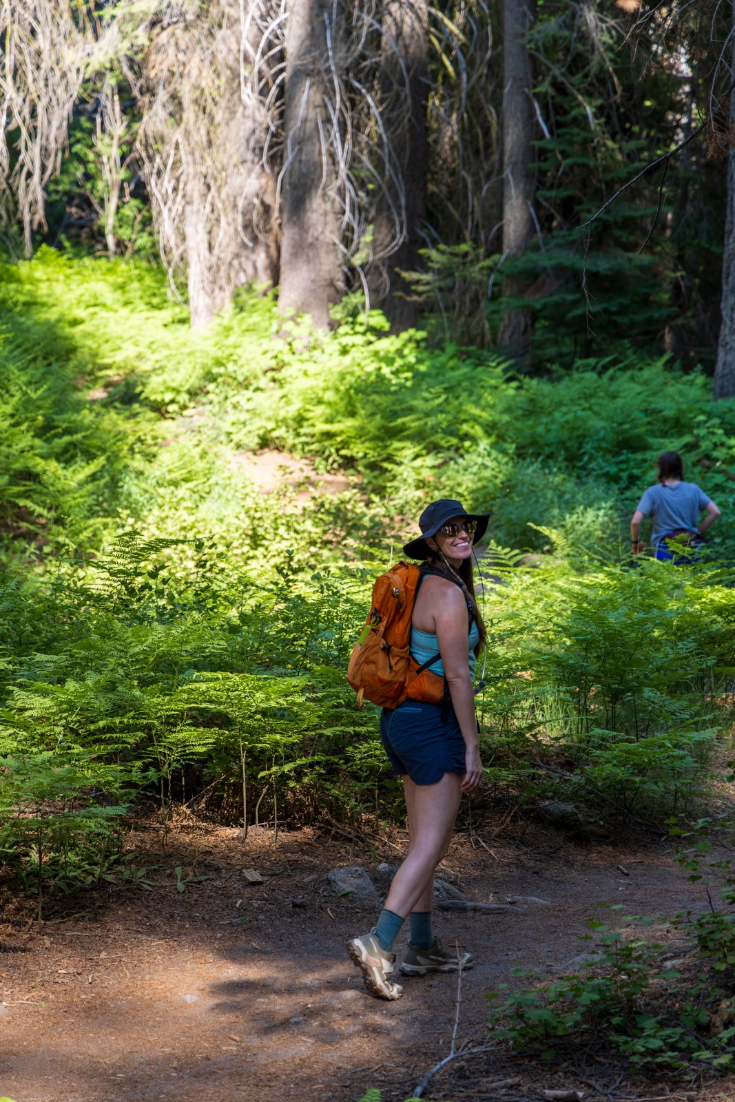
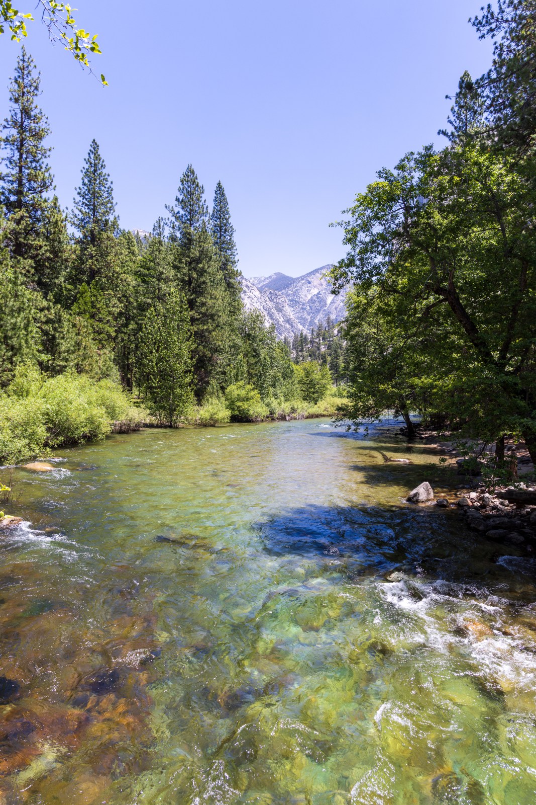
Hiking at Sequoia & Kings Canyon
Both Sequoia and Kings Canyon National Parks offer miles of incredible trails that lead through wilderness areas, alpine lakes, meadows, waterfalls, and scenic mountain ranges. Many of the longer trails go deep into the backcountry and require an overnight trip with a permit from the National Park Service.
Since this was our first time visiting, we decided to stick with front country hiking. Even without going into the backcountry, there are still plenty of rewarding trails to explore. Our goal was to see as many of the park’s main highlights as possible. We did not get to every trail, but we highly recommend the ones below if it is your first visit.
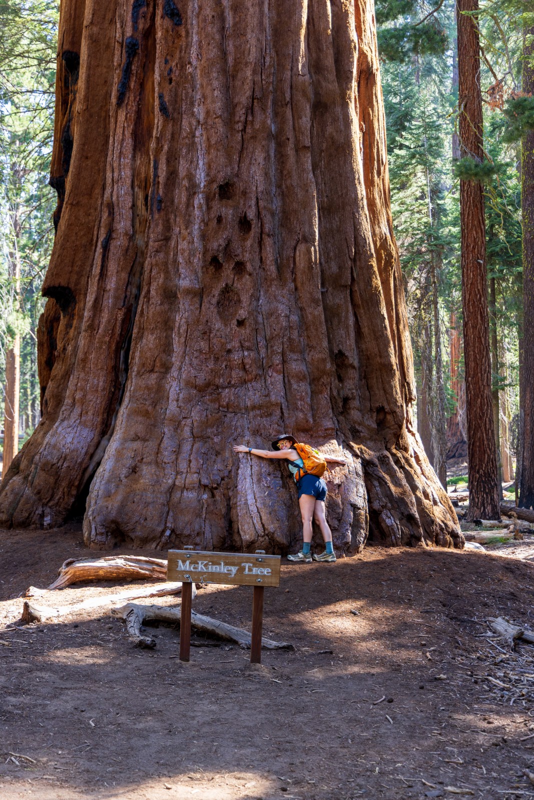
General Grant Trail
Our route was slightly shorter than the full loop listed on AllTrails, which is about seven tenths of a mile. This is an easy and family-friendly trail that takes you to the base of the General Grant Tree, the second largest tree in the world by volume. Along the way, there are interpretive signs and other massive sequoias to admire.
Quick Stats
Length:
.7 miles
Route Type:
Out & back
Elevation Gain:
82 ft recorded
Vaulted Toilets:
Yes


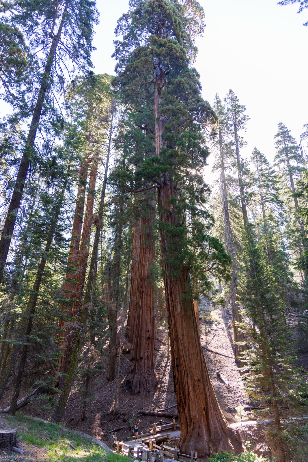
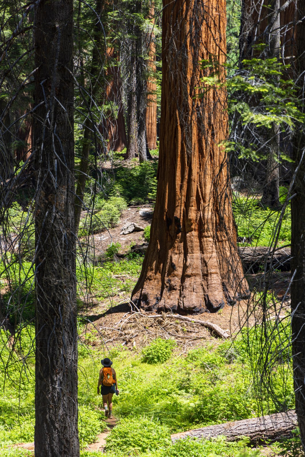
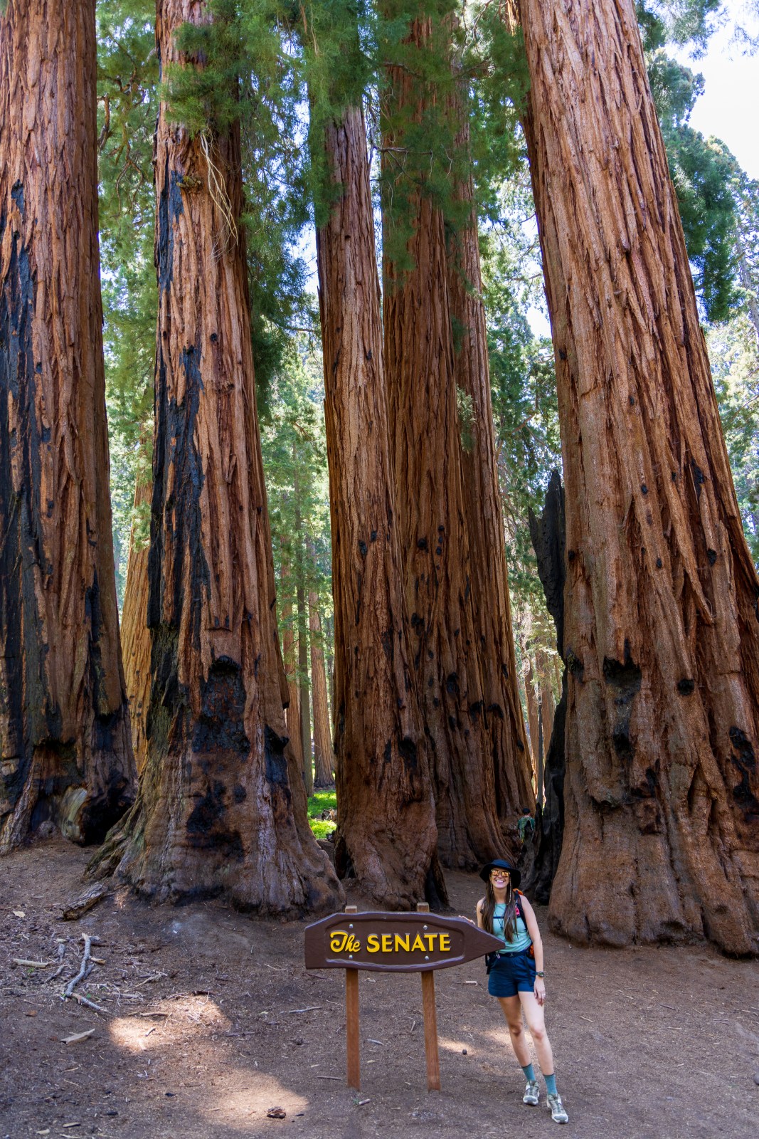
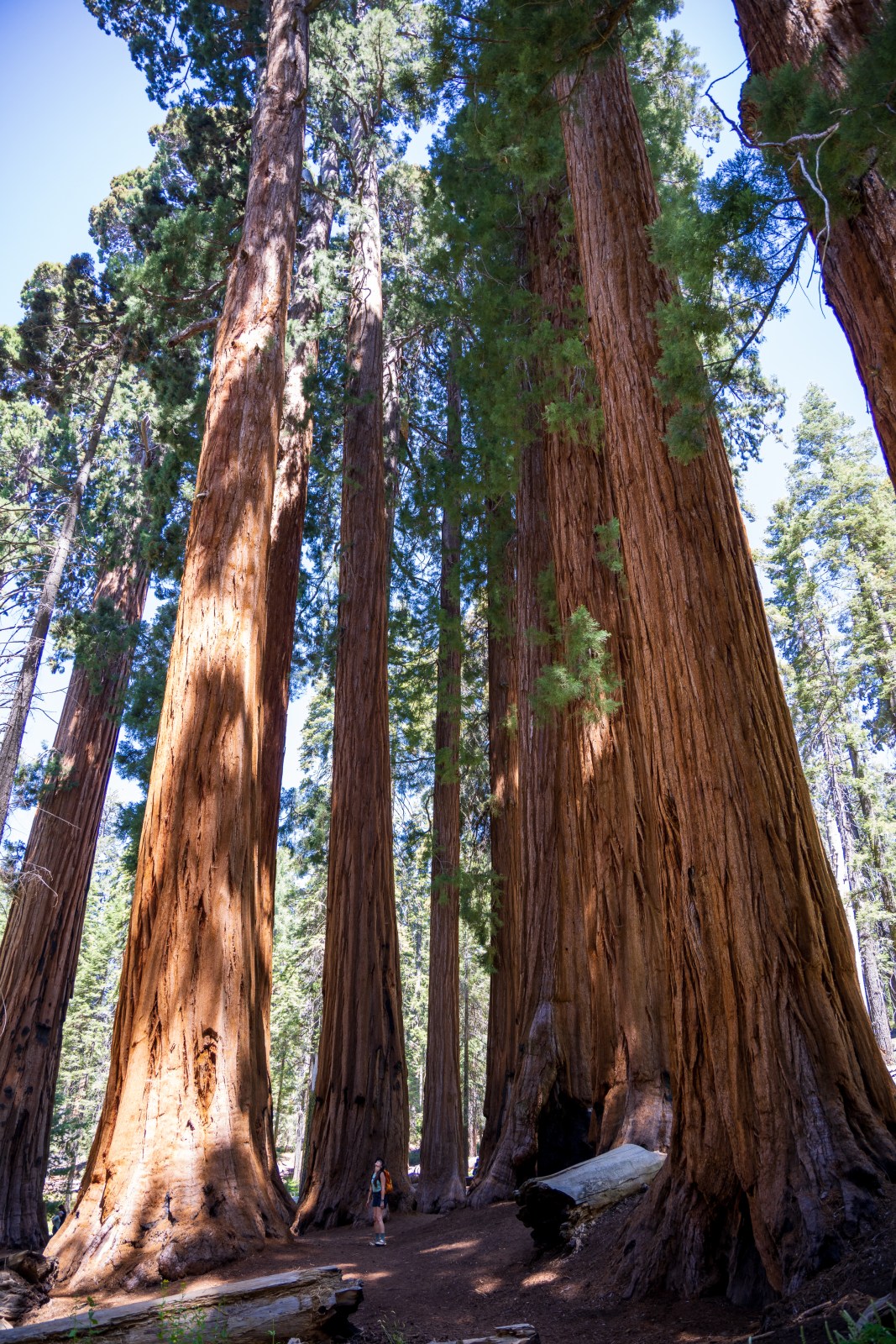
Circle Meadow Loop via Congress and General Sherman Tree Trail
We followed this route through the Giant Forest and absolutely loved it. Pictures do not do it justice. Being surrounded by giant sequoias in every direction was an incredible experience.
We made a small detour to visit the Three Amigos trees, which added a little extra distance but was completely worth it. If we had unlimited time, we would have stayed out there even longer, but we had more hikes planned that day.
This trail is a great way to experience both the popular highlights and the quieter corners of the Giant Forest.
Quick Stats
Length:
5.3 miles recorded
Route Type:
Loop
Elevation Gain:
826 ft recorded
Vaulted Toilets:
Yes
Dog Friendly:
NO
Fee:
Yes (Park Entrance)
Difficulty:
Moderate
Water:
Yes


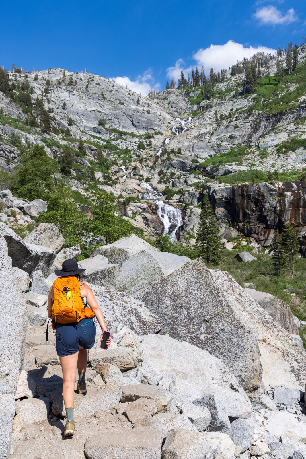
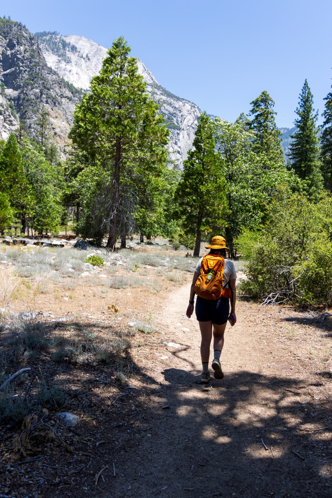
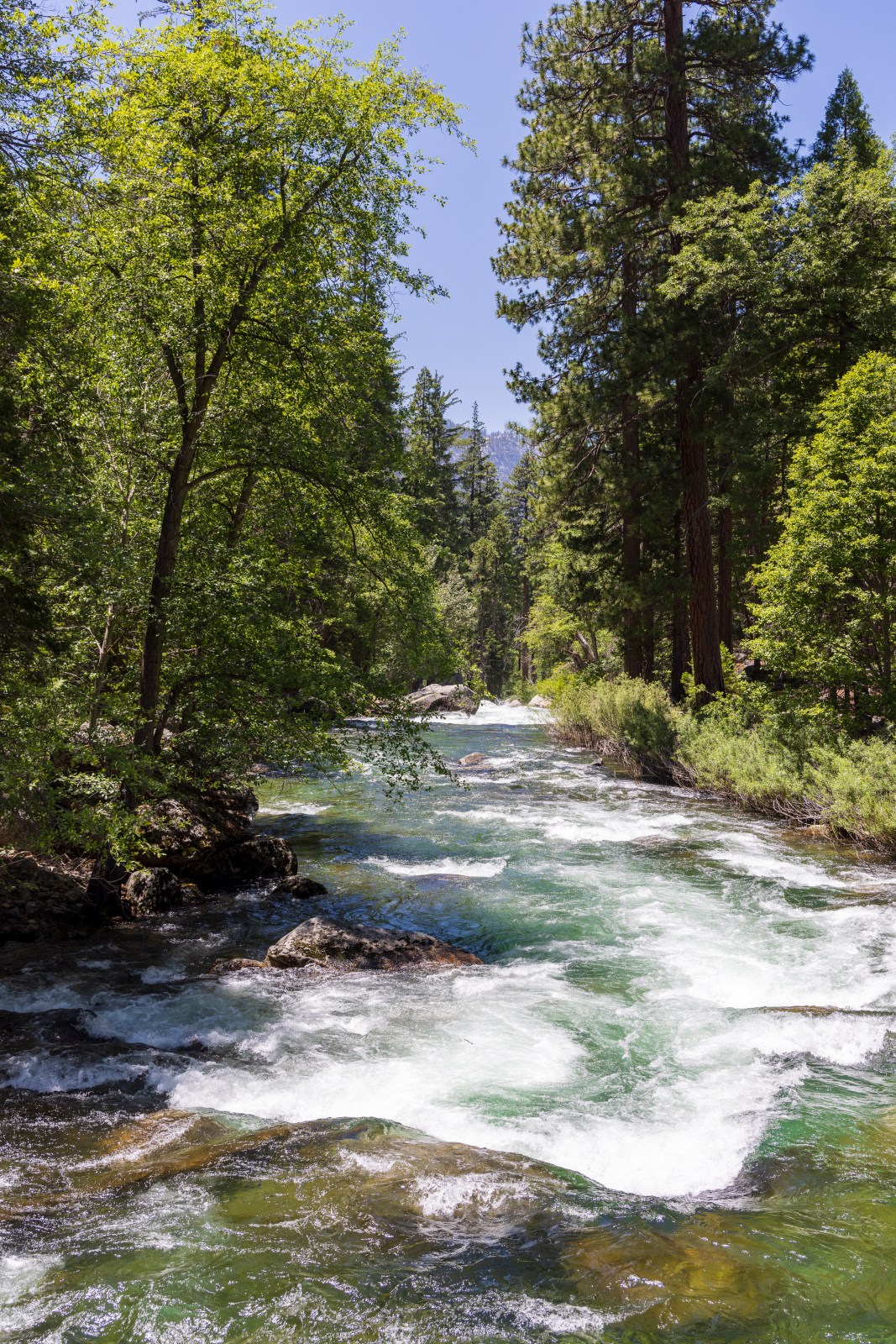
Tokopah Falls
We started this hike around 3:30 in the afternoon, and outside of the shaded areas, the sun felt strong. The trail to the falls was not too difficult and offered beautiful scenery the entire way.
This is a very popular trail, so expect to see other hikers. There is a large parking area near the Lodgepole Campground that is available for both day visitors and backpackers.
Getting close to the base of the waterfall requires a bit more effort. The boulders near the water are large and uneven, and the final stretch can be tricky. If you are not confident climbing over large rocks or pulling yourself up steep sections, we recommend enjoying the view from the main trail rather than heading down to the water.
Quick Stats
Length:
4 miles recorded
Route Type:
Out and back
Elevation Gain:
515 ft recorded
Vaulted Toilets:
Yes
Dog Friendly:
NO
Fee:
Yes (Park Entrance)
Difficulty:
Moderate
Water:
At parking lot and at trailhead


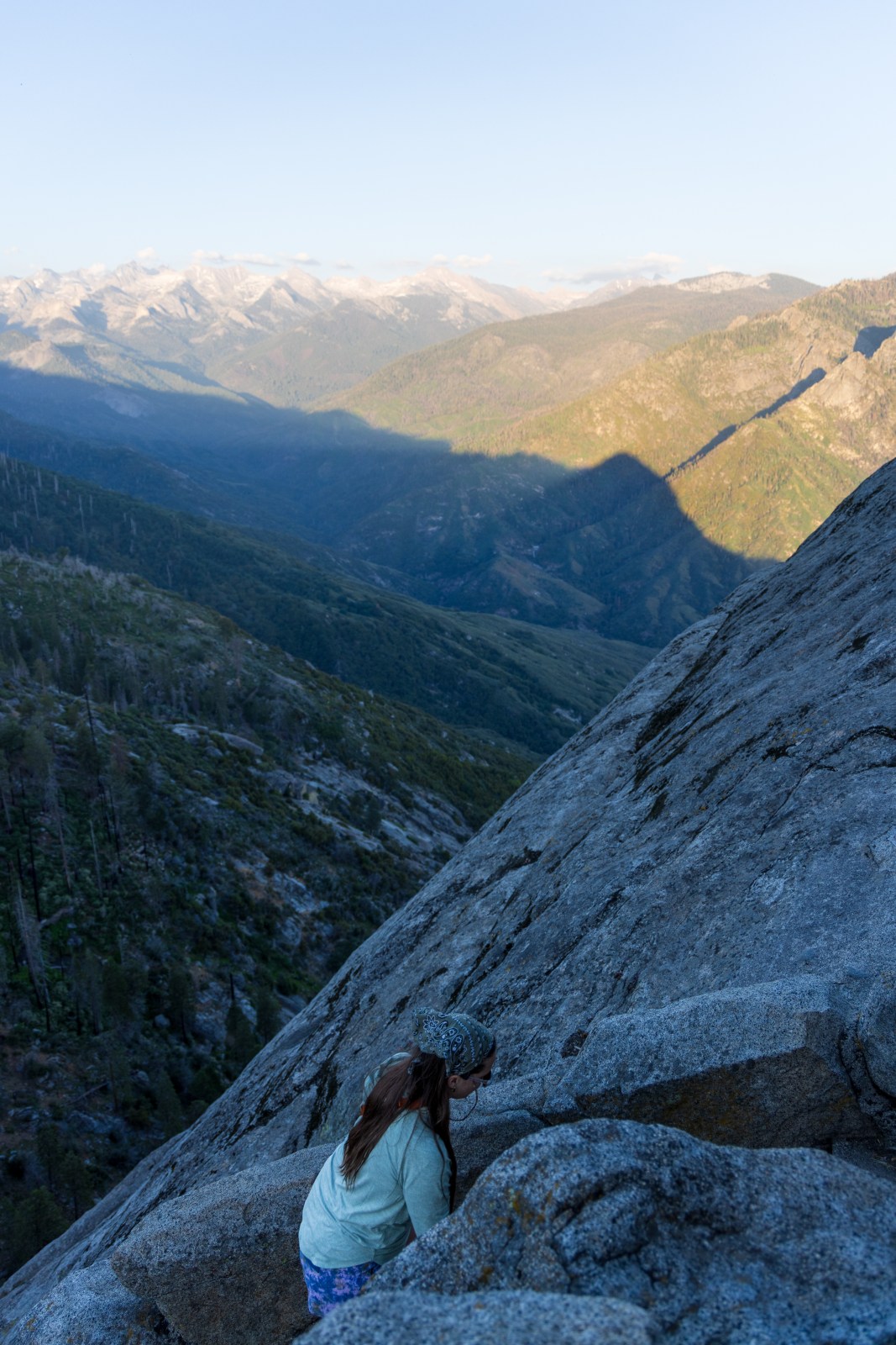
Moro Rock
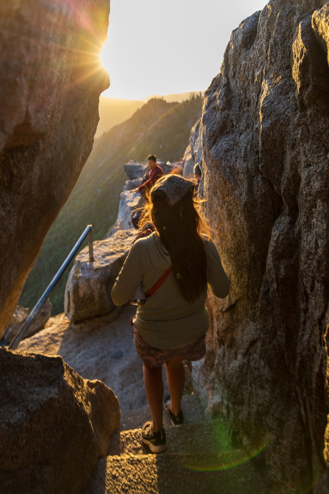
During the summer the road to Moro Rock, Crescent Meadow Rd, is closed on weekends and holidays from early in the morning to about 7 pm. However, it may open earlier. We visited on Juneteenth and the parking lot was completely full even though the road was supposed to have just opened. This hike is very popular in the evening. Additionally, it is quite steep and narrow at higher elevation. Be prepared for a lot of stopping. If you plan to be there for sunset, make sure you have a flashlight.
Quick Stats
Length:
0.5 miles
Route Type:
Out and back
Elevation Gain:
255 ft recorded
Vaulted Toilets:
Yes
Dog Friendly:
NO
Fee:
Yes (Park Entrance)
Difficulty:
Moderate
Water:
At parking lot and at trailhead


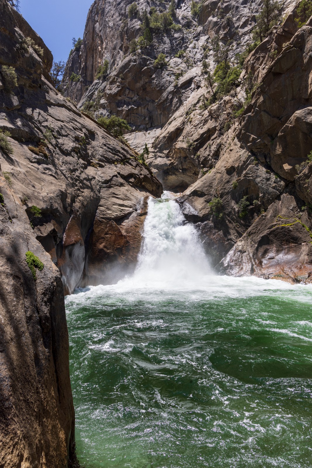
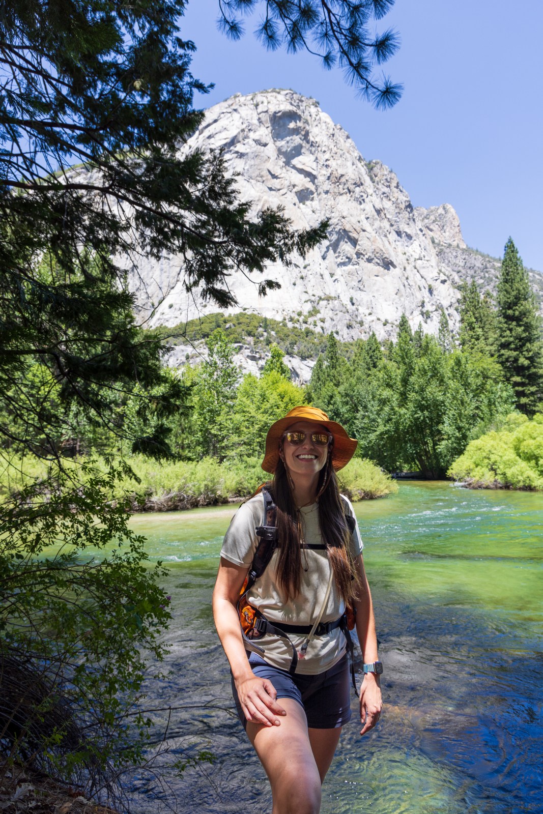
Roaring River to Zumwalt Meadow
The parking near the waterfall is limited. There are some roadside spots just before the parking lot too. Other hikers parked at the trailhead starting at Zumwalt Meadow and hiked to the Roaring River waterfall. We did the opposite and hiked from the waterfall to the meadow. This hike wasn’t too challenging. In some spots the trail is overgrown making it narrow.
Quick Stats
Length:
4.3 miles recorded
Route Type:
Out and back
Elevation Gain:
450 ft recorded
Vaulted Toilets:
No
Dog Friendly:
NO
Fee:
Yes (Park Entrance)
Difficulty:
Moderate
Water:
No


Other Hikes in Sequoia & Kings Canyon
These are some of the other day hike trails we wish we had more time and energy to hike during our trip. However, we look at them as a reason to return soon!
Scenic Drives
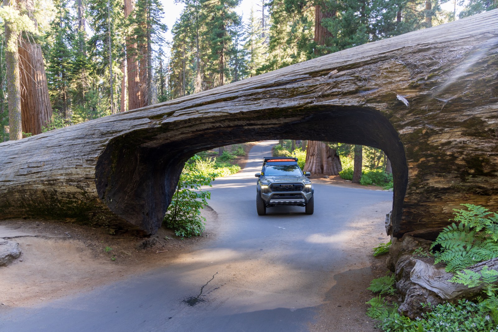
Tunnel Log
Tunnel log is accessible by vehicle on Crescent Meadow Rd when open to the public. During other times visitors must take the shuttle bus or hike. During the winter visitors must snowshoe, or cross country ski to the iconic log. We went Wednesday evening and there were only a few other cars.
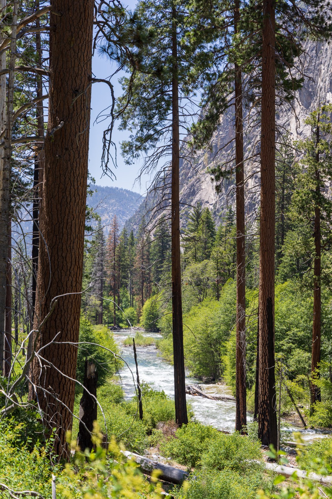
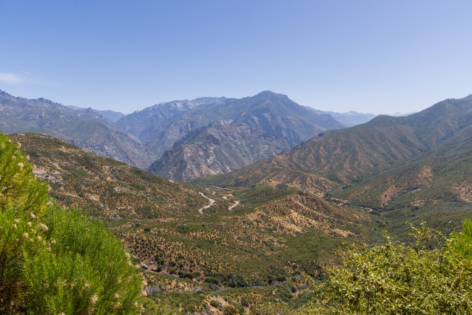
Kings Canyon Scenic Byway
The highway between Grant Grove and Cedar Grove is spectacular. The Kings Canyon Scenic Byway actually spends most of its time outside of the park. However, the drive offers great views of the park cliffs and canyons as well as the forks of the Kings River.
This is a twisting and winding road with steep drop offs. If you get carsick easily, this might not be the best idea for you.


Camping at Sequoia & Kings Canyon
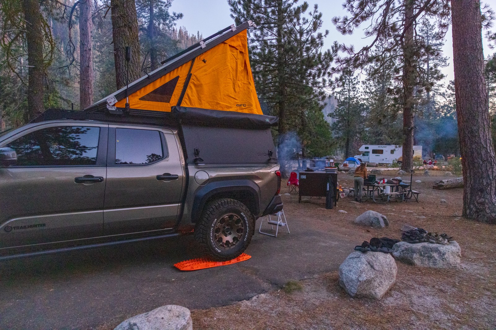
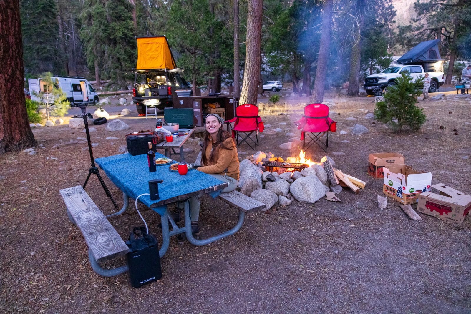
Between both parks, there are many campgrounds to choose from. However, make sure to regularly check the status of the campgrounds because each year there could be closures for different reasons. We ultimately picked Lodgepole Campground as our ideal base for a number of different reasons.
- There were showers at the general store
- It was the closest campground to the Giant Forest (General Sherman) and not as far from General Grove in Kings Canyon
- There are a lot of spots that can accommodate a roof top tent camper
- The campground is at higher elevation and therefore cooler than other parts of the parks in mid-summer
Lodgepole Campground
Once we decided Lodgepole Campground was where we wanted to camp we figured out when campsites would be released for June. All sites are reservation only and released four months in advance of the first date of your stay. We knew June would be a popular time so we were prepared to reserve a campsite immediately when it was released. Prior to reservations opening we had researched all the sites that were compatible with our camping set up. We had a list and were prepared to work our way through it. Because others could secure a site with overlapping dates when checking in prior, not all of our pre-identified sites were available.
Things to Know
- Campsites are close together
- There are free potable water spigots throughout the campground
- The bathrooms have flush toilets
- Most sites are on somewhat of a sloped driveway
- Bear boxes must be used


Additional Information
If you’re interested in the gear we’re using and wearing check out our favorite gear recommendations that we’ve tested and used, including on our trip to Sequoia and Kings Canyon.
For more insights on how we plan trips and what to consider check out our blog post about the Top 6 Things you should consider.
New to camping? Check out our Beginner’s Guide to Camping & Gear.
Check out the first half of our road trip in Yosemite National Park and everything we recommend!

