

Tonto National Forest OHV & Forest Roads
Tonto National Forest is the largest of Arizona’s seven National Forests and the ninth largest in country, encompassing over 2.9 million acres. We love all of our National Forests and their unique qualities! However, we often pick Tonto National Forest as our favorite for a number of reasons. But the number one reason is the fact that the forest really represents what Arizona has to offer. The forests elevation ranges from the Sonoran Desert at 1,300 feet above sea level to the Mogollon Rim at 7,900 feet above sea level. And within the vast expanse of the forest and the numerous mountain ranges, canyons, rivers, and watersheds is a variety of plant and animal life.
One can easily see the National Forest change simply by driving State Route 87 from Mesa to Payson. However, sometimes staying on the pavement at 65 mph isn’t enough or moves too fast. Luckily, Tonto National Forest is so large and old that it’s rich with forest roads, fire roads, OHV trails, and highways that run through it.
A great way to see Tonto National Forest show off it’s incredible diversity in less than 30 miles and at a very slow speed is by driving the Montana Mountain Loop. This loop includes Queen Valley Road, Hewitt Station Road (FR 357), and Forest Roads 172, 172A, and 650 with the US 60 completing the loop if you choose.
Need To Know: 4x4 & High Clearance
- The roads get progressively worse as they climb in elevation
- A high clearance vehicle and 4WD is necessary
- We used 4-Low in a couple uphill locations and stayed in 4-Low for the steep downhill to help our breaks
- Forest Road 650 has steep and very narrow switch backs with many cliff ledges
- On Montana Mountain the road is not wide enough for two vehicles
- A large portion of these forest roads border the Superstition Wilderness where motorized vehicles are prohibited by federal law
- Cell phone signal is not strong and unavailable in some locations
- Do not attempt the drive after recent rain or if rain is in the forecast


Leave No Trace + Tread Lightly
Please remember to Leave No Trace and Tread Lightly when exploring. Pack out all trash and plan ahead. Check out our hiking tips for more information.
1) Travel Responsibly on land by staying on designated roads, trails and area.
2) Respect The Rights of Others including private property owners, all recreational trail users, campers and others so they can enjoy their recreational activities undisturbed. Leave gates as you found them.
3) Educate Yourself prior to your trip by obtaining travel maps and regulations from public agencies. Plan for your trip, take recreation skills classes and know how to operate your equipment safely.
4) Avoid Sensitive Areas on land such as meadows, lake shores, wetlands and streams. Always ride with caution any time water is present. Wet soils are more susceptible to damage.
5) Do Your Part by modeling appropriate behavior, leaving the area better than you found it, properly disposing of waste, minimizing the use of fire, avoiding the spread of invasive species and repairing degraded areas.
Hewitt Station & Montana Mountain Loop
On our route, we traveled from west to east starting closer to Queen Valley and ending closer to Superior, across the highway from Picketpost Mountain. From the US 60 eastbound we exited at the Queen Valley Rd exit. The exit is off the left lane and does require crossing westbound lanes.
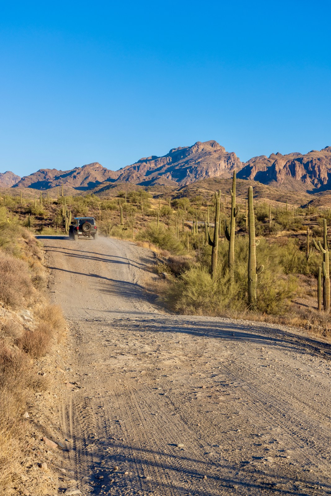
Once on Queen Valley Road we traveled about 1.5 miles until a fork intersection with Hewitt Station Road. This is also knowns as Forest Road 357. Take the turn onto the dirt road, Hewitt Station Rd. The next 32+ miles are all dirt. Once on the dirt road we pulled over and aired down our tires to about 23 psi. There is also a staging area just a bit further down the road but we weren’t aware at the time. Follow Hewitt Station Rd for about 3 miles to its intersection with Hewitt Canyon Rd, also known as Forest Road 172 on the left hand side of the road. You’ll see the Hewitt Station OHV Trails sign in the photos above on the right hand side of the road.

Hewitt Canyon Road (Forest Road 172)
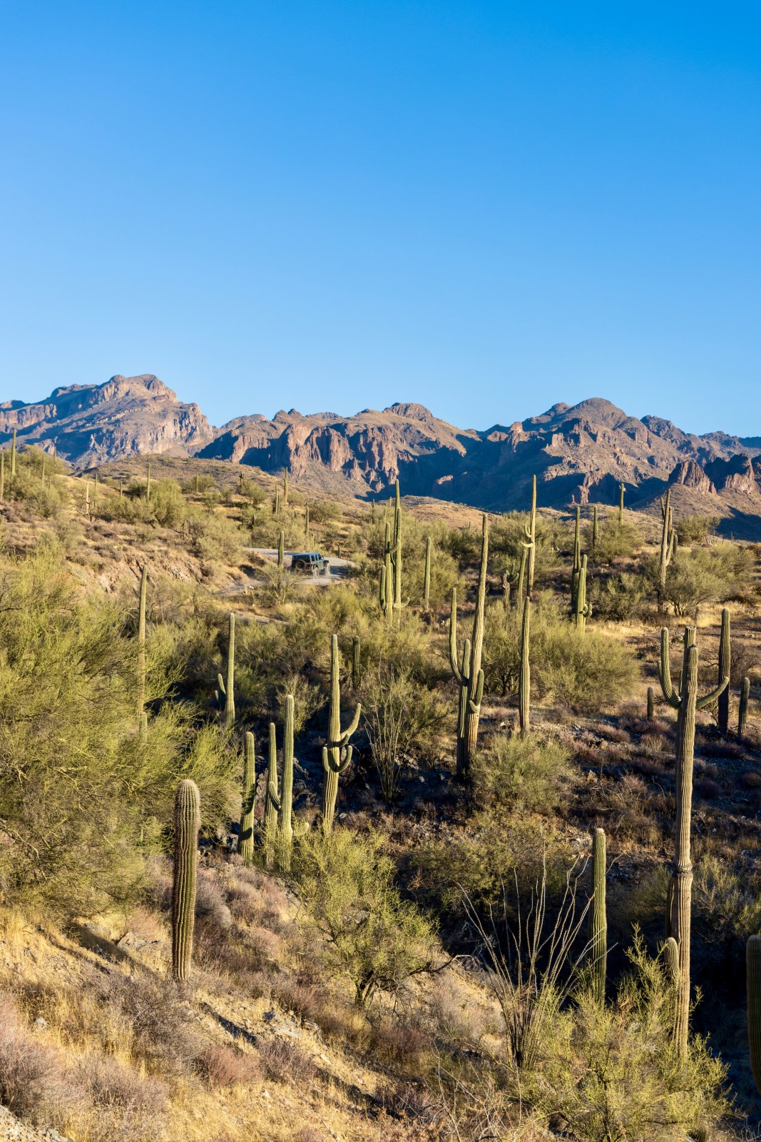
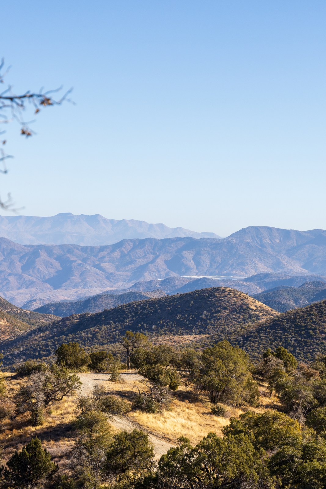
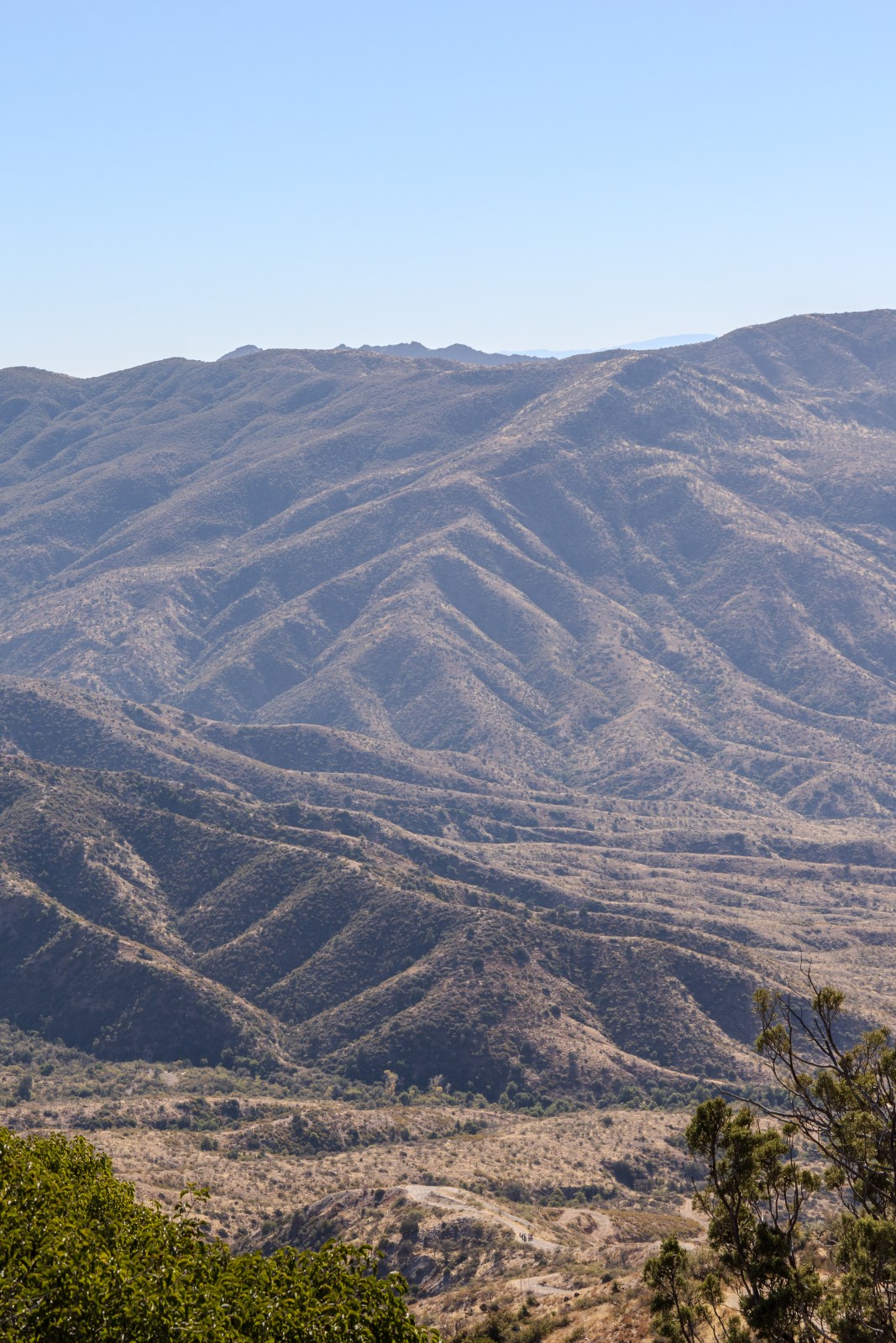
After turning on Hewitt Canyon Rd the road remains suitable for most vehicles for quite a while. Because it is still dirt and rocky off road travel, we do recommend a vehicle with good tires and some ground clearance. If there has been recent weather in the area, specifically rain then proceed with caution. Overall, much of this road twists and turns around hills dotted with desert plants and saguaros. In the distance are epic views of the mountains and canyons.


Forest Road 172A
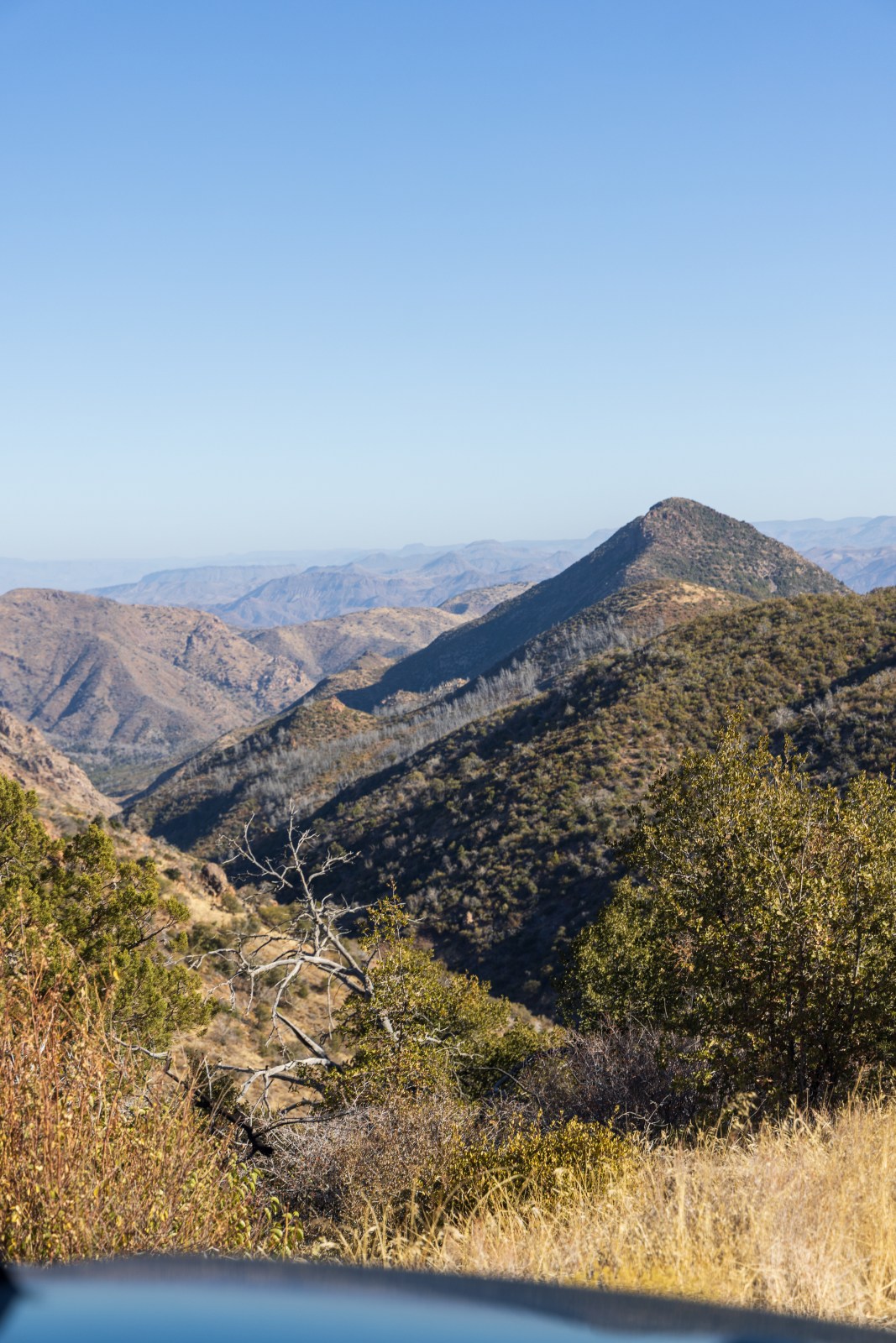
Shortly after 9 miles from the start of FR 172 there is a junction with FR 172A that leads towards Montana Mountain and to the left leads towards the Woodbury Trailhead. Forest Road 127A is definitely rougher than FR 127. The road has more ruts from water erosion and has some more narrow sections with tighter turns. High clearance and 4-wheel drive is needed here. We disconnected our sway-bar on the Wrangler. At this point you’re now climbing the western slope of Montana mountain and the vegetation starts to change and the views are awesome!


Forest Road 650
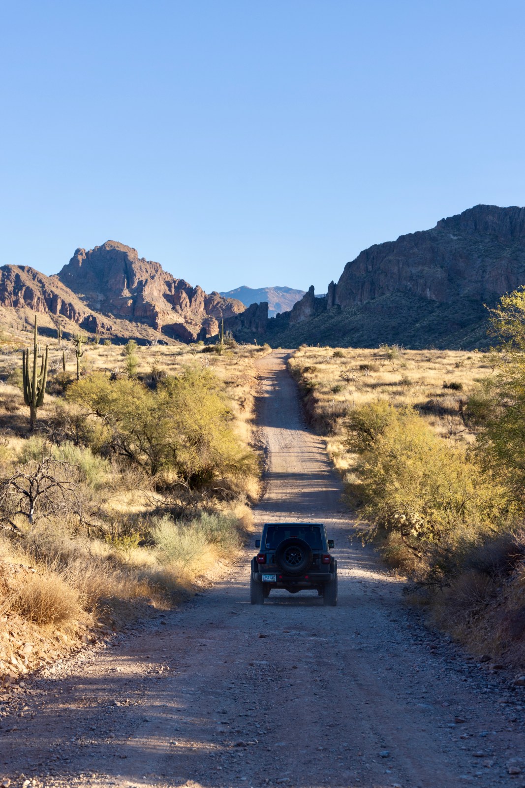
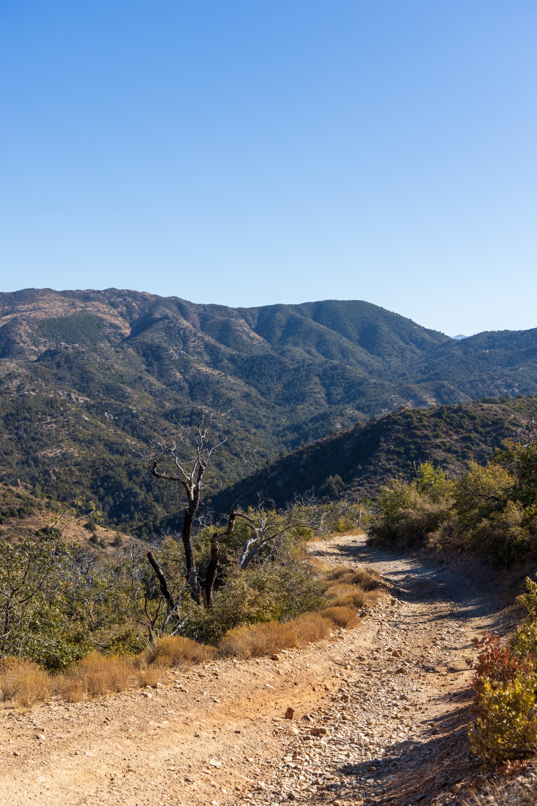
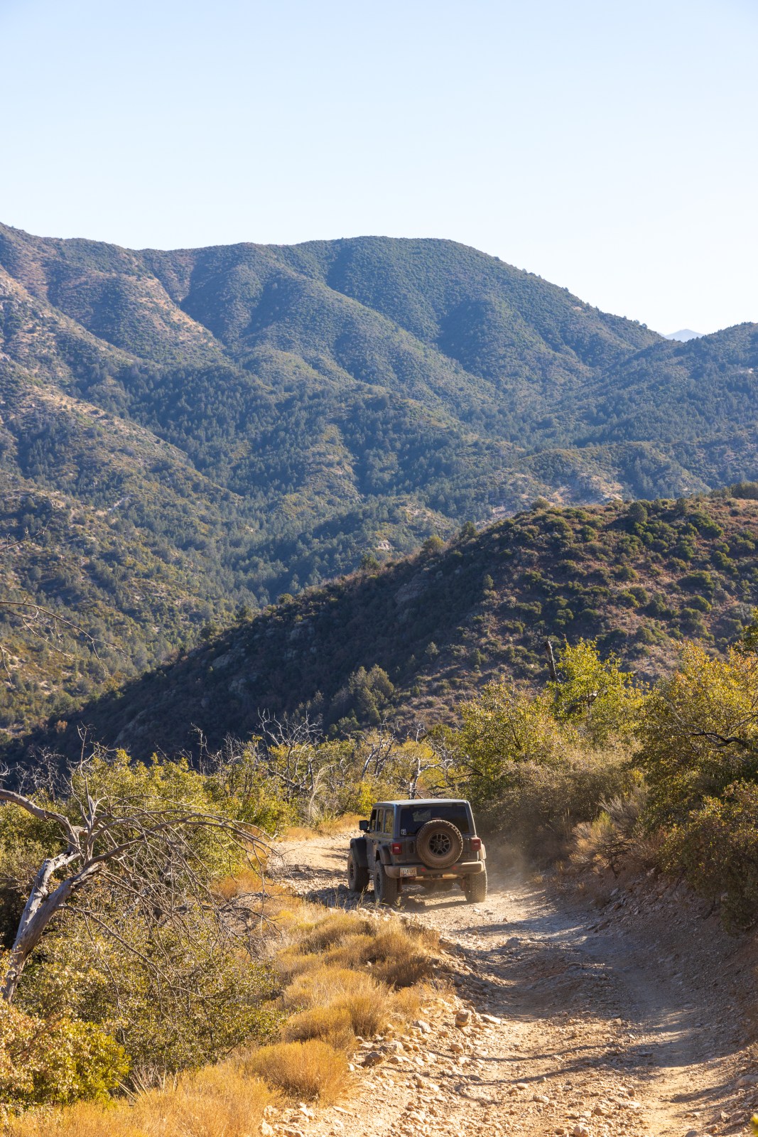
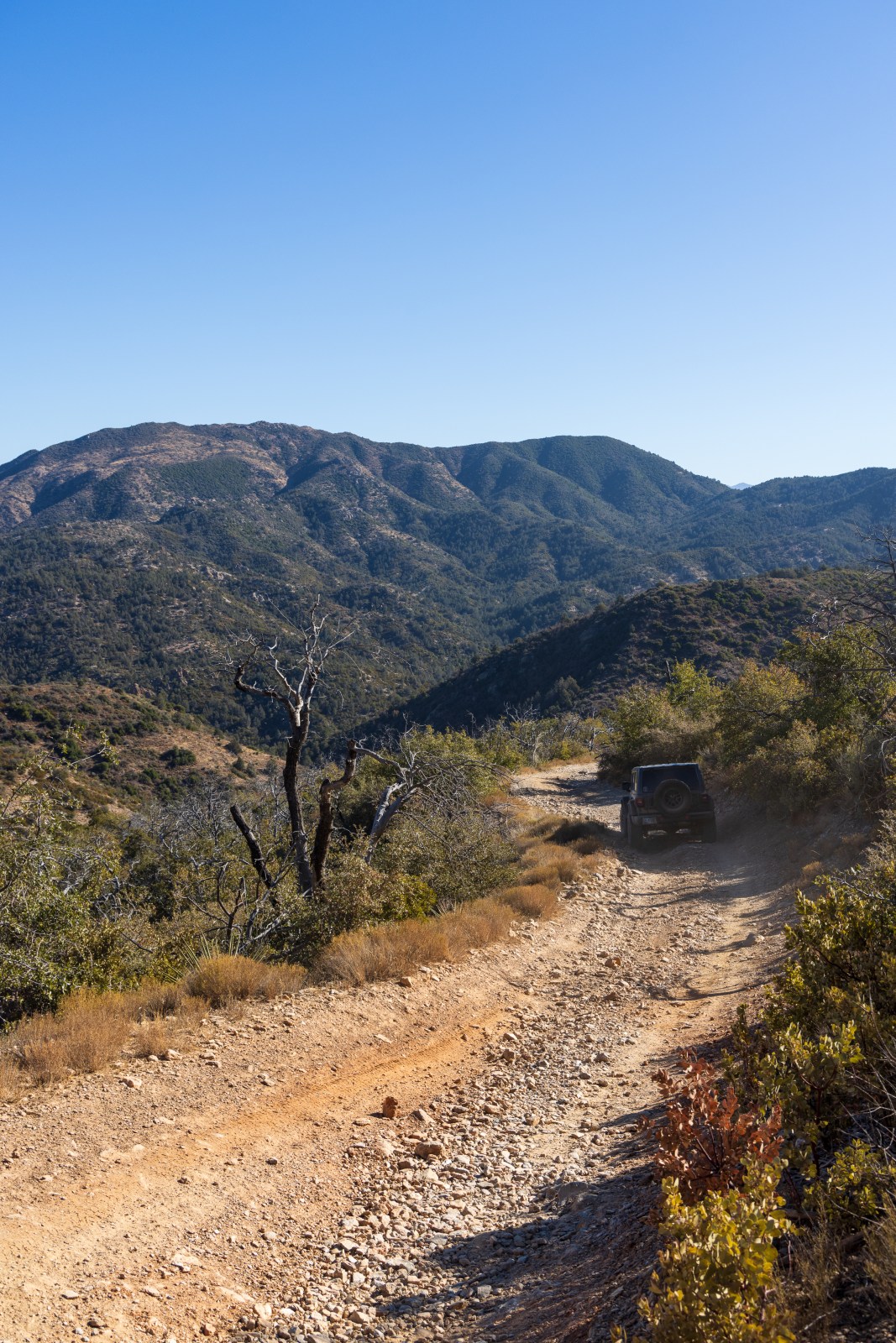
In less than 4 miles the Forest Road 172A intersects with Forest Road 650. This is by far the roughest road with large rocks and boulders, deep ruts and short ledges as the road continues to climb up Montana Mountain. To get onto FR 650 is a steep and short climb and it’s immediately followed by an extended steep climb. We didn’t film the first section but did film the following climb. On the mountain the road is single vehicle wide and there are sections where Arizona pinstripes will be earned. The road will take you through some woodlands, mostly pinyon and or juniper pine (sorry we aren’t experts). There are some areas that we’ve noticed previous campers have created campsites. We highly encourage you to re-use those vs creating your own as that aligns with the best Leave No Trace practice.
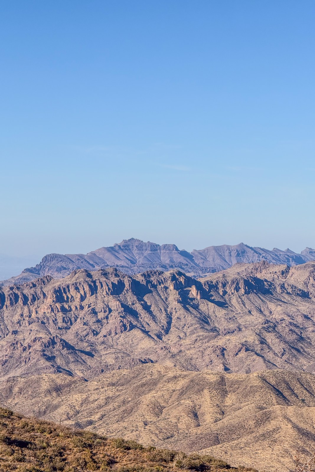
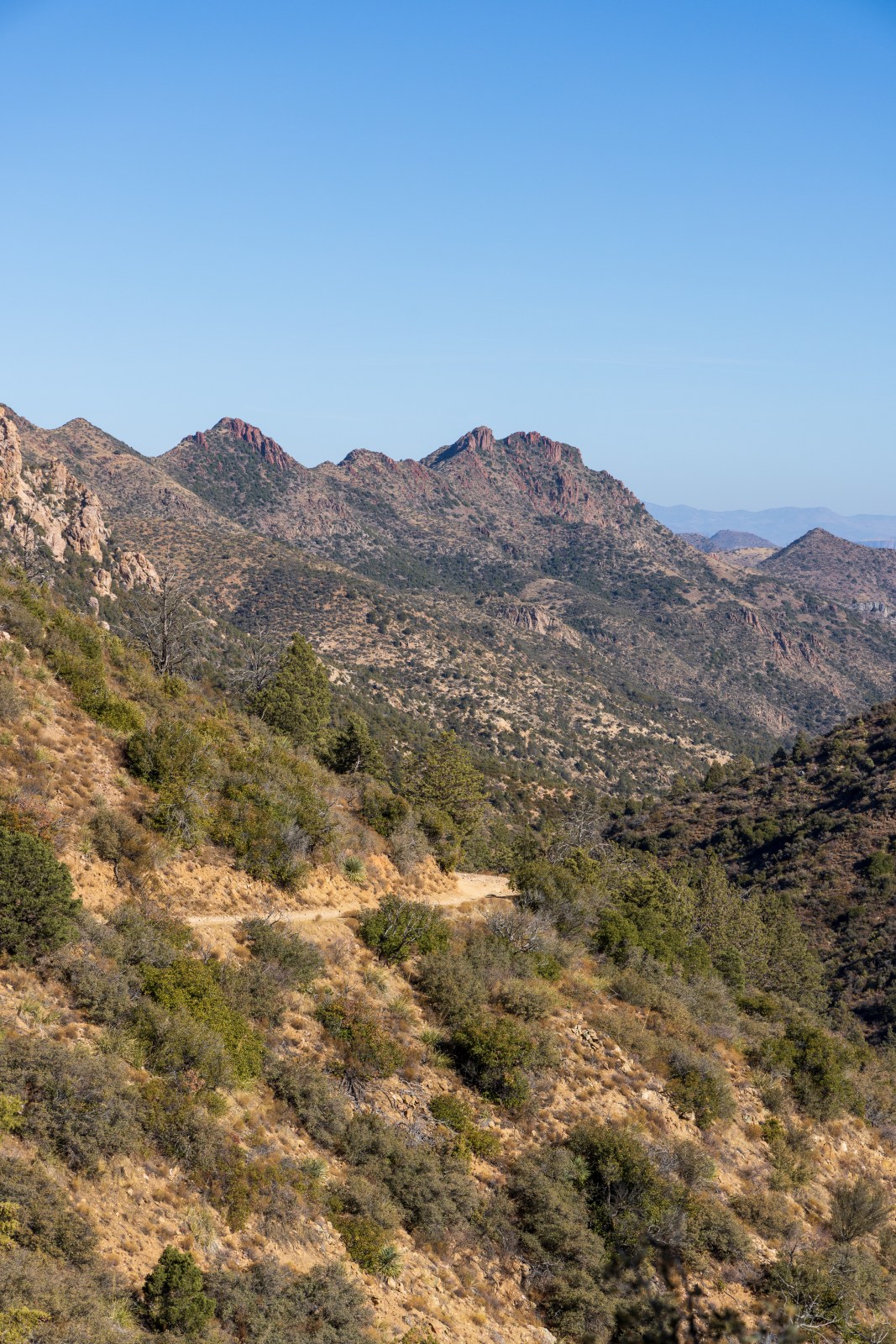
At the top there is a burn scar and Passage 18 of the Arizona Trail that shares a portion of FR 650 as its route. We stopped to take in the view and have a snack without the constant bouncing and shaking of the Jeep on the rocky road. After the burn scar section the road starts to wrap around and the mountain and slowly down. The road here is narrow with many blind corners but not quite the sharp turns of the upcoming switchbacks. The view here continues to be stunning with eastward views of the Sierra Anchas and other mountain ranges.
The Switchbacks
The road continues to be very narrow as it hugs the side of the mountain with steep drop offs to one side and mountain on the other side. There are some spots where we were able to pull over and let side-by-sides and dirt bikers pass us. After a gradual descent there is a saddle point right before the switchbacks start. We stopped here for a quick breather and opportunity to stretch our legs. And now the fun part, the steep downhill with tight switchbacks. We were definitely nervous here but the jeep handled it well. There was only one section where we needed to do a 3 point turn because the road led to deep divot that we wanted to avoid.
Once down the switch backs FR 650 is much easier. The road is still rough and best suited for high clearance and 4WD but it’s not nearly as challenging or frightening. We cruised south towards the US 60 and stopped at the Silver King Staging area to air our tires back up and make a Mountain House meal.


Recovery Gear & Risk Management
Traveling on un-maintained backcountry and forest roads is inherently risky. Roads only get worse as more vehicles travel on them and weather erosion continues to take its course. Therefore, pictures and videos of one person’s experience doesn’t mean the roads will look the same when you travel on them. Because of our personal experiences getting stuck and witnessing others, we’ve collected recovery gear that we now always travel with when traveling on 4×4 backcountry roads. Some things below may be affiliate links. By using our links you can support us without any additional cost at check out. Thank you for your support!
On the Jeep we have a Warn EVO 10 Synthetic Rope winch with an Ultra Hook from Factor 55.
In our recovery gear box we carry products from Yankum Ropes, a brand we trust. They make high quality, American made recovery gear to top of the line industry standards. For 10% Off at checkout, use coupon code: YANKAZHIKE
- Yankum Products
- 30′ Kinetic Recovery Rope
- 3 soft shackles
- Green pin bow shackle
- 3″ Flat Tow Strap which can also be used as a Tree Strap
- Offset Winch Snatch Ring
- Other Brands
In addition to the gear below we carry our Garmin satellite communicator, download maps for offline use on Google and OnX Offroad.

