
Picketpost Mountain Hike Overview
Picketpost Mountain, located near Superior in Arizona’s Tonto National Forest, is a rugged and challenging trail that rewards hikers with panoramic desert views. This hike is part of the Arizona Trail system before breaking off toward the summit, where a mailbox full of notes, trinkets, and mementos waits at the top. At about 4.2 miles round trip with steep scrambling sections, Picketpost is best suited for experienced hikers looking for a strenuous adventure outside the Phoenix metro area.
Quick Stats
Length:
5 miles
Route Type:
Out and back
Elevation Gain:
2,037 ft
Vaulted Toilets:
No
Dog Friendly:
Not recommended
Fee:
No
Difficulty:
Difficult
Water:
No
How to Get to Picketpost Mountain Trailhead
From the Phoenix metro, take US 60 East toward Superior. Visitors coming from Tucson or southern Arizona can connect via State Route 79. Along the way, you’ll pass views of the Superstition Mountains before exiting onto Uno Trail. Follow signs for Picketpost Trailhead.
The parking lot has room for cars, horse trailers, and mountain bikers, and includes restrooms. If the lot is full, some overflow parking is available along the roadside. You can also simply enter “Picketpost Trailhead” into Google Maps or Apple Maps for easy directions.
Hiking the Picketpost Mountain Trail
The hike begins along the Arizona Trail before branching off toward the summit. We started from the main trailhead around 9:30 a.m., and the lot was already full. About half a mile in, the trail splits — take the right fork to stay on the correct route. (We went left by mistake, so downloading the route on AllTrails really helped us get back on track.)
After about 1.4 miles, the climb steepens and the scrambling begins. There is no perfectly clear path, but red and white arrows mark the general direction. Expect to use both hands and feet as you climb over large boulders. Unlike Browns Peak, it never felt dangerously exposed, but this section is tough and not for casual hikers.
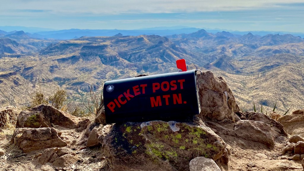
Once near the top, the trail levels briefly before one last push to the summit. This final half mile feels long, especially after scrambling, but the mailbox at the top is a fun reward. Inside are notes, stickers, and small items left by hikers. We added one of our AZ Hikeaholics stickers to the collection.
What to Expect on the Climb
This hike is a full-body workout and one of the more demanding trails near Phoenix. The rocky scramble sections make it slow-going, and while the incline is steady, it feels relentless. We were sore for days afterward!
Crowds are relatively light compared to Sedona or Camelback, though the parking lot is often busy with mountain bikers and horseback riders. The area is popular for multiple trail uses, so expect to see others enjoying different activities.


Tips for Hiking Picketpost Mountain
- Wear proper hiking shoes. Sturdy boots with good traction are essential for scrambling.
- Bring plenty of water. We each carried over 2.5 liters and finished every drop.
- Wear pants. Climbing over sharp rocks is easier with leg protection.
- Pack snacks. The summit mailbox is a perfect snack spot.
- Know your limits. The scrambling is challenging and can be intimidating.
- Leave No Trace. Pack out everything you bring, including food waste.
Other Phoenix Hikes
Picketpost Mountain is a hidden gem in Tonto National Forest that delivers both challenge and reward. Between the scrambling, sweeping summit views, and the quirky mailbox at the top, it’s a hike worth adding to your Arizona bucket list if you’re an experienced hiker. For more trails in the area, check out our full guide to the best hikes near Phoenix.

