
White Mountain Apache Reservation
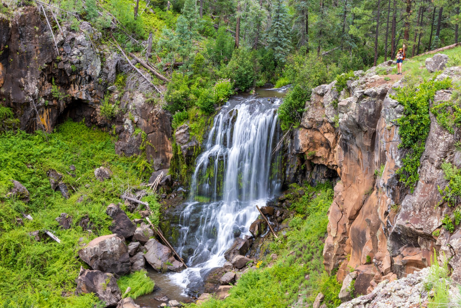
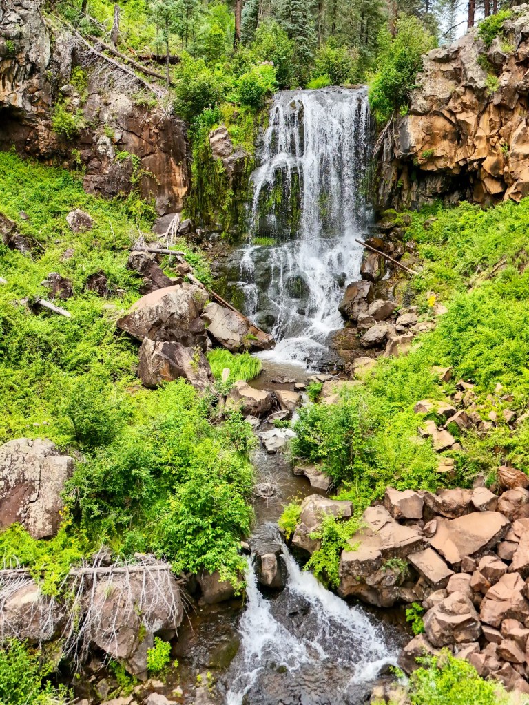
Pacheta Falls is on White Mountain Apache Land. The White Mountain Apache Reservation is located in eastern Arizona where they have lived for thousands of years. It’s incredibly important to respect the land if you do choose to go to the waterfall. Please remember to Leave No Trace. Pack it in, pack it out! We are very grateful that the tribe allows us to visit such a beautiful waterfall on their land. You NEED a permit to visit and we will get into all of the details below.
Pacheta Falls Permit
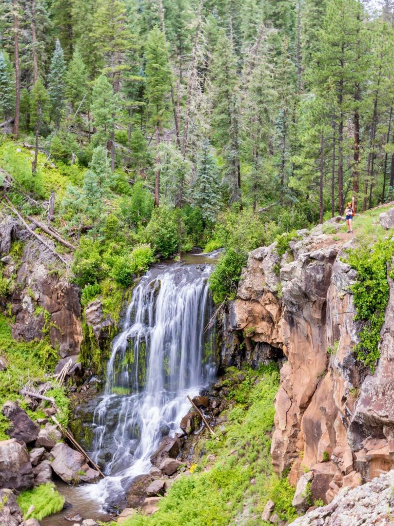
The journey to Pacheta Falls is long and challenging. The remote falls are deep in the forest and over 5 hours from Phoenix and easily over 2 hours from the town of Pinetop-Lakeside. We stayed in Pinetop and drove to Pacheta Falls from our stay at The Corduroy Lodge. A permit from the White Mountain Apache tribe is required to visit the falls, and to visit or recreate on all White Mountain Apache lands.
There are multiple places to buy a permit and they’re all listed on the White Mountain Apache Game & Fish website. We bought ours at the Hon-Dah Outdoor Sports Center off Highway 260 just south of Pinetop. The permits are $45 a person and you must carry it with you at all times. On our way to the waterfall a ranger did stop and check to see if we had our permits.
While buying our permits the store clerks let us know that the Tribe was not issuing permits in September. Unfortunately, we didn’t learn why. However, we highly suggest calling ahead of time if you don’t want to make the drive to the White Mountains and not get a permit.
Getting to Pacheta Falls

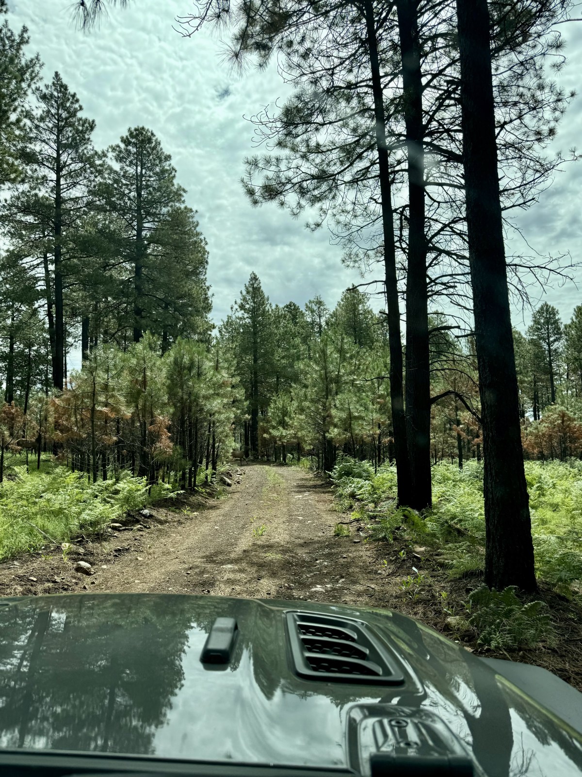
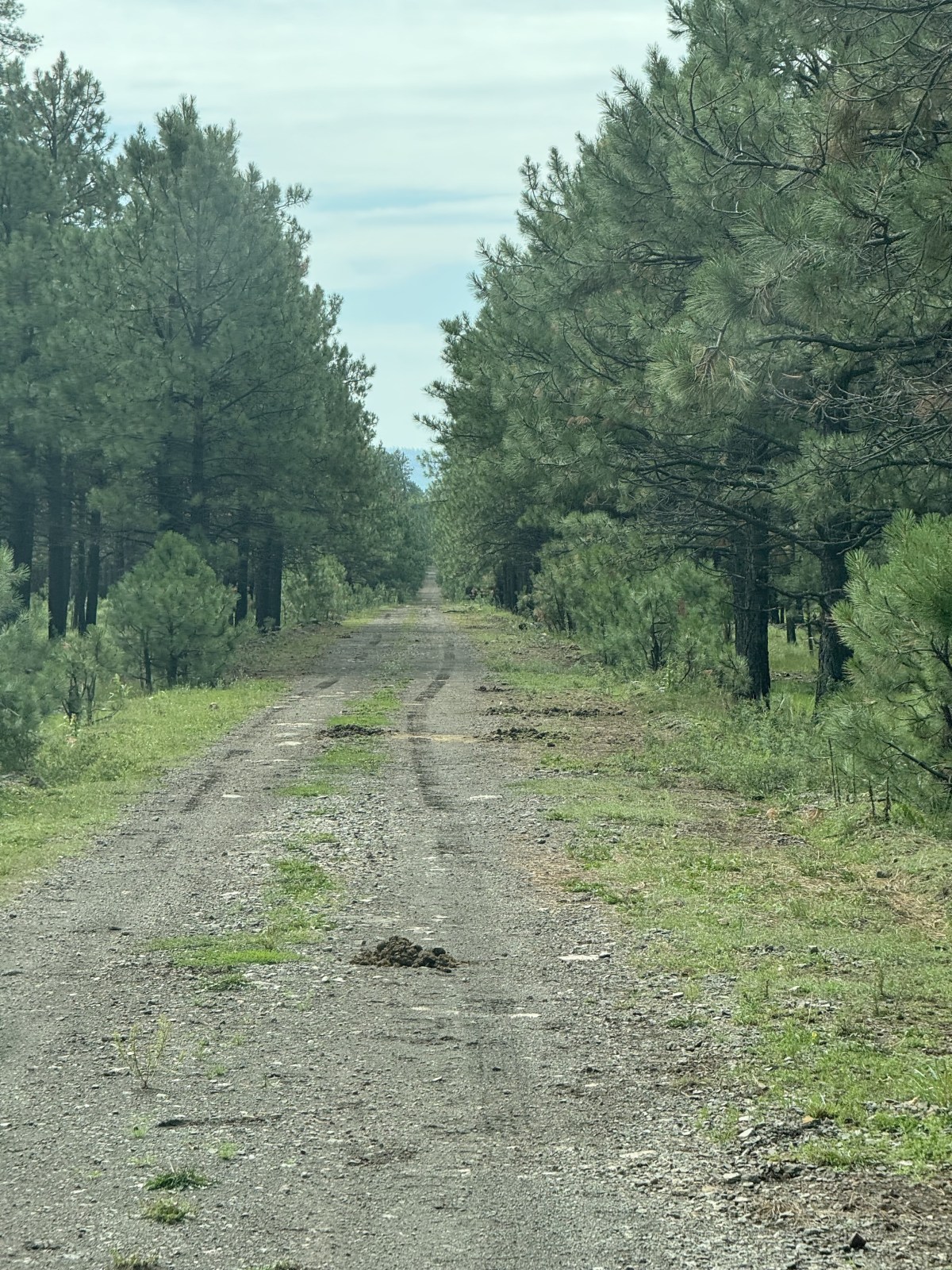
According to Google Maps there are multiple ways to get to Pacheta Falls. From the north you can get the falls from Reservation Lake. From the west, you can travel through Whiteriver and head east to the falls. Based on our research we read that previous visitors had made it from the north so that’s the way we took. Before our trip, we downloaded the area from Thompson Trail to Pacheta Falls on Google Maps for offline use. From Pinetop we had google direct us to Pacheta Falls and with the online maps, the app was able to provide instructions on when to turn based on mapped roads.
In addition to Google Maps, we also downloaded the area on OnX Offroad. We like to use the app because it has a tracking feature. The feature allows you to follow the same route back, or make sure to avoid a specific road you don’t want to travel again. Apple Maps also has a feature to download the maps to your phone. We aren’t sure on their map accuracy so we didn’t rely on them. Google Maps and OnX weren’t fully accurate, but they were pretty close.
We highly recommend downloading maps to your phone beforehand because there is zero cell phone service in the area. In addition, to no cell phone service there are NO services, meaning there are no restrooms, trash cans, etc. Please be prepared if you plan to visit. Besides no services, once past Reservation Lake and the campground just south of it, we didn’t see another person besides the ranger that checked our permits in the middle of the road.

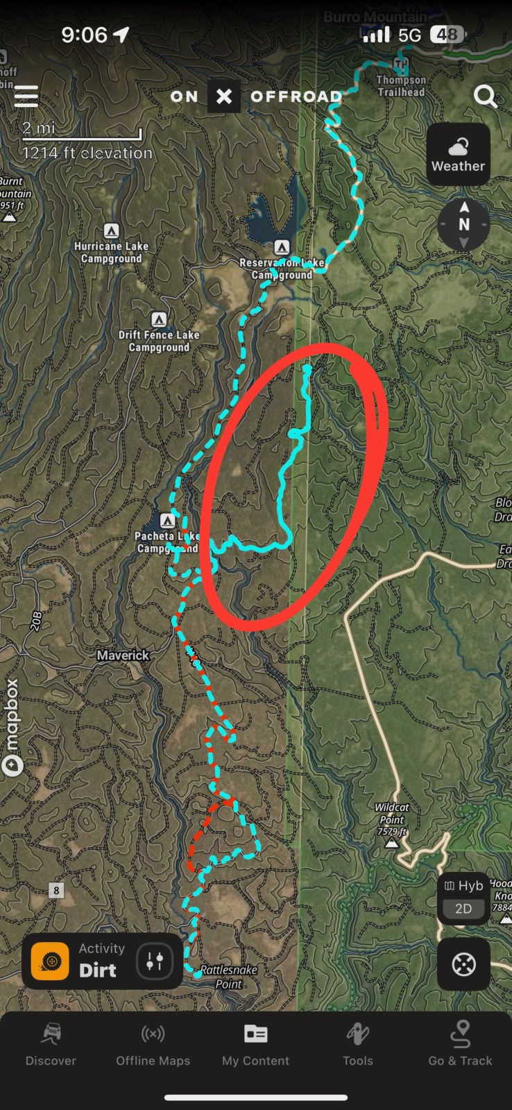

Tracking our Route with OnX Offroad
The screenshot above highlighting the red track is our route to the waterfall. We started our tracking a little late after passing Pacheta Lake. The screenshot highlighting the blue track is our track back. We tried to do something different from what Google suggested and it didn’t work. You can see the circled section is where we thought we were taking a different route on Country Road 7. The road was supposed to connect us to Apache-Sitgreaves National Forest but when we got there the the gate between White Mountain Apache reservation and the National Forest was closed and locked.


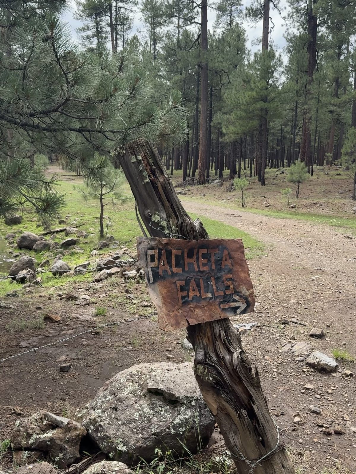
Parking at Pacheta Falls
Google has Pacheta Falls marked, however mapping to it directly will take you on the south side of the canyon. We didn’t see any pictures from that side so we decided not to go that route. After studying Google Maps satellite images we saw a road that leads close to the falls on the north side of the canyon. We saved the pinned location on Google Maps (33°40’11.4″N 109°31’26.0″W). However, once we got there we saw there was a road that travels a little farther.


Preparing for Pacheta Falls
We put together a checklist of what you should have with you at the minimum. Weather in the high country can change fast and is hard to predict. During our trip we crossed many puddles and drove through multiple muddy spots. It’s often hard to accurately gage how deep those crossings actually are.
- Correct White Mountain Apache issued permit
- Downloaded maps to your phone (Google Maps or OnX Offroad)
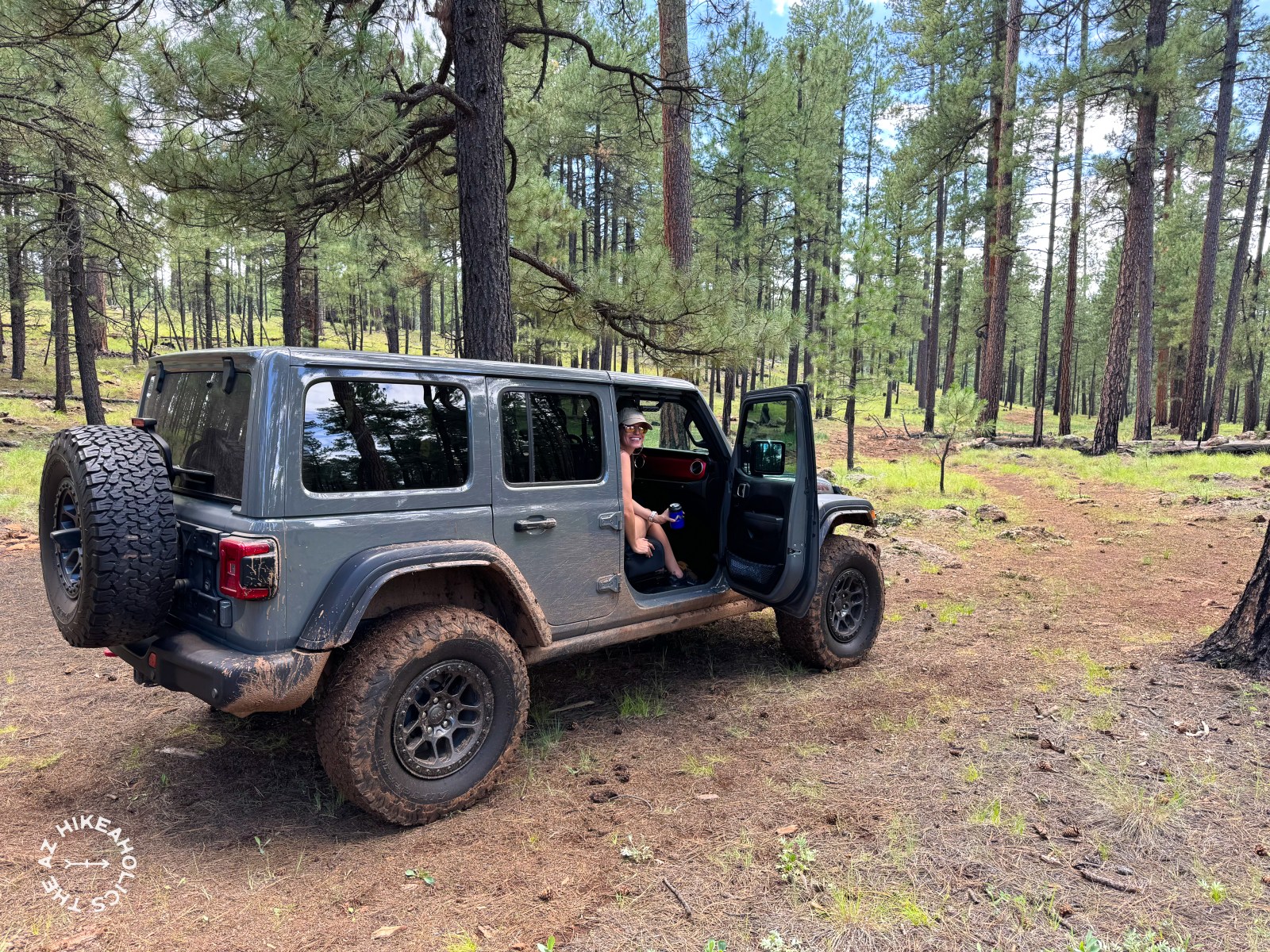
- Four Wheel Drive Vehicle with 4Low capability
- High Clearance Vehicle
- Recovery gear to self recover vehicle if necessary
- SOS device (satellite communicator or capable iPhone)
- Air compressor to inflate tires after deflating
- Enough food and water (mountainhouse.com or REI)

Recovery Gear & Risk Management
Traveling on un-maintained backcountry and forest roads is inherently risky. Roads only get worse as more vehicles travel on them and weather erosion continues to take its course. Therefore, pictures and videos of one person’s experience doesn’t mean the roads will look the same when you travel on them. Because of our personal experiences getting stuck and witnessing others, we’ve collected recovery gear that we now always travel with when traveling on 4×4 backcountry roads. Some the links below do include affiliate links so you can support us at no additional cost to you at check out.
On the Jeep we have a Warn EVO 10 Synthetic Rope winch with an Ultra Hook from Factor 55.
In our recovery gear box we carry products from Yankum Ropes, a brand we trust. They make high quality, American made recovery gear to top of the line industry standards. For 10% Off at checkout, use coupon code: YANKAZHIKE
- Yankum Products
- 30′ Kinetic Recovery Rope
- 3 soft shackles
- Green pin bow shackle
- 3″ Flat Tow Strap which can also be used as a Tree Strap
- Offset Winch Snatch Ring
- Other Brands

