Flatiron Hike via Siphon Draw Trail: Superstition Mountains

Flatiron via Siphon Draw Trail of the Superstition Mountains

Hiking Flatiron via Siphon Draw Trail

Flatiron is one of the most challenging and popular hikes in the Phoenix area. Rising sharply from the Superstition Mountains east of the valley, the massive rock formation gets its name from resembling the Flatiron Building in New York City.

Although the hike sits in Pinal County, it draws countless hikers from Phoenix and beyond. We like to describe the Siphon Draw Trail to Flatiron as the “steroid version” of Echo Canyon Trail on Camelback Mountain. It’s steeper, longer, and more rugged — but the views at the top are unmatched.

We’ve hiked this trail multiple times, including beyond Flatiron to Peak 5024 and across the full Superstition Ridgeline Trail down Carney Springs. Every variation proves why this area is one of the best hiking destinations in Arizona.

Siphon Draw Trailhead at Lost Dutchman State Park

The most direct route to Flatiron begins at the Siphon Draw Trailhead in Lost Dutchman State Park (Google Maps | Apple Maps). From here, the trail quickly enters Tonto National Forest and, near the base of the siphon, crosses into the Superstition Wilderness.

Lost Dutchman State Park does require an entrance fee: $10 per vehicle Friday–Sunday (and holidays) from October through May, or $7 per vehicle Monday–Thursday. Parking lots fill quickly on weekends with good weather, so plan to arrive early or consider camping inside the park for easier access.

Alternate Route from Massacre Grounds Trailhead

If you prefer a longer route or don’t want to pay the state park fee, you can start at the Massacre Grounds Trailhead. From there, take Jacob’s Crosscut Trail through Tonto National Forest, which eventually connects with the Siphon Draw Trail north of the state park boundary. This option adds distance but avoids the entrance fee.

Superstition Wilderness Rules & Safety

Much of this hike lies within the Superstition Wilderness, a federally designated area where motorized vehicles, bicycles, and drones are prohibited. Please respect these rules and always follow the Leave No Trace principles: stay on trail, pack out all trash, and hike prepared.

The Superstitions are rugged, shaped by prehistoric volcanic activity. Expect jagged rock, thorny desert plants, and the potential to encounter wildlife. Proper shoes, sun protection, and plenty of water are essential for a safe and enjoyable hike.

Quick Stats: Siphon Draw to Flatiron

Length:

5.5 Miles

Route Type:

Out and back

Elevation Gain:

2,641 ft

Vaulted Toilets:

Yes, at the State Park

Dog Friendly:

Yes - but not recommended

Fee:

Yes - Lost Dutchman State Park fee

Difficulty:

Hard with scrambles

Water:

Yes, at the state park

Siphon Draw Hike: Trail Overview

From the parking lot at Lost Dutchman State Park, follow the well-signed paths that lead directly to the Siphon Draw Trail. We recommend grabbing a paper map from the ranger station when you enter the park, especially if it’s your first visit. Most parking is northwest of the siphon, but the trail begins by heading south before curving east toward the looming Superstition Mountains.

Soon you’ll cross over into the Tonto National Forest and a little bit later into Superstition Wilderness Area. The trail flows through the wilderness area until it meets the base of the siphon. Some of the trail here can be difficult to follow so we suggest staying left and out of the natural wash. At the base of the siphon the defined trail is all but gone. The National Forest does not maintain an official trail up the siphon or once on ridge line. It’s a scramble to the top!

The Scramble

At the mouth of the siphon it’s relatively slick and steep. Lots of balance and leg strength will help you get up; keeping your chest over your toes is helpful. Towards the top of the siphon keep your balance as the terrain becomes a loose scree. We use the rocks and ground in front of us to keep ourselves from falling. However, at the top is a short saddle point and a slight downhill, then a short hike along the mountain side. 

Next, you’ll find yourself at the base of boulders and intense scramble. You can tell these massive rocks have fallen into place over time. Be ready to make giant steps using all the muscles in the lower half of the body and sometimes you’ll find yourself using arm strength to pull yourself up. Our best advice is to stay to left when in doubt going up and to the right when going down. Take your time, plan your steps and look ahead.

The Summit

We’re unsure if this scramble has been officially assessed, but we’d say it’s Class III, borderline Class IV. There is no need to be in a harness, but there are some steep sections that should be approached cautiously. Don’t be afraid to ask your hiking partner for help or maybe a stranger if needed. At the top, once you are done climbing and scrambling, it gets flat again and you can see the edge of what is known as Flatiron. The trail from here on out to the edge of Flatiron is easy to follow, and the view makes this strenuous hike worth it. Additionally, it’s good to keep in mind that it could feel a lot colder at the top, about 5,000 feet above sea level. Pack a light jacket just in case.

Going back down is sometimes worse than going up. For many, including us, the steep downhill climb of the siphon is strenuous on the knees and quads. Take your time, know when you need a break and watch your step. Remember, when in doubt stay to the right. In our experience we found it easier to run down the slick part of the siphon. However, a lot of people sit on their butts and try to edge their way down. Overall, either way works and we recommend whatever makes you most comfortable and safest.

What Else

  • To see what gear we like to use, check out our post here. We also have individual posts about what we like to use here: Lauren | Owen.

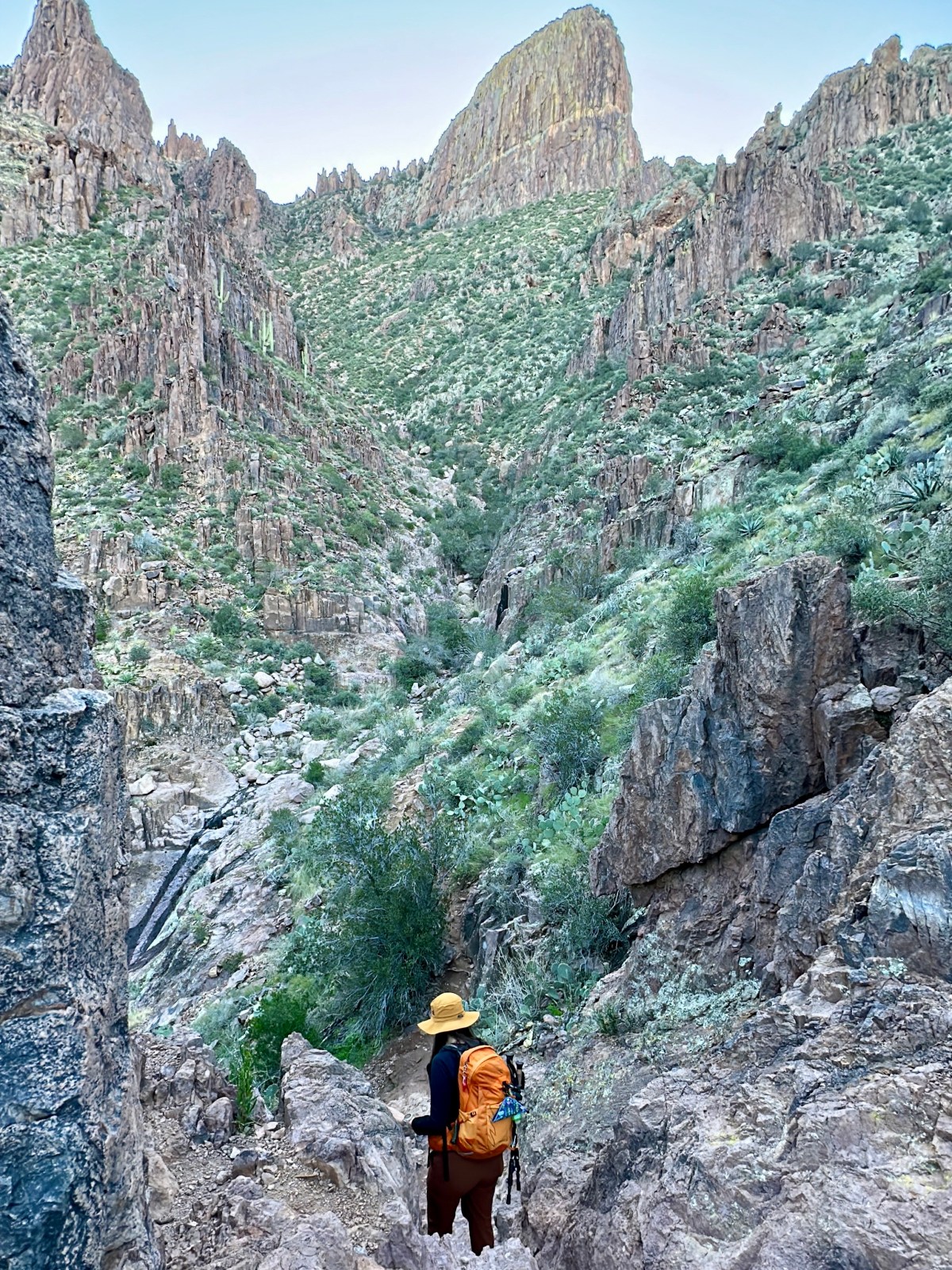
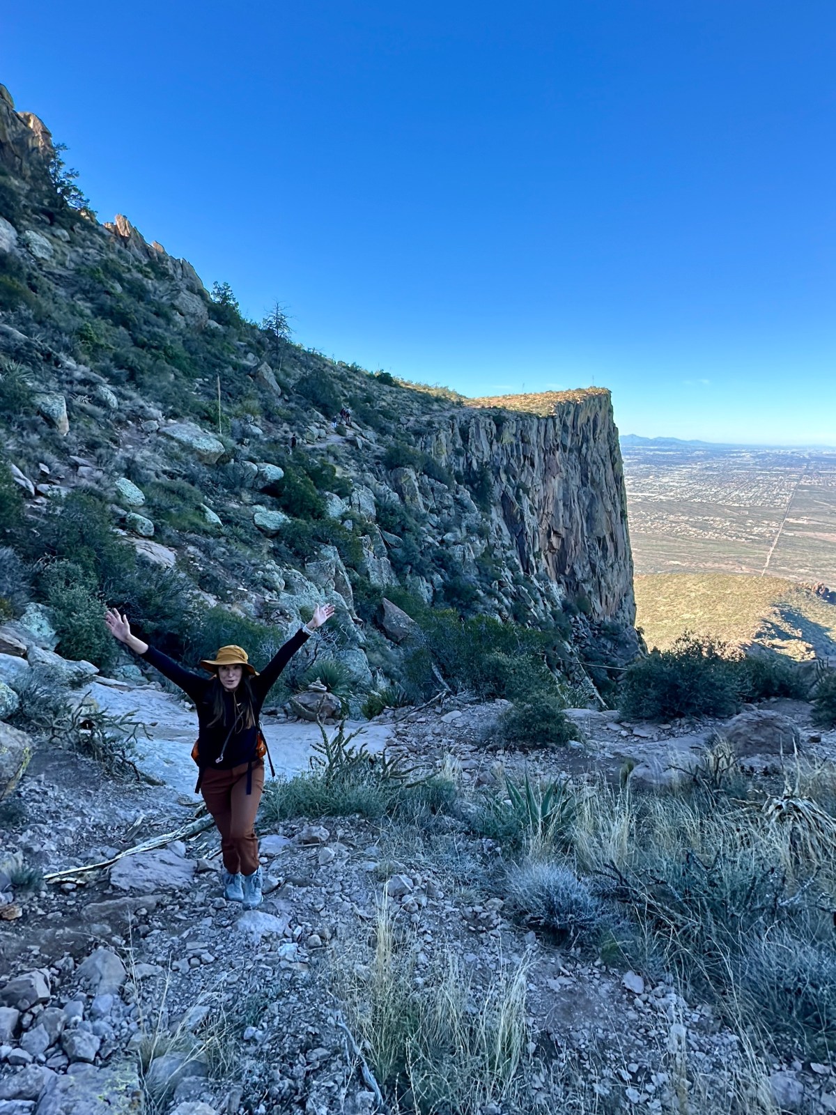
Superstition Ridgeline Trail: Superstition Mountains

The Superstition Ridgeline Trail in Tonto National Forest is an unofficial but popular 11.25-mile hike with challenging sections and stunning views. It’s mostly exposed, so be prepared for little shade and some tricky scrambles. Don’t forget your hiking poles for the descent and watch out for wildlife!

Read More »

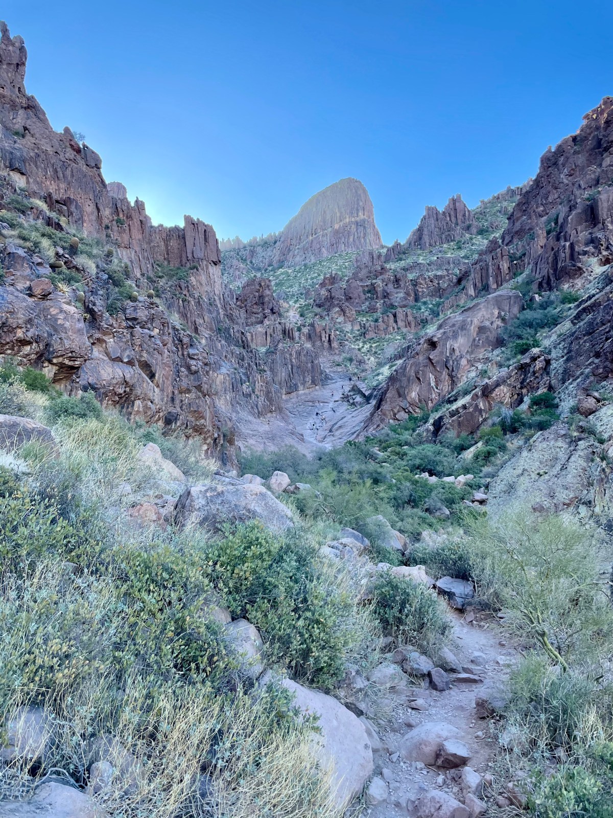
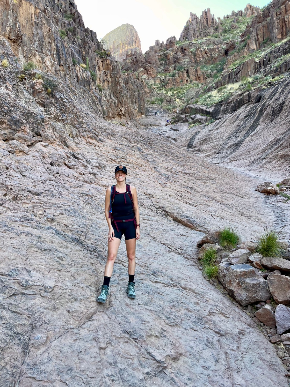
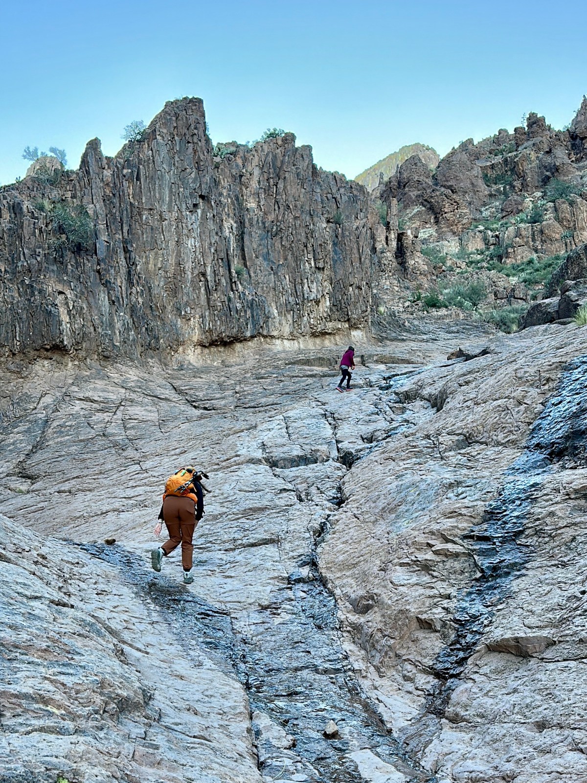
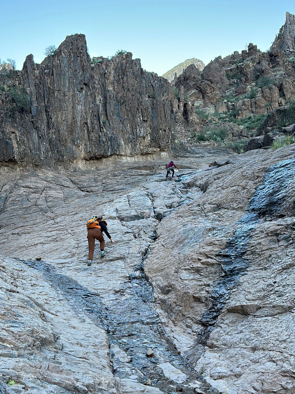
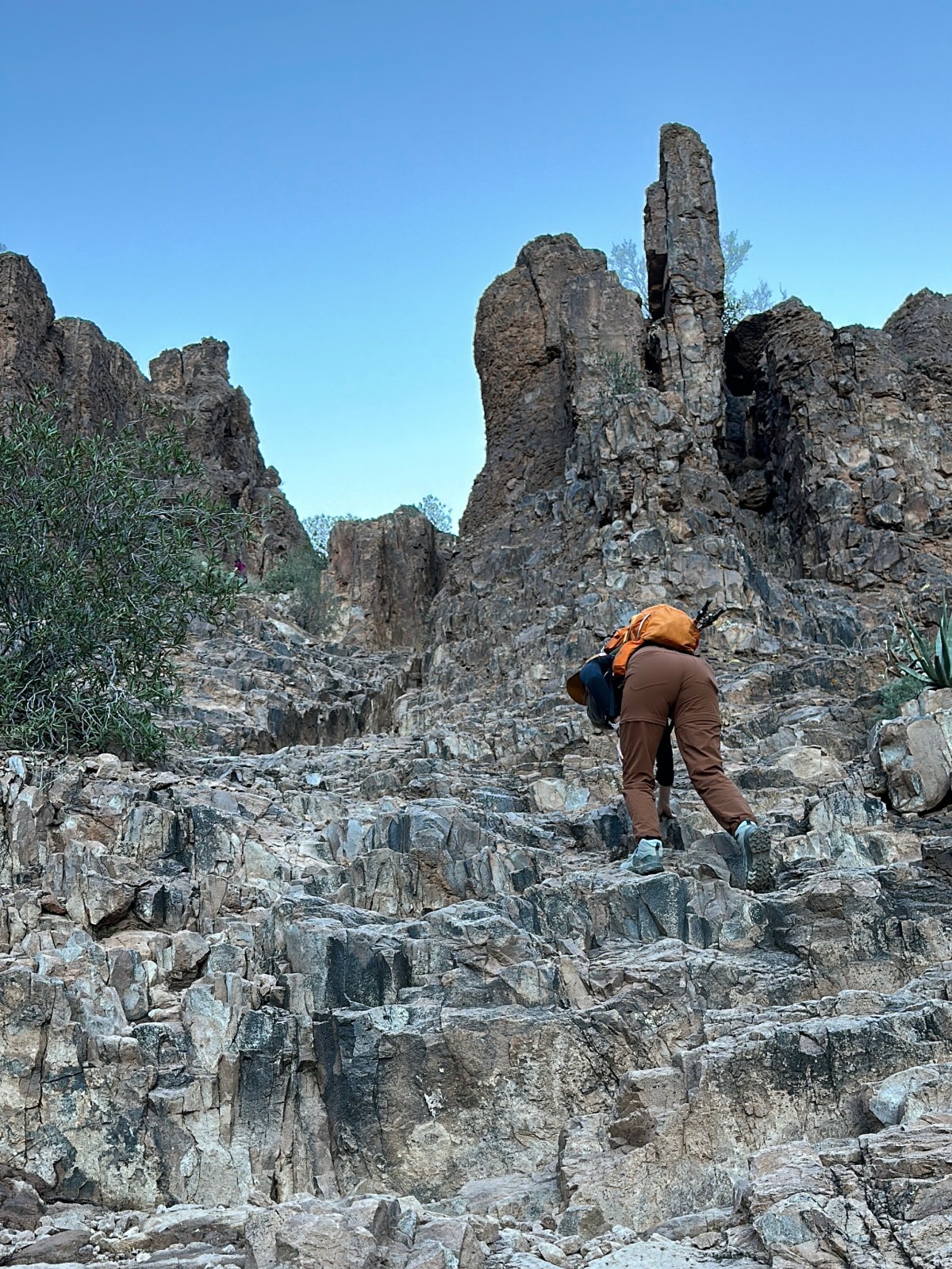
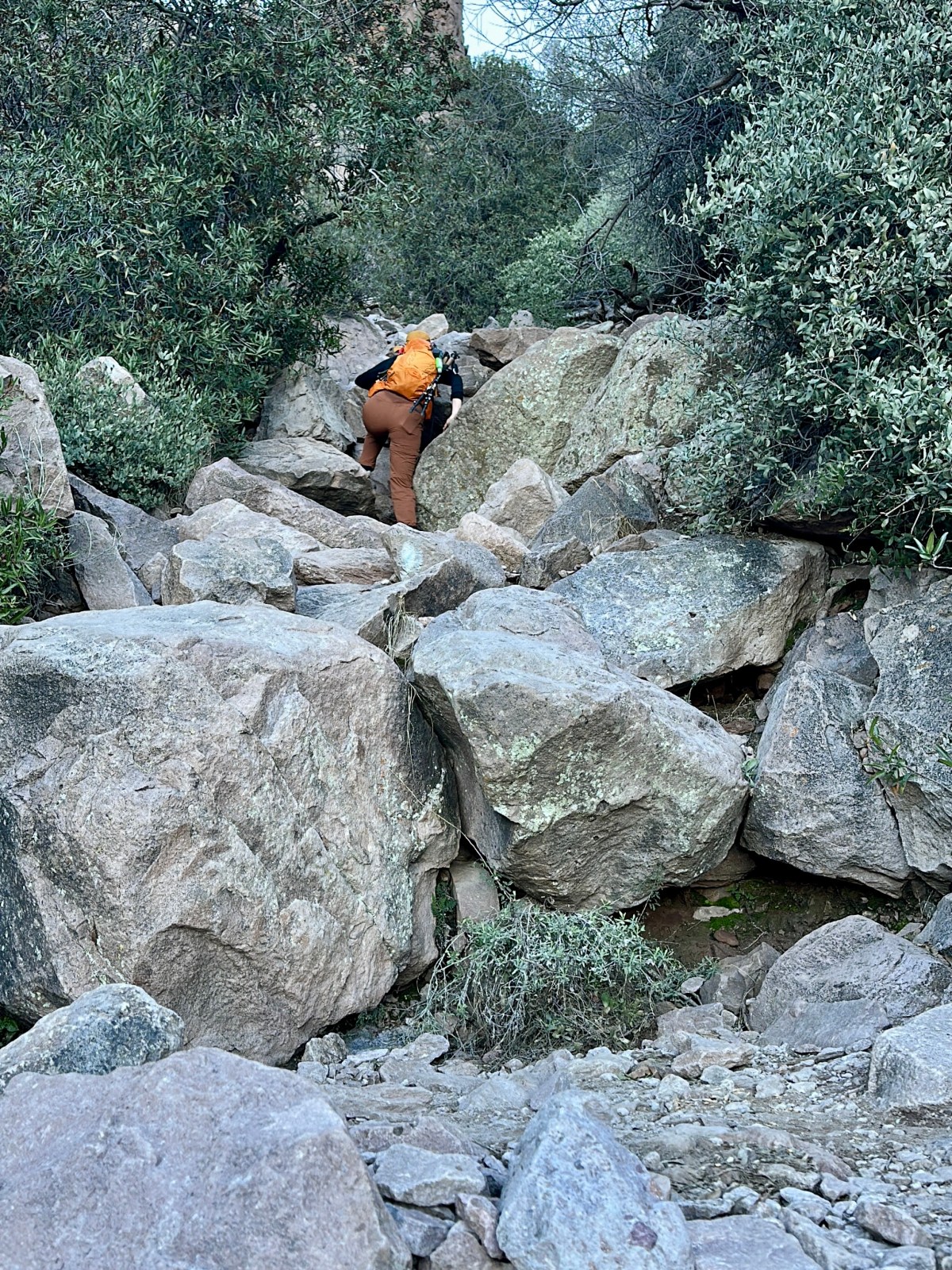
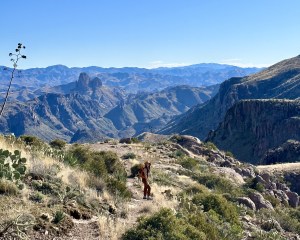
Battleship Mountain Scramble: Superstition Wilderness Hike

Battleship Mountain is a tough but rewarding hike in the Superstition Wilderness near Phoenix. Starting from First Water Trailhead, the 12-mile round trip involves tricky scrambles and stunning views. Just watch out for sharp rocks and wildlife, and remember to pack plenty of water. It’s not for beginners, but definitely worth it!
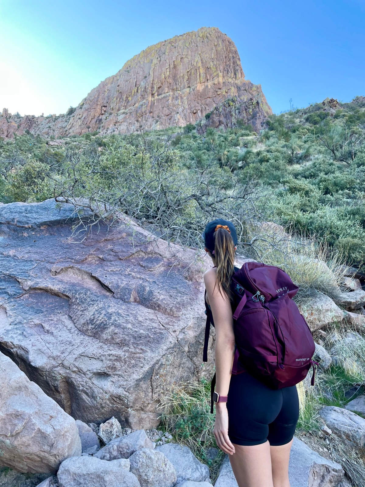
Read More »
Hi There!

We're Lauren and Owen -

We started The AZ Hikeaholics as a way to share our adventures with an audience that was interested. It soon grew into a community and we were all in! The more we learned about the history, geology, culture, biology etc, of the places we were exploring, the more we wanted to know.

You may also like -

Join our mailing list!

Never miss an update

Stay up to date by subscribing to our mailing list to receive our monthly newsletter and other important updates!