

Visiting Channel Islands National Park
Our trip to Channel Islands National Park’s Santa Cruz Island in July 2021 was a two-day, one-night backpacking adventure at Del Norte Campground. We hiked across the island, kayaked at Scorpion Anchorage, and soaked up the unique beauty of one of the park’s five islands. All our water and food came with us, and we packed out every bit of trash. While we made a few mistakes in planning (do as we say, not as we did!), the trip was an unforgettable way to experience this incredible national park.
Things To Know
- Book ferry tickets first – Secure your transportation to and from the island before spending money on anything else.
- No water at Prisoners Harbor or Del Norte Campground – We carried about 13 liters total: two 3L CamelBak reservoirs, one 3L HydraPak, and one 4L HydraPak. It was heavy, but essential.
- Kayak tours are limited – Island Adventure Company is the only kayaking tour operator on the island, and they only operate out of Scorpion Anchorage.
- Long and strenuous hike – The trek from Del Norte Campground to Scorpion Anchorage is 10 miles and challenging.
- A true wilderness experience – Expect solitude, silence, and a sense of remoteness that is both rewarding and humbling.
How to Get to Santa Cruz Island in Channel Islands National Park
The only way to reach Santa Cruz Island is by boat, and Island Packers is the official ferry service for Channel Islands National Park. Departures leave from Ventura, California, with multiple trips available each day.
The ferry ride takes about 60 to 90 minutes depending on weather conditions and sea life sightings. It’s common to spot dolphins, sea lions, and other marine wildlife along the way. On our trip, the captain even slowed down so we could get a better look.
For schedules, pricing, and reservations, visit the Island Packers Ferry Company website before your trip.
The Ferry Ride
Island Packers Cruises is the only public ferry service to Santa Cruz Island in Channel Islands National Park. They also provide transportation to the other islands in the park. At Santa Cruz, passengers are dropped off at either Prisoners Harbor or Scorpion Anchorage, with multiple daily departures from Ventura and return trips from the islands.
When planning your trip, it’s important to match your ferry tickets with your activities. We originally booked round-trip tickets to and from Prisoners Harbor because it’s only 3.5 miles from the Del Norte Campground. However, we also booked a 9:30 a.m. kayaking tour at Scorpion Anchorage without adjusting our ferry tickets ahead of time.
By the time we realized the conflict, it was too late to cancel and get a refund. Our choice was either to hike across the island or lose the kayaking money. We called Island Adventure Company to see if they had space on their 12:30 p.m. tour (they did!) and then contacted Island Packers, who were able to adjust our departure location and time to work with our updated kayaking schedule.


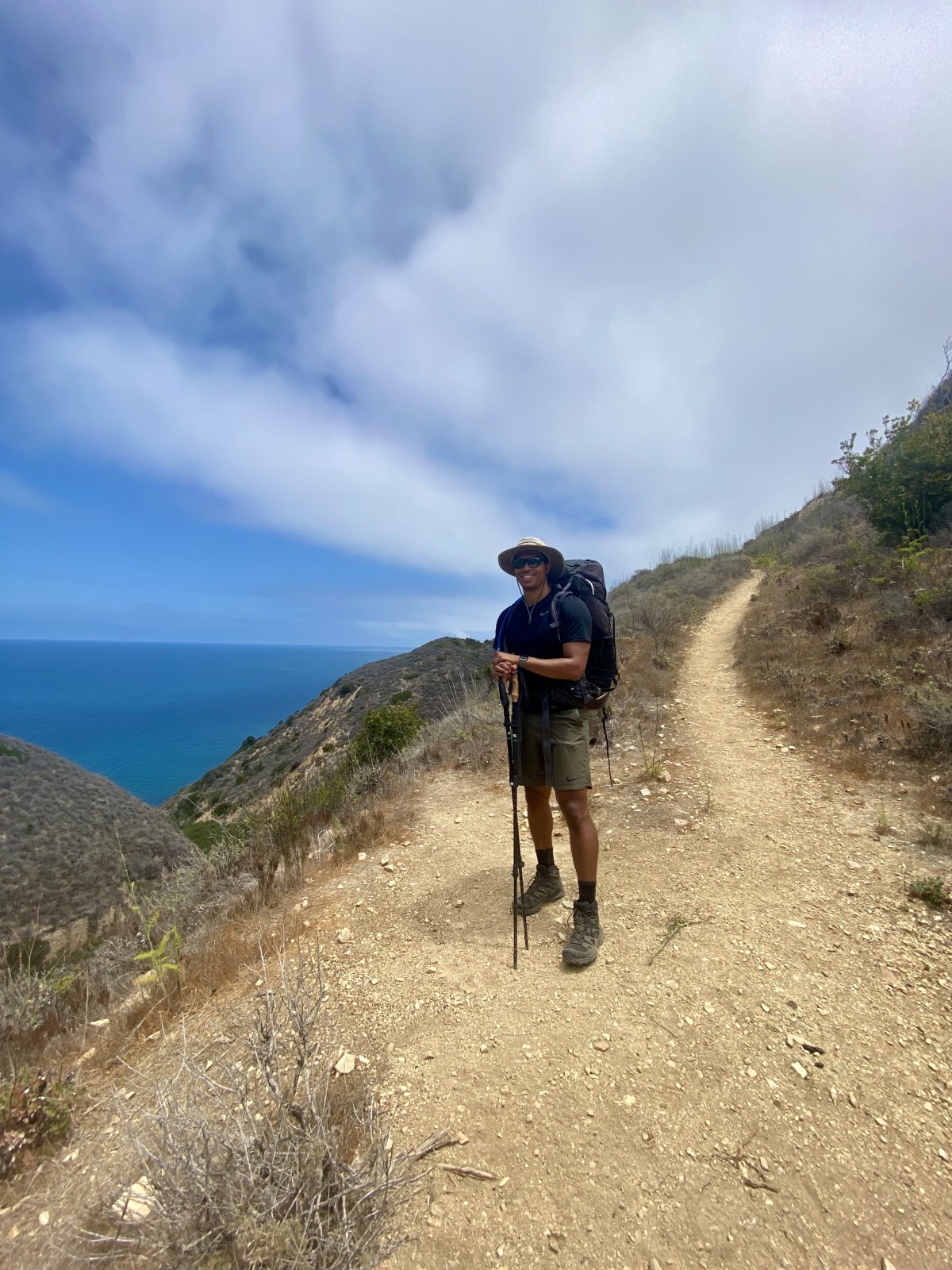
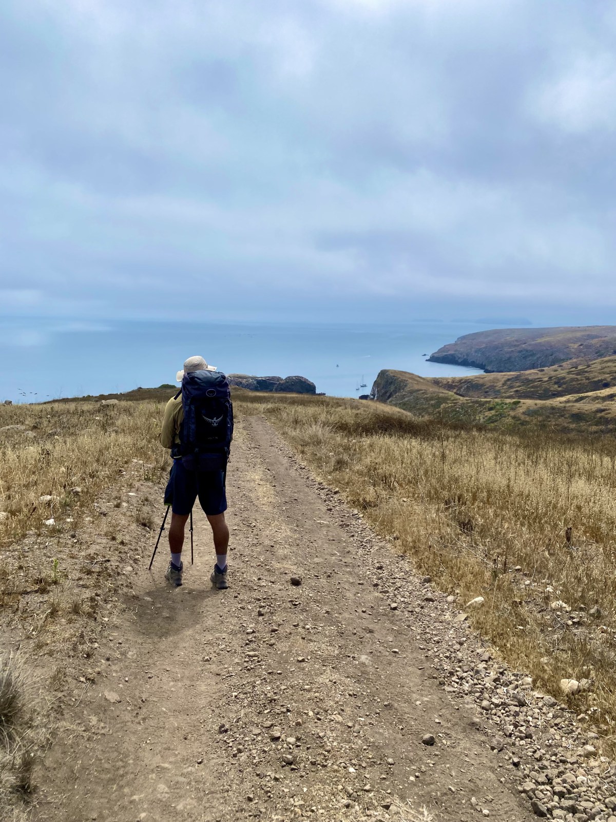
The Hike to Del Norte Campground
The hike to Del Norte Campground from Prisoners Harbor is a challenging yet incredibly rewarding trek. After stepping off the pier, you’ll see some visitor information and a restroom on your right. From there, you’ll quickly reach Old Navy Road, which marks the start of your journey.
We followed the steep Old Navy Road along the coastline for about 1.1 miles until it intersected with the Del Norte Trail. At this point, the path narrows and feels more like a true hiking trail. For the next 2.4 miles, we wound our way through the rolling, hilly coastline of Santa Cruz Island, constantly ascending and descending with our 35+ pound backpacks.
It’s a tough hike with heavy packs, but the views make every step worth it. Be sure to watch for the sign that directs you toward the campground — it’s easy to miss. If you stay on the Del Norte Trail instead of turning, you’ll bypass the campsite entirely.
Prisoners Harbor to Del Norte Campground: Trail Stats
- Distance: 3.5 miles one way from Prisoners Harbor
- Elevation Change: 1,200 feet
- Difficulty: Hard
- Water: None available at the trailhead or along the route — bring all you need
- Restrooms: Vault toilets available at Prisoners Harbor
- Shade: Minimal to none along the trail
- AllTrails


Camping at Del Norte Campground
The campsites at Del Norte Campground are spaced out but offer limited privacy from trees. Each designated site includes a picnic table, a fox box for food storage, and a marked tent pad. We stayed at campsite No. 3, which had the bonus of a large oak tree providing some shade. The campground sits in a small oak grove, but sites No. 1 and 2 do not have shade.
An above ground vault toilet is located just up the road from the fourth campsite. It has privacy walls but no roof, and more importantly, no toilet paper, so be sure to bring your own.
The views of the ocean from the campground are fantastic. At night, the lack of light pollution makes for incredible stargazing. We slept without a rainfly and were treated to an unforgettable night sky. Unfortunately, exhaustion kept us from grabbing our phones for a photo. By morning, the marine layer inversion had rolled in, surrounding us with a cool fog.
Del Norte camping details
- There are only 4 campsites and the max people allowed is 16 at the campground at a time.
- No water at the campground
- “Vaulted toilet” but it is an open toilet meaning there is no inside to it
- Picnic tables at campsites
- Fox boxes at campsites
- Sites 3 and 4 have shades from trees
The Hike to Prisoner's Harbor
Starting the Hike from Del Norte Campground
We were up early, well before sunrise, so we could pack up and eat before our long hike. Our goal was to reach Scorpion Anchorage before our prepaid kayaking tour at 12:30 p.m. We officially started our 10 mile journey at 6:44 a.m., giving us just under six hours to make it across the island.
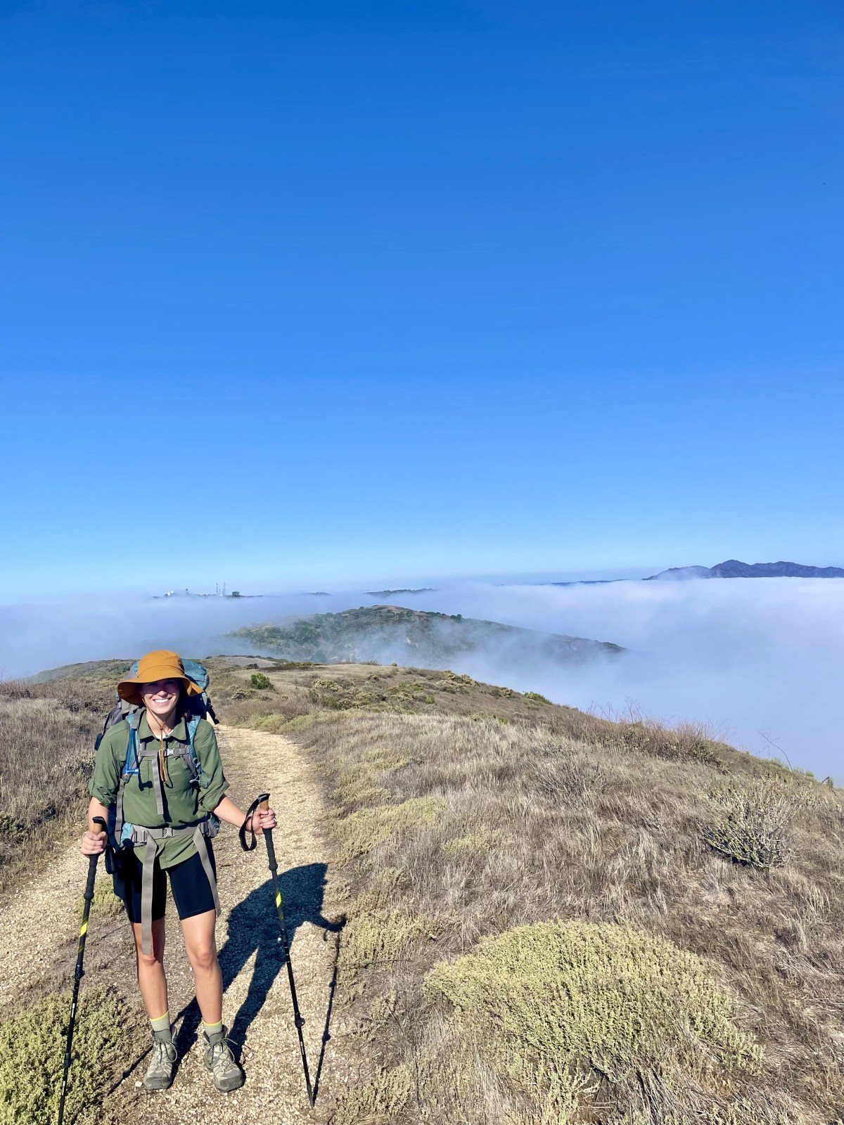
Hiking Through Fog and Coastal Hills
The hike begins as a continuation of Del Norte Trail. This time, we were hiking in dense fog with only about 20 feet of visibility. The trail was much the same as the previous day, with consistent elevation changes as we ascended and descended the hillside. We believe we were near the coast at the start, but we could not see the ocean. Our packs were slightly lighter since we had consumed a good amount of water the day before.
Breaking Through the Clouds
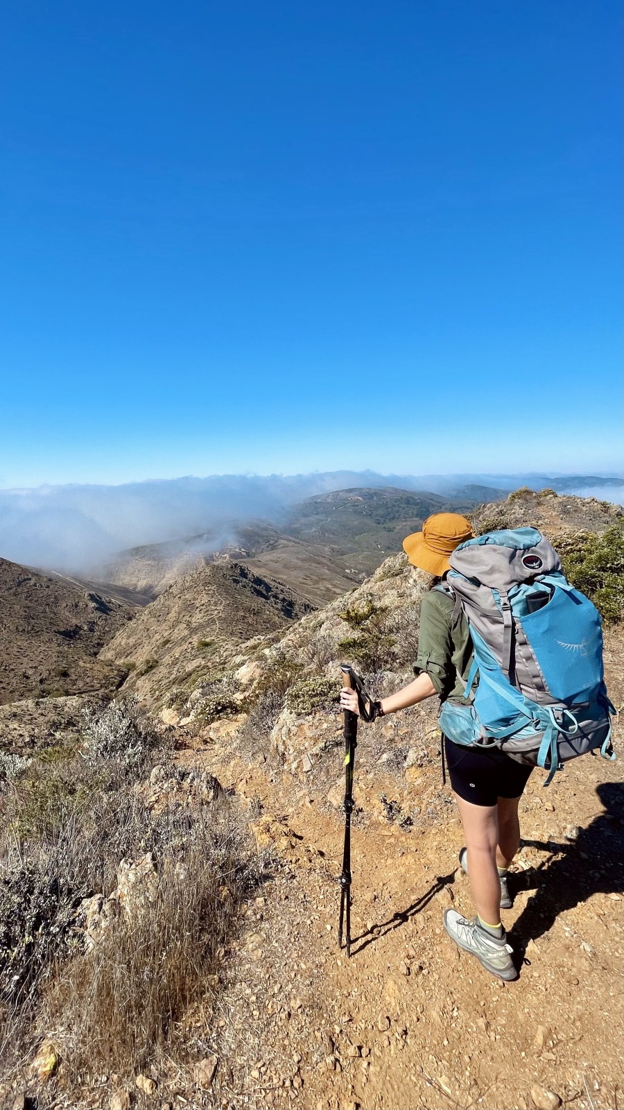
After a while, we returned to the Old Navy Road. Signs along the trail directed us toward Scorpion Anchorage. The road stretches on and continues to climb in elevation. Along the way, the vegetation and even the geology changed as we gained altitude. After about three miles, we broke through the cloud layer. The view from high above the ocean and clouds was spectacular.
At mile four, we had a stunning view of Montona Ridge. The trail dips slightly here, and the mile five marker, which marks the halfway point, is at the base of the trail before a steep climb up the spine of a ridge to a major saddle point. At the bottom of the climb, we stopped to take off our packs and enjoy a quick snack. Little did we know, just 30 feet farther down the trail there was a picnic table that would have made our break even more comfortable.


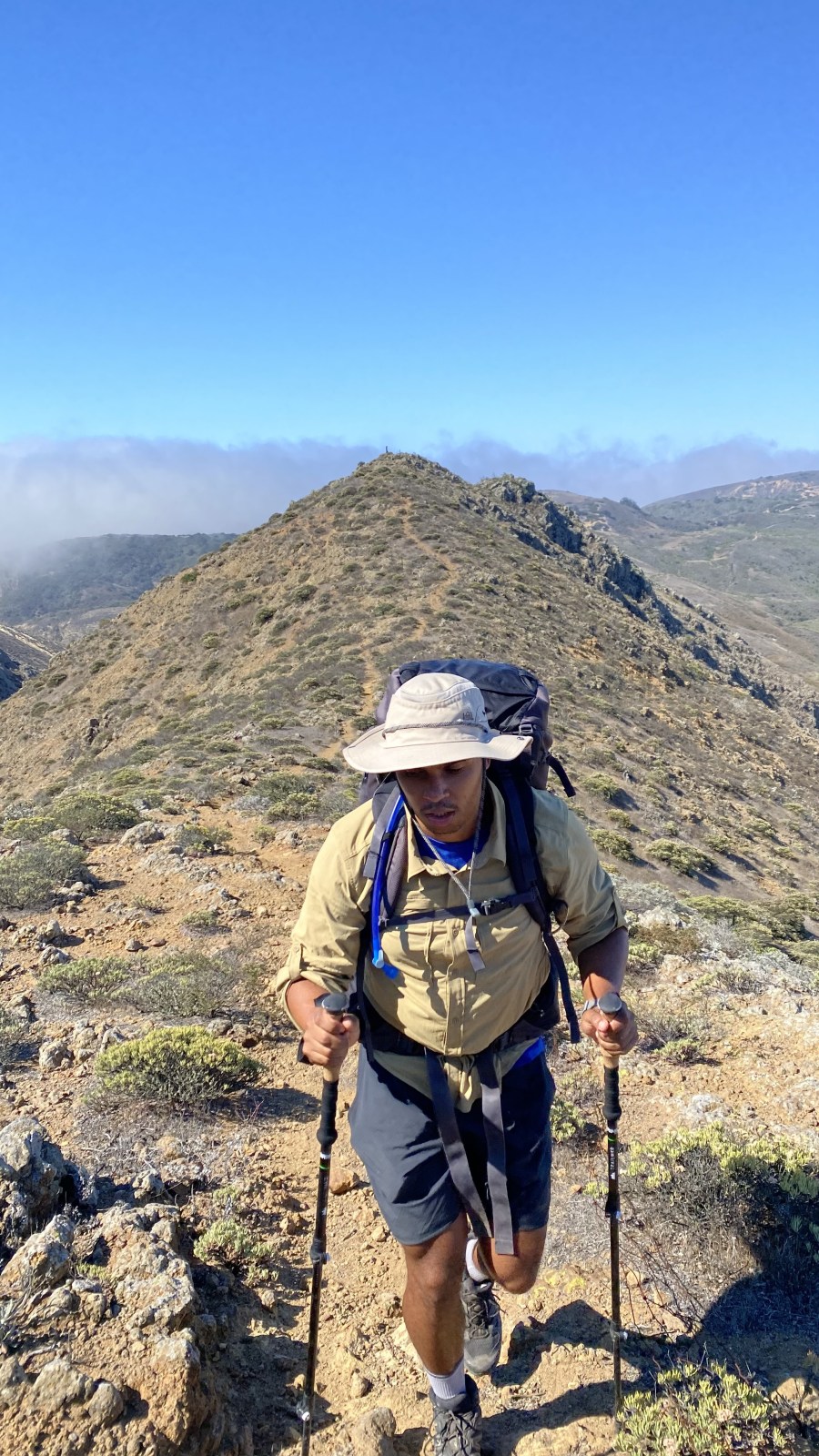
The Toughest Climb of the Hike
After a short break, we were ready for arguably the toughest part of the hike. From here, we were on a steady elevation gain and the trail quickly turned rocky. At this point, foot placement was very strategic and so was balance. We had steep drop-offs to the side, and the heavy packs were definitely influencing our center of gravity. We were a little nervous scaling this part of the ridge. The trail was difficult to find at points, and we were no longer using the hiking poles as we needed our hands for stability on rocks or to pull ourselves up.
Reaching the Saddle
We had some awesome views as we looked back over the island. Soon we were at the saddle of the ridge. Our trail continued north toward Scorpion Anchorage, and to the west was a trail continuing along the ridge and eventually to Coche Point. To the east was the tallest point on the mountain, but we didn’t look for a trail to that point. We continued along our trail making good time. At this point, we were on a consistent decline, but the trail was much different than the other side of the island. The trail was quite rocky, there were significantly fewer trees, and the view was unobstructed.
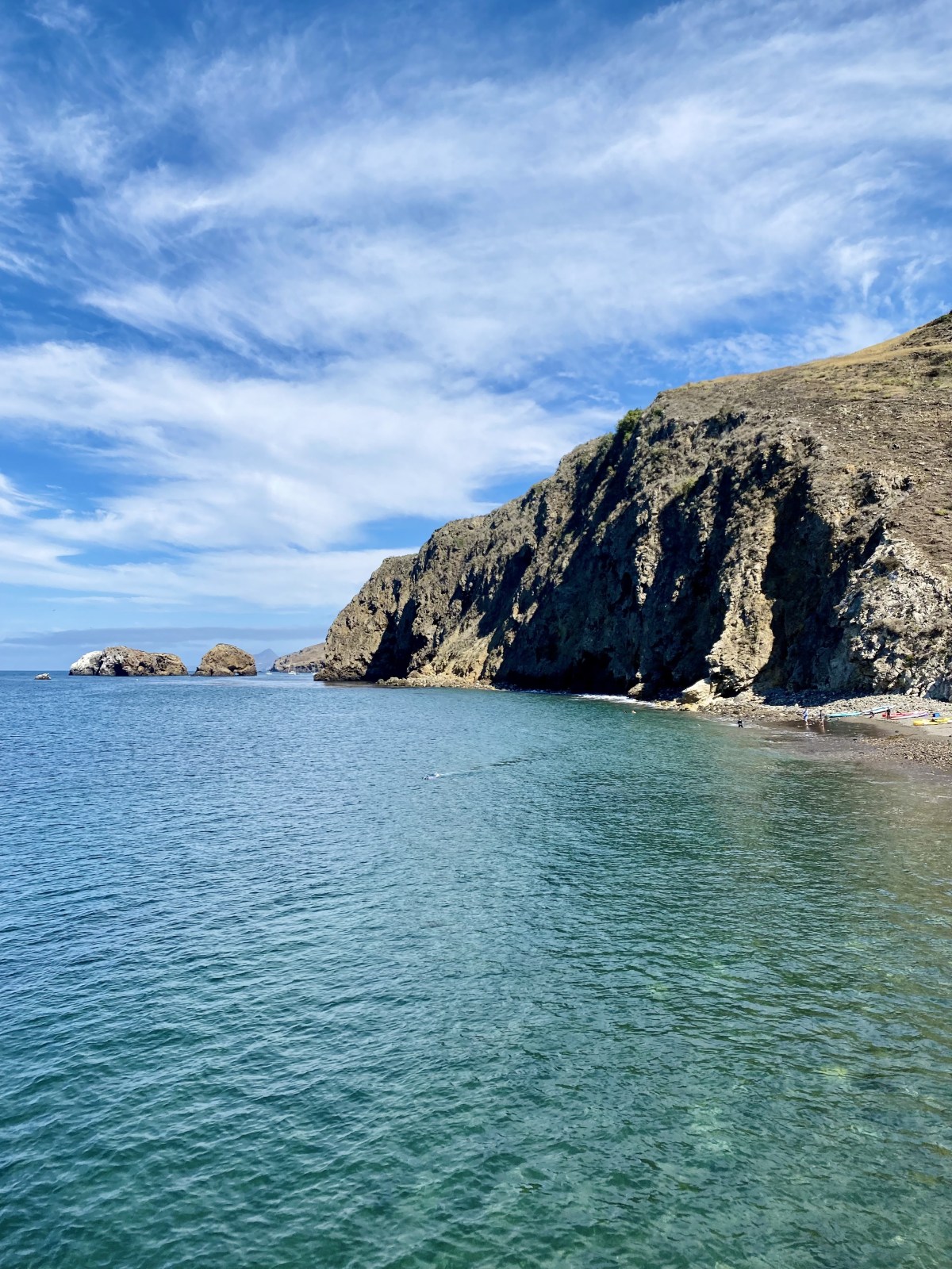
Arriving at Scorpion Anchorage
We made it to Scorpion Anchorage just after 11 am. We had time to relax, hide in the shade, and eat some food using our Jetboil. After checking in with Island Adventure Company and changing, we were ready to hit the ocean in the kayak.


Hike Details
- 10 miles one way to Scorpion Anchorage
- Over 1,743 ft in elevation gain
- There is no water on the trail
- No toilets along the trail
- Minimal to no shade
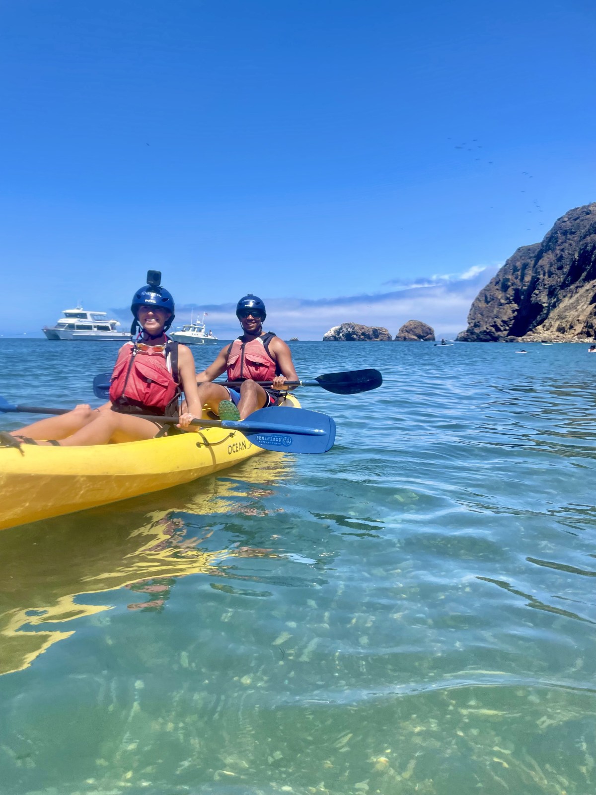
Kayaking at Channel Islands National Park
Kayaking was such a fun experience! We were a little nervous at first since we are not experienced kayakers, having only paddled on small lakes with minimal wake. We knew the ocean would be very different, and it was, but it turned out to be less difficult than we expected.
Island Adventure Company is the only tour operator on the island. They offer guided trips because kayaking around the island’s coastline can be dangerous without local knowledge. Our guide, Jeremy, was fantastic. We booked the Discovery Tour, which is the shorter 3 hour option. Out of that time, we spent a little over an hour on the ocean, and that was plenty for us.
Before getting on the water, Jeremy reviewed safety rules and shared helpful tips. We then followed him along the coastline to explore a series of sea caves. They were both spectacular and a little nerve racking. Inside the caves, the current and wave action can be stronger as the water crashes against the walls. Jeremy never pressured us to do anything beyond our comfort level and kept the experience both safe and enjoyable. His knowledge, humor, and encouragement made the trip even better.
We visited in July when the water is generally calmer but not at its warmest. The ocean off the California coast is typically warmest in August and September after heating up all summer. A kayaking tour here is something we highly recommend. It was worth every penny.


Kayaking Details
- Guided tours exclusively through Channel Island Adventure Company
- No rentals; guided tours only
- Different packages available
- Helmet and personal flotation device provided
- Wetsuit and other gear available
Final Thoughts on Visiting Channel Islands National Park
Backpacking, hiking, and kayaking on Santa Cruz Island gave us an unforgettable adventure. The combination of rugged coastal cliffs, peaceful campgrounds, and hidden sea caves makes this park feel like a world away from mainland California. If you plan ahead and bring everything you need, you’ll be rewarded with solitude, stunning views, and unique wildlife encounters. Whether you spend a day exploring or stay overnight, Channel Islands National Park is a place that belongs on every outdoor lover’s bucket list. Interested in our gear? You can check it out here.

